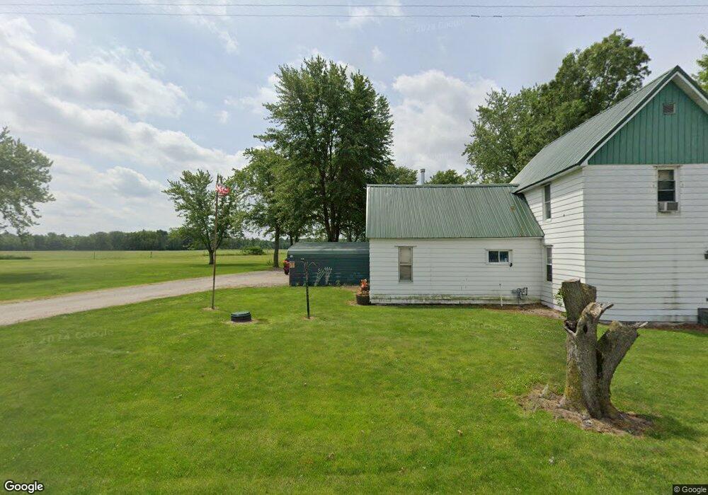
10302 W 2350 S La Crosse, IN 46348
Estimated Value: $171,357 - $271,000
2
Beds
1
Bath
1,400
Sq Ft
$154/Sq Ft
Est. Value
About This Home
This home is located at 10302 W 2350 S, La Crosse, IN 46348 and is currently estimated at $215,089, approximately $153 per square foot. 10302 W 2350 S is a home located in LaPorte County.
Ownership History
Date
Name
Owned For
Owner Type
Purchase Details
Closed on
Sep 19, 2008
Sold by
Sills Taylor M
Bought by
Lane Steven and Lane Mona J
Current Estimated Value
Home Financials for this Owner
Home Financials are based on the most recent Mortgage that was taken out on this home.
Original Mortgage
$89,814
Outstanding Balance
$59,882
Interest Rate
6.57%
Mortgage Type
FHA
Estimated Equity
$155,207
Purchase Details
Closed on
Mar 30, 2007
Sold by
Quinlan Paul M and Quinlan Karen M
Bought by
Sills Taylor M
Home Financials for this Owner
Home Financials are based on the most recent Mortgage that was taken out on this home.
Original Mortgage
$80,275
Interest Rate
6.31%
Mortgage Type
Unknown
Create a Home Valuation Report for This Property
The Home Valuation Report is an in-depth analysis detailing your home's value as well as a comparison with similar homes in the area
Home Values in the Area
Average Home Value in this Area
Purchase History
| Date | Buyer | Sale Price | Title Company |
|---|---|---|---|
| Lane Steven | -- | Meridian Title Corp | |
| Sills Taylor M | -- | Ticor Title Insurance Co |
Source: Public Records
Mortgage History
| Date | Status | Borrower | Loan Amount |
|---|---|---|---|
| Open | Lane Steven | $89,814 | |
| Previous Owner | Sills Taylor M | $80,275 |
Source: Public Records
Tax History Compared to Growth
Tax History
| Year | Tax Paid | Tax Assessment Tax Assessment Total Assessment is a certain percentage of the fair market value that is determined by local assessors to be the total taxable value of land and additions on the property. | Land | Improvement |
|---|---|---|---|---|
| 2024 | $590 | $95,100 | $32,000 | $63,100 |
| 2022 | $546 | $94,500 | $29,600 | $64,900 |
| 2021 | $527 | $89,900 | $29,000 | $60,900 |
| 2020 | $493 | $89,900 | $29,000 | $60,900 |
| 2019 | $591 | $95,200 | $29,800 | $65,400 |
| 2018 | $543 | $94,200 | $29,900 | $64,300 |
| 2017 | $558 | $96,500 | $30,700 | $65,800 |
| 2016 | $537 | $95,900 | $31,000 | $64,900 |
| 2014 | $424 | $89,100 | $31,300 | $57,800 |
Source: Public Records
Map
Nearby Homes
- 10231 W 2350 S
- 10301 W 2350 S
- 10202 W 2350 S
- 10202 W 2350 S
- 10201 W 2350 S
- 10388 W 2350 S
- 10152 W 2350 S
- 23444 S Us Highway 421
- 23752 S Us Highway 421
- 23652 S 1050 W
- 23232 S Us Highway 421
- 10101 W 2400 S
- 23201 S Us Highway 421
- 10102 W 2400 S
- 24035 S Us Highway 421
- 10256 W 2400 S
- 10248 W 2400 S
- 23202 S 1100 W
- 8195 S U S 421
- 0 S U S 421