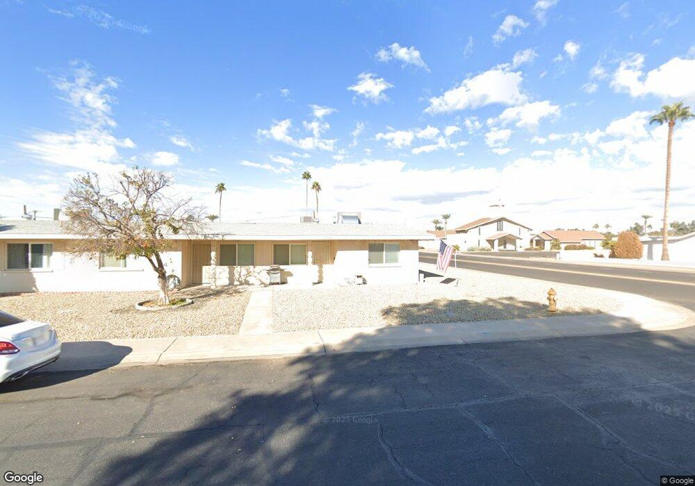
10302 W Deanne Dr Unit 23 Sun City, AZ 85351
Estimated Value: $143,031 - $164,000
--
Bed
1
Bath
876
Sq Ft
$172/Sq Ft
Est. Value
About This Home
This home is located at 10302 W Deanne Dr Unit 23, Sun City, AZ 85351 and is currently estimated at $150,758, approximately $172 per square foot. 10302 W Deanne Dr Unit 23 is a home located in Maricopa County with nearby schools including Desert Mirage Elementary School, Ombudsman - Northwest Charter, and Peoria Accelerated High School.
Ownership History
Date
Name
Owned For
Owner Type
Purchase Details
Closed on
Apr 23, 2021
Sold by
Kush Stanley
Bought by
Kush Stanley and Kush Daniel
Current Estimated Value
Purchase Details
Closed on
Sep 9, 1997
Sold by
Sheppard Marie R
Bought by
Kush Stanley
Home Financials for this Owner
Home Financials are based on the most recent Mortgage that was taken out on this home.
Original Mortgage
$36,000
Interest Rate
7.34%
Mortgage Type
New Conventional
Purchase Details
Closed on
Jul 11, 1996
Sold by
Gilson Maude
Bought by
Sheppard Marie R
Home Financials for this Owner
Home Financials are based on the most recent Mortgage that was taken out on this home.
Original Mortgage
$28,000
Interest Rate
8.32%
Create a Home Valuation Report for This Property
The Home Valuation Report is an in-depth analysis detailing your home's value as well as a comparison with similar homes in the area
Home Values in the Area
Average Home Value in this Area
Purchase History
| Date | Buyer | Sale Price | Title Company |
|---|---|---|---|
| Kush Stanley | -- | None Listed On Document | |
| Kush Stanley | $40,000 | Security Title Agency | |
| Sheppard Marie R | $40,000 | First American Title |
Source: Public Records
Mortgage History
| Date | Status | Borrower | Loan Amount |
|---|---|---|---|
| Previous Owner | Kush Stanley | $36,000 | |
| Previous Owner | Sheppard Marie R | $28,000 |
Source: Public Records
Tax History Compared to Growth
Tax History
| Year | Tax Paid | Tax Assessment Tax Assessment Total Assessment is a certain percentage of the fair market value that is determined by local assessors to be the total taxable value of land and additions on the property. | Land | Improvement |
|---|---|---|---|---|
| 2025 | $351 | $4,361 | -- | -- |
| 2024 | $318 | $4,154 | -- | -- |
| 2023 | $318 | $11,670 | $2,330 | $9,340 |
| 2022 | $296 | $9,310 | $1,860 | $7,450 |
| 2021 | $306 | $8,650 | $1,730 | $6,920 |
| 2020 | $298 | $7,080 | $1,410 | $5,670 |
| 2019 | $296 | $6,130 | $1,220 | $4,910 |
| 2018 | $286 | $5,530 | $1,100 | $4,430 |
| 2017 | $276 | $4,530 | $900 | $3,630 |
| 2016 | $257 | $3,450 | $690 | $2,760 |
| 2015 | $246 | $2,950 | $590 | $2,360 |
Source: Public Records
Map
Nearby Homes
- 10314 W Deanne Dr
- 10345 W Peoria Ave Unit 5
- 10318 W Corte Del Sol Este Unit 21
- 10323 W Deanne Dr
- 10614 N 103rd Ave
- 10351 W Pinehurst Dr
- 10404 W Audrey Dr
- 10635 N 103rd Ave
- 10426 W Deanne Dr Unit 15
- 10417 W Deanne Dr Unit 5
- 10410 W Audrey Dr Unit 8
- 10414 W Audrey Dr
- 10341 W Clair Dr
- 10102 W Deanne Dr Unit 6
- 10076 W Peoria Ave
- 10240 W Concord Ave
- 10236 N 105th Dr Unit 8
- 10821 N Fairway Ct E
- 10222 N 105th Dr Unit 5
- 10405 W Andover Ave
- 10304 W Deanne Dr Unit 22
- 10306 W Deanne Dr
- 10432 N 103rd Ave
- 10300 N 103rd Ave
- 10434 N 103rd Ave
- 10310 W Deanne Dr Unit 19
- 10312 W Deanne Dr Unit 18
- 10436 N 103rd Ave Unit 27
- 10301 W Deanne Dr
- 10303 W Deanne Dr Unit 11
- 10238 W Deanne Dr Unit 6
- 10316 W Deanne Dr Unit 16
- 10305 W Deanne Dr Unit 10
- 10318 W Deanne Dr Unit 15
- 10301 W Peoria Ave
- 10303 W Peoria Ave
- 10305 W Peoria Ave Unit 5
- 10307 W Deanne Dr Unit 9
- 10237 W Deanne Dr
- 10320 W Deanne Dr Unit 14