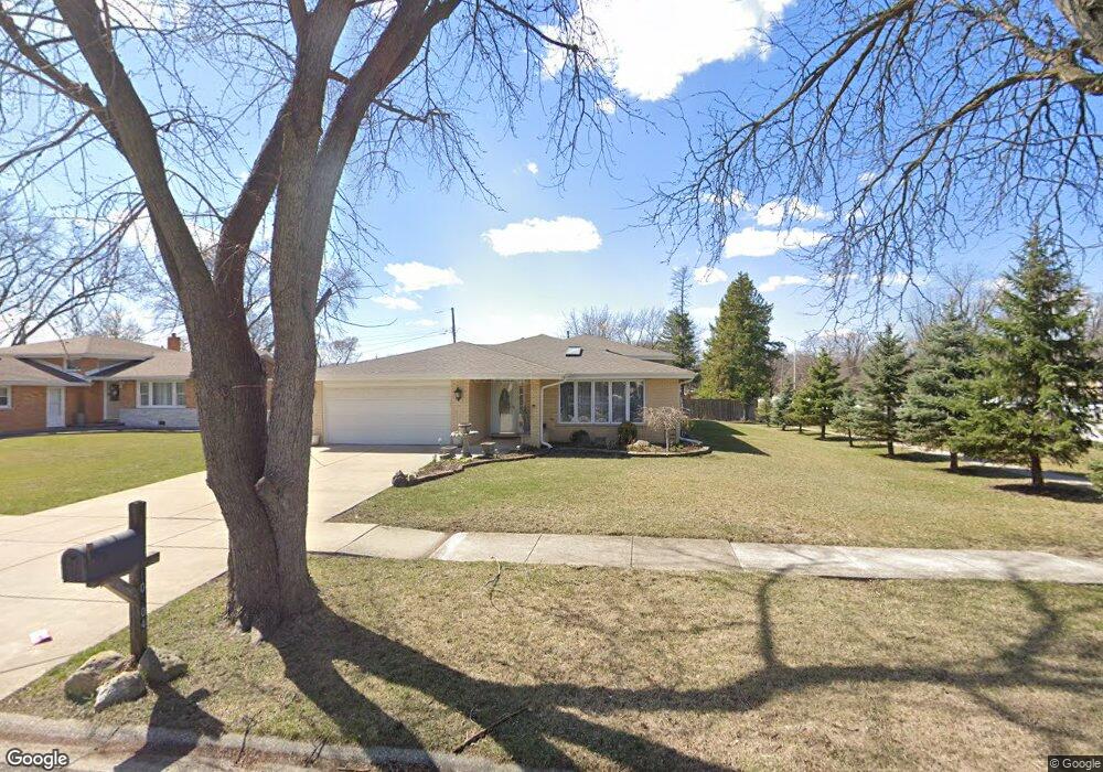
10304 S 81st Ave Palos Hills, IL 60465
Estimated Value: $400,000 - $466,000
4
Beds
3
Baths
1,823
Sq Ft
$230/Sq Ft
Est. Value
About This Home
This home is located at 10304 S 81st Ave, Palos Hills, IL 60465 and is currently estimated at $419,240, approximately $229 per square foot. 10304 S 81st Ave is a home located in Cook County with nearby schools including Sorrick Elementary School, Oak Ridge Elementary School, and H H Conrady Jr High School.
Ownership History
Date
Name
Owned For
Owner Type
Purchase Details
Closed on
May 28, 2004
Sold by
Standard Bank & Trust Co
Bought by
Ogrodny Stanislaw and Ogrodny Anna
Current Estimated Value
Home Financials for this Owner
Home Financials are based on the most recent Mortgage that was taken out on this home.
Original Mortgage
$100,000
Interest Rate
6.37%
Mortgage Type
Unknown
Purchase Details
Closed on
Feb 27, 1996
Sold by
Lundin Brian G
Bought by
Standard Bank & Trust Company
Purchase Details
Closed on
Oct 26, 1995
Sold by
Rankin Mary R
Bought by
Lundin Brian G
Home Financials for this Owner
Home Financials are based on the most recent Mortgage that was taken out on this home.
Original Mortgage
$90,000
Interest Rate
7.7%
Create a Home Valuation Report for This Property
The Home Valuation Report is an in-depth analysis detailing your home's value as well as a comparison with similar homes in the area
Home Values in the Area
Average Home Value in this Area
Purchase History
| Date | Buyer | Sale Price | Title Company |
|---|---|---|---|
| Ogrodny Stanislaw | $170,000 | First American | |
| Standard Bank & Trust Company | -- | -- | |
| Lundin Brian G | $185,000 | Attorneys Natl Title Network |
Source: Public Records
Mortgage History
| Date | Status | Borrower | Loan Amount |
|---|---|---|---|
| Closed | Ogrodny Stanislaw | $100,000 | |
| Previous Owner | Lundin Brian G | $90,000 |
Source: Public Records
Tax History Compared to Growth
Tax History
| Year | Tax Paid | Tax Assessment Tax Assessment Total Assessment is a certain percentage of the fair market value that is determined by local assessors to be the total taxable value of land and additions on the property. | Land | Improvement |
|---|---|---|---|---|
| 2024 | $4,215 | $30,000 | $9,174 | $20,826 |
| 2023 | $5,492 | $30,000 | $9,174 | $20,826 |
| 2022 | $5,492 | $21,892 | $7,990 | $13,902 |
| 2021 | $5,385 | $21,891 | $7,989 | $13,902 |
| 2020 | $5,151 | $21,891 | $7,989 | $13,902 |
| 2019 | $5,671 | $25,546 | $7,398 | $18,148 |
| 2018 | $5,468 | $25,546 | $7,398 | $18,148 |
| 2017 | $5,182 | $25,546 | $7,398 | $18,148 |
| 2016 | $6,650 | $24,204 | $6,510 | $17,694 |
| 2015 | $8,244 | $24,204 | $6,510 | $17,694 |
| 2014 | $6,623 | $24,204 | $6,510 | $17,694 |
| 2013 | $7,922 | $25,276 | $6,510 | $18,766 |
Source: Public Records
Map
Nearby Homes
- 10324 S 81st Ave
- 10226 S 81st Ave
- 10125 S 81st Ct
- 10221 S Eleanor Ave
- 10409 Sheffield Dr Unit 13
- 10441 S 83rd Ave
- 10230 S 83rd Ct
- 10531 S Roberts Rd Unit 2D
- 7810 W 102nd St
- 10427 S Alta Dr
- 10408 S Alta Dr
- 8360 W 100th Place
- 9940 S Wood Ln
- 10562 S 84th Ave
- 10300 S Kathy Ct
- 8556 W 102nd Terrace Unit 5315
- 7822 W 99th Place
- 9950 S 84th Terrace Unit 215
- 9954 S 84th Terrace Unit 109
- 10820 Kathleen Ct Unit D
- 10316 S 81st Ave
- 10303 S 81st Ct
- 10309 S 81st Ct
- 10260 S 81st Ave
- 10315 S 81st Ct
- 10253 S 81st Ct
- 10332 S 81st Ave
- 10248 S 81st Ave
- 10265 S 81st Ave
- 10321 S 81st Ct
- 10249 S 81st Ct
- 10340 S 81st Ave
- 10261 S 81st Ave
- 10300 S 81st Ct
- 10246 S 81st Ave
- 10327 S 81st Ct
- 10306 S 81st Ct
- 10312 S 81st Ct
- 10245 S 81st Ct
- 10248 S 80th Ct