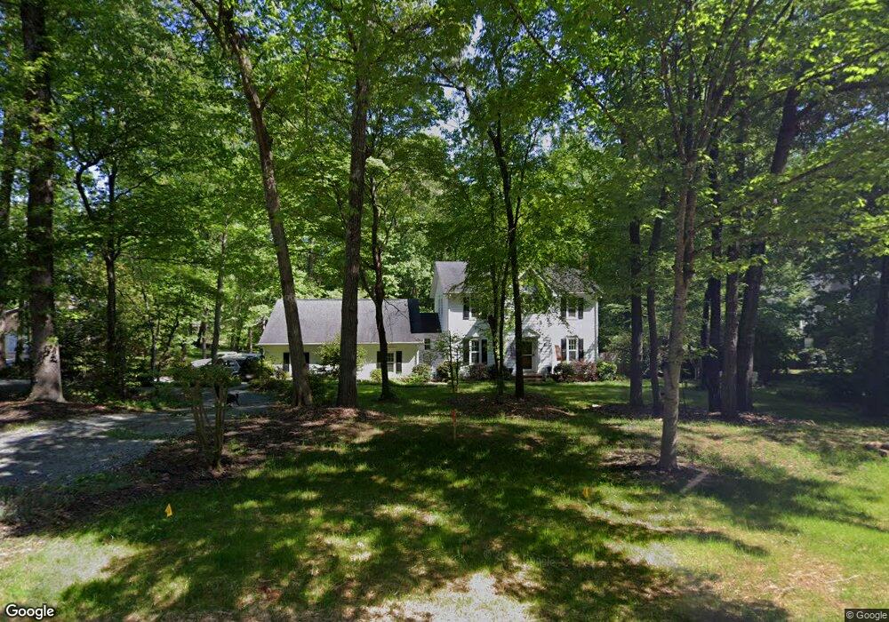
10307 Rutledge Ct Waxhaw, NC 28173
Estimated Value: $476,110 - $610,000
3
Beds
3
Baths
1,742
Sq Ft
$312/Sq Ft
Est. Value
About This Home
This home is located at 10307 Rutledge Ct, Waxhaw, NC 28173 and is currently estimated at $544,028, approximately $312 per square foot. 10307 Rutledge Ct is a home located in Union County with nearby schools including Waxhaw Elementary School, Parkwood Middle School, and Parkwood High School.
Ownership History
Date
Name
Owned For
Owner Type
Purchase Details
Closed on
Oct 15, 2003
Sold by
Shuman James F and Shuman Anne Marie P
Bought by
Larkins Todd Anthony and Larkins Amy Michelle
Current Estimated Value
Home Financials for this Owner
Home Financials are based on the most recent Mortgage that was taken out on this home.
Original Mortgage
$175,920
Outstanding Balance
$83,444
Interest Rate
6.45%
Mortgage Type
Unknown
Estimated Equity
$460,584
Create a Home Valuation Report for This Property
The Home Valuation Report is an in-depth analysis detailing your home's value as well as a comparison with similar homes in the area
Home Values in the Area
Average Home Value in this Area
Purchase History
| Date | Buyer | Sale Price | Title Company |
|---|---|---|---|
| Larkins Todd Anthony | $220,000 | Lawyers Title |
Source: Public Records
Mortgage History
| Date | Status | Borrower | Loan Amount |
|---|---|---|---|
| Open | Larkins Todd Anthony | $175,920 | |
| Closed | Larkins Todd Anthony | $32,985 |
Source: Public Records
Tax History Compared to Growth
Tax History
| Year | Tax Paid | Tax Assessment Tax Assessment Total Assessment is a certain percentage of the fair market value that is determined by local assessors to be the total taxable value of land and additions on the property. | Land | Improvement |
|---|---|---|---|---|
| 2024 | $1,603 | $250,400 | $50,900 | $199,500 |
| 2023 | $1,577 | $250,400 | $50,900 | $199,500 |
| 2022 | $1,577 | $250,400 | $50,900 | $199,500 |
| 2021 | $1,573 | $250,400 | $50,900 | $199,500 |
| 2020 | $1,545 | $197,200 | $36,900 | $160,300 |
| 2019 | $1,549 | $197,200 | $36,900 | $160,300 |
| 2018 | $0 | $197,200 | $36,900 | $160,300 |
| 2017 | $1,622 | $197,200 | $36,900 | $160,300 |
| 2016 | $1,582 | $197,200 | $36,900 | $160,300 |
| 2015 | $1,606 | $197,200 | $36,900 | $160,300 |
| 2014 | $1,389 | $197,850 | $57,820 | $140,030 |
Source: Public Records
Map
Nearby Homes
- 0 Rockwood Dr
- 4607 Ferguson Cir
- 1017 Cheviot Ct
- 3105 Deep River Way
- 1009 Cheviot Ct
- 3013 Whipcord Dr
- 3009 Lydney Cir
- 3038 Lydney Cir
- 2004 Whipcord Dr
- 5031 Lydney Cir
- 2028 Cedar Falls Dr
- 1024 Gabardine Ln
- 8000 Millbridge Pkwy
- 3010 Cedar Falls Dr
- 1001 Linn Cove
- 4010 Cedar Falls Dr
- 3025 Cedar Falls Dr
- 1005 Argentium Way
- 5013 Hamilton Mill Dr
- 1128 Piper Meadows St
- 10303 Rutledge Ct
- 10309 Rutledge Ct
- 10308 Rutledge Ct
- 4500 Rockwood Dr
- 10311 Rutledge Ct
- 4504 Rockwood Dr
- 4508 Rockwood Dr
- 10304 Rutledge Ct
- 10310 Rutledge Ct
- 10314 Rutledge Ct
- 10302 Rutledge Ct
- 4512 Rockwood Dr
- 10313 Rutledge Ct
- 10300 Rutledge Ct
- 10315 Waxhaw Hwy
- 10319 Waxhaw Hwy
- 4607 Rockwood Dr Unit 96
- 10309 Waxhaw Hwy
- 4507 Rockwood Dr
- 4406 Rockwood Dr