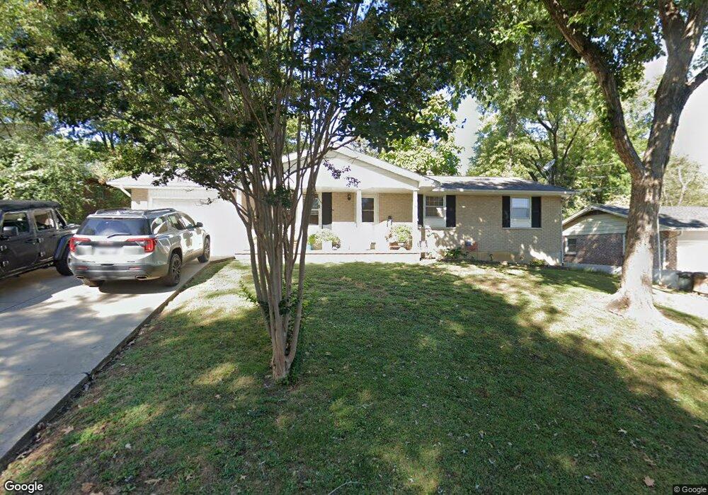
1031 Caufield Dr Cape Girardeau, MO 63701
Estimated Value: $184,000 - $210,795
3
Beds
3
Baths
1,161
Sq Ft
$174/Sq Ft
Est. Value
About This Home
This home is located at 1031 Caufield Dr, Cape Girardeau, MO 63701 and is currently estimated at $201,699, approximately $173 per square foot. 1031 Caufield Dr is a home located in Cape Girardeau County with nearby schools including Clippard Elementary School, Central Middle School, and Central Junior High School.
Ownership History
Date
Name
Owned For
Owner Type
Purchase Details
Closed on
Aug 31, 2021
Sold by
Lawrence Terry and Lawrence Lindsey
Bought by
Double A Mini Storage Llc
Current Estimated Value
Purchase Details
Closed on
Apr 22, 2011
Sold by
Tanz Jared L and Tanz Michelle L
Bought by
Cook Michael G and Cook Spring
Home Financials for this Owner
Home Financials are based on the most recent Mortgage that was taken out on this home.
Original Mortgage
$129,900
Interest Rate
4.87%
Mortgage Type
Unknown
Purchase Details
Closed on
Aug 12, 2005
Sold by
Duben Anthony J and Duben Darlene A
Bought by
Tanz Jared
Home Financials for this Owner
Home Financials are based on the most recent Mortgage that was taken out on this home.
Original Mortgage
$84,875
Interest Rate
5.51%
Mortgage Type
New Conventional
Create a Home Valuation Report for This Property
The Home Valuation Report is an in-depth analysis detailing your home's value as well as a comparison with similar homes in the area
Home Values in the Area
Average Home Value in this Area
Purchase History
| Date | Buyer | Sale Price | Title Company |
|---|---|---|---|
| Double A Mini Storage Llc | -- | None Available | |
| Cook Michael G | -- | None Available | |
| Tanz Jared | -- | None Available |
Source: Public Records
Mortgage History
| Date | Status | Borrower | Loan Amount |
|---|---|---|---|
| Previous Owner | Cook Michael G | $129,900 | |
| Previous Owner | Tanz Jared | $84,875 |
Source: Public Records
Tax History Compared to Growth
Tax History
| Year | Tax Paid | Tax Assessment Tax Assessment Total Assessment is a certain percentage of the fair market value that is determined by local assessors to be the total taxable value of land and additions on the property. | Land | Improvement |
|---|---|---|---|---|
| 2025 | $13 | $26,520 | $1,820 | $24,700 |
| 2024 | $13 | $25,250 | $1,730 | $23,520 |
| 2023 | $1,312 | $25,250 | $1,730 | $23,520 |
| 2022 | $1,211 | $23,280 | $1,600 | $21,680 |
| 2021 | $1,210 | $23,280 | $1,600 | $21,680 |
| 2020 | $1,214 | $23,280 | $1,600 | $21,680 |
| 2019 | $1,212 | $23,280 | $0 | $0 |
| 2018 | $1,210 | $23,280 | $0 | $0 |
| 2017 | $1,213 | $23,280 | $0 | $0 |
| 2016 | $1,134 | $21,850 | $0 | $0 |
| 2015 | $1,127 | $21,700 | $0 | $0 |
| 2014 | $1,132 | $21,700 | $0 | $0 |
Source: Public Records
Map
Nearby Homes
- 1070 Dorothy St
- 1107 Dorothy St
- 835 Lochinvar Ln
- 1246 Marilyn Dr
- 2629 Hopper Rd
- 1000 N Mount Auburn Rd
- 3269 Hopper Rd
- 769 Cedar Ln
- 2550 Marvin St
- 2449 Janet Dr
- 2615 Maria Louise Ln
- 2412 Masters Dr
- 2416 Terrie Hill Rd
- 3002 Melrose Ave
- 3014 Keystone Dr
- 3022 Wisteria Dr
- 3036 Keystone Dr
- 3027 Wisteria Dr
- 1701 Brookwood Dr
- 1705 Paul Revere Dr
- 1029 Caufield Dr
- 1062 Dorothy St
- 1032 Caufield Dr
- 1028 Caufield Dr
- 1064 Dorothy St
- 1027 Caufield Dr
- 3821 Silverton Cir
- 3828 Silverton Cir
- 983 Rifle Dr
- 3820 Silverton Cir
- 975 Rifle Dr
- 995 Rifle Dr
- 1066 Dorothy St
- 1035 Caufield Dr
- 1036 Caufield Dr
- 1024 Caufield Dr
- 1060 Dorothy St
- 1068 Dorothy St
- 1025 Caufield Dr
- 1058 Dorothy St