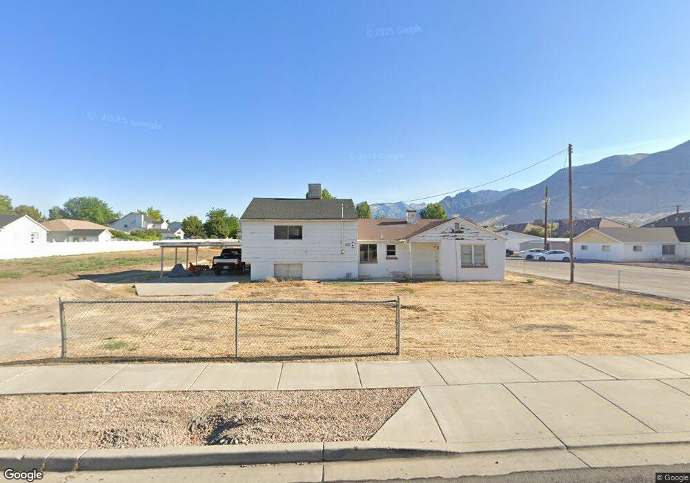
1031 E 50 S American Fork, UT 84003
Estimated Value: $553,000 - $636,866
4
Beds
3
Baths
1,502
Sq Ft
$401/Sq Ft
Est. Value
About This Home
This home is located at 1031 E 50 S, American Fork, UT 84003 and is currently estimated at $602,717, approximately $401 per square foot. 1031 E 50 S is a home located in Utah County with nearby schools including Barratt Elementary School, American Fork Junior High School, and American Fork High School.
Ownership History
Date
Name
Owned For
Owner Type
Purchase Details
Closed on
Jun 18, 2012
Sold by
Ashworth Jay B and Ashworth Deanne
Bought by
Leavitt Timothy V
Current Estimated Value
Purchase Details
Closed on
Aug 17, 2007
Sold by
Johnson Reese H
Bought by
Ashworth Jay B and Ashworth Deanne
Purchase Details
Closed on
Aug 16, 2004
Sold by
Richan William B and Richan Helen N
Bought by
Ashworth Jay B and Ashworth Deanne
Create a Home Valuation Report for This Property
The Home Valuation Report is an in-depth analysis detailing your home's value as well as a comparison with similar homes in the area
Home Values in the Area
Average Home Value in this Area
Purchase History
| Date | Buyer | Sale Price | Title Company |
|---|---|---|---|
| Leavitt Timothy V | -- | First American Title Ins Llc | |
| Ashworth Jay B | -- | Bartlett Title Insurance Ag | |
| Ashworth Jay B | -- | Backman Stewart Title Servi |
Source: Public Records
Tax History Compared to Growth
Tax History
| Year | Tax Paid | Tax Assessment Tax Assessment Total Assessment is a certain percentage of the fair market value that is determined by local assessors to be the total taxable value of land and additions on the property. | Land | Improvement |
|---|---|---|---|---|
| 2025 | $2,433 | $306,130 | $317,900 | $238,700 |
| 2024 | $2,296 | $280,445 | $0 | $0 |
| 2023 | $2,296 | $283,360 | $0 | $0 |
| 2022 | $2,648 | $317,845 | $0 | $0 |
| 2021 | $2,191 | $395,400 | $199,600 | $195,800 |
| 2020 | $2,013 | $356,200 | $178,200 | $178,000 |
| 2019 | $1,837 | $336,300 | $168,300 | $168,000 |
| 2018 | $1,695 | $294,600 | $148,500 | $146,100 |
| 2017 | $1,684 | $156,585 | $0 | $0 |
| 2016 | $1,424 | $121,605 | $0 | $0 |
| 2015 | $1,456 | $118,855 | $0 | $0 |
| 2014 | $1,351 | $109,725 | $0 | $0 |
Source: Public Records
Map
Nearby Homes
- 1879 W 1100 N
- 1184 E 110 S
- 1198 E 110 S
- 759 W 930 N Unit 502
- 708 W 930 N Unit 505
- 734 W 930 N Unit 506
- 92 S 920 E
- 1141 E 50 N
- 152 S 930 E
- 35 S 800 E
- 170 N 825 E
- 1541 W 1060 N
- Lytham Plan at Grove Acres
- 1498 W 1060 N Unit 5
- 1515 W 1010 St N
- 1491 W 1010 N
- 1171 N 1430 W
- 1065 N 1420 W
- 1443 W 1010 N
- 1088 E 390 S