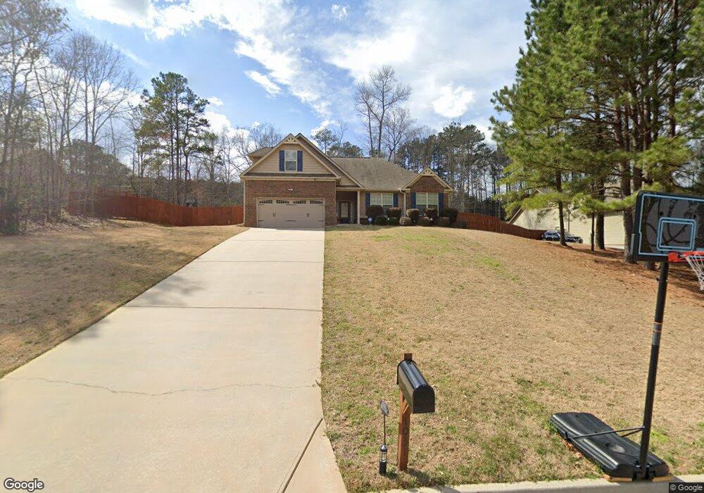
1031 Ezekiel Way Unit 659 Locust Grove, GA 30248
Estimated Value: $344,000 - $378,000
4
Beds
2
Baths
2,103
Sq Ft
$170/Sq Ft
Est. Value
About This Home
This home is located at 1031 Ezekiel Way Unit 659, Locust Grove, GA 30248 and is currently estimated at $357,277, approximately $169 per square foot. 1031 Ezekiel Way Unit 659 is a home located in Henry County with nearby schools including Unity Grove Elementary School, Locust Grove Middle School, and Locust Grove High School.
Ownership History
Date
Name
Owned For
Owner Type
Purchase Details
Closed on
Apr 26, 2013
Sold by
Capshaw Development Co Llc
Bought by
Cutrell Allison M
Current Estimated Value
Home Financials for this Owner
Home Financials are based on the most recent Mortgage that was taken out on this home.
Original Mortgage
$144,795
Outstanding Balance
$102,759
Interest Rate
3.59%
Mortgage Type
New Conventional
Estimated Equity
$254,518
Purchase Details
Closed on
Feb 13, 2013
Sold by
Henry Development Co Llc
Bought by
Capshaw Development Co Llc
Purchase Details
Closed on
Sep 28, 2012
Sold by
Kfr Homes Llc
Bought by
Henry Development Co Llc
Purchase Details
Closed on
Jul 20, 2012
Sold by
Fdic
Bought by
Hamilton State Bank
Create a Home Valuation Report for This Property
The Home Valuation Report is an in-depth analysis detailing your home's value as well as a comparison with similar homes in the area
Home Values in the Area
Average Home Value in this Area
Purchase History
| Date | Buyer | Sale Price | Title Company |
|---|---|---|---|
| Cutrell Allison M | $141,900 | -- | |
| Capshaw Development Co Llc | -- | -- | |
| Henry Development Co Llc | -- | -- | |
| Hamilton State Bank | -- | -- | |
| Kfr Homes Llc | $301,200 | -- |
Source: Public Records
Mortgage History
| Date | Status | Borrower | Loan Amount |
|---|---|---|---|
| Open | Cutrell Allison M | $144,795 |
Source: Public Records
Tax History Compared to Growth
Tax History
| Year | Tax Paid | Tax Assessment Tax Assessment Total Assessment is a certain percentage of the fair market value that is determined by local assessors to be the total taxable value of land and additions on the property. | Land | Improvement |
|---|---|---|---|---|
| 2025 | $5,951 | $148,480 | $18,000 | $130,480 |
| 2024 | $5,951 | $143,080 | $18,000 | $125,080 |
| 2023 | $3,396 | $137,720 | $14,800 | $122,920 |
| 2022 | $3,255 | $110,400 | $14,800 | $95,600 |
| 2021 | $2,859 | $93,640 | $14,800 | $78,840 |
| 2020 | $2,643 | $84,480 | $12,000 | $72,480 |
| 2019 | $2,545 | $80,320 | $12,000 | $68,320 |
| 2018 | $2,429 | $75,440 | $12,000 | $63,440 |
| 2016 | $2,192 | $65,400 | $10,000 | $55,400 |
| 2015 | $2,303 | $67,960 | $10,000 | $57,960 |
| 2014 | $2,058 | $56,760 | $9,309 | $47,451 |
Source: Public Records
Map
Nearby Homes
- 143 Kimbell Farm Dr
- 521 Deadwood Trail
- 121, 125, 129 Case Dr
- 601 Amerigo Ct
- 218 Baxter Ln
- 1000 Coan Dr
- 1126 Old Jackson Rd
- 100 Harbin Trail
- 281 Laney Dr
- 995 Old Jackson Rd
- 705 S Bethany Rd
- 604 Onieda Dr
- 705 Seabolt Rd
- 215 Laney Rd
- 767 Old Jackson Rd
- 678 Seabolt Rd
- 201 Nina Cir
- 125 Laney Ct
- 560 Coan Dr
- 125 Karen Dr
- 1031 Ezekiel Way
- 1027 Ezekiel Way
- 1027 Ezekiel Way Unit 658
- 1035 Ezekiel Way
- 1035 Ezekiel Way Unit 660
- 1037 Ezekiel Way
- 1037 Ezekiel Way Unit 661
- 576 Deadwood Trail
- 576 Deadwood Trail Unit 654
- 1005 Ezekiel Way
- 1005 Ezekiel Way Unit 657
- 580 Deadwood Trail
- 580 Deadwood Trail Unit 653
- 572 Deadwood Trail
- 572 Deadwood Trail Unit 655
- 1028 Ezekiel Way
- 584 Deadwood Trail
- 584 Deadwood Trail Unit 652
- 1040 Ezekiel Way
- 1040 Ezekiel Way Unit 662