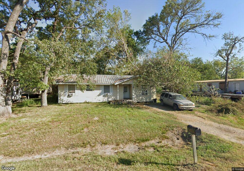
1031 Finesse Dr Houston, TX 77032
Greenspoint NeighborhoodEstimated Value: $163,770 - $196,000
3
Beds
1
Bath
1,442
Sq Ft
$124/Sq Ft
Est. Value
About This Home
This home is located at 1031 Finesse Dr, Houston, TX 77032 and is currently estimated at $178,943, approximately $124 per square foot. 1031 Finesse Dr is a home located in Harris County with nearby schools including Calvert Elementary School, Nimitz Ninth Grade School, and Teague Middle School.
Ownership History
Date
Name
Owned For
Owner Type
Purchase Details
Closed on
Aug 7, 2017
Sold by
Toghani Hossein
Bought by
Jones Emmet E and Jones Emmet Edward
Current Estimated Value
Purchase Details
Closed on
Dec 6, 2016
Sold by
Reson Alan
Bought by
Lone Star Investment
Purchase Details
Closed on
Dec 18, 2002
Sold by
Jones Emmett E
Bought by
First Capital Interest Llc
Create a Home Valuation Report for This Property
The Home Valuation Report is an in-depth analysis detailing your home's value as well as a comparison with similar homes in the area
Home Values in the Area
Average Home Value in this Area
Purchase History
| Date | Buyer | Sale Price | Title Company |
|---|---|---|---|
| Jones Emmet E | -- | None Available | |
| Lone Star Investment | -- | None Available | |
| First Capital Interest Llc | $16,250 | -- |
Source: Public Records
Tax History Compared to Growth
Tax History
| Year | Tax Paid | Tax Assessment Tax Assessment Total Assessment is a certain percentage of the fair market value that is determined by local assessors to be the total taxable value of land and additions on the property. | Land | Improvement |
|---|---|---|---|---|
| 2025 | $2,547 | $145,178 | $42,403 | $102,775 |
| 2024 | $2,547 | $131,964 | $35,633 | $96,331 |
| 2023 | $2,039 | $109,864 | $35,633 | $74,231 |
| 2022 | $1,772 | $86,457 | $35,633 | $50,824 |
| 2021 | $1,218 | $56,519 | $21,380 | $35,139 |
| 2020 | $1,284 | $56,519 | $21,380 | $35,139 |
| 2019 | $1,345 | $56,519 | $21,380 | $35,139 |
| 2018 | $812 | $56,519 | $21,380 | $35,139 |
| 2017 | $1,281 | $56,519 | $21,380 | $35,139 |
| 2016 | $1,083 | $47,795 | $10,690 | $37,105 |
| 2015 | $1,065 | $47,795 | $10,690 | $37,105 |
| 2014 | $1,065 | $47,795 | $10,690 | $37,105 |
Source: Public Records
Map
Nearby Homes
- 15607 Dowlwood Dr
- 1042 Tunell Ln
- 1114 Blackwood Ave
- 810 Benmar Dr
- 1159 Aldine Meadows Rd
- 1403 Old Greens Rd
- 15607 Weldon Dr
- 2115 Whittier Dr
- 2112 Greenbriar Colony Dr
- 14811 W Hardy Rd
- 2120 Greenbriar Colony Dr
- 15611 Martineau St
- 2106 Shiveley Cir
- 2129 Whittier Dr
- 0 W Hardy Rd Unit 90623815
- 2142 Greenbriar Colony Dr
- 15522 Blake Way St
- 16124 Aldine Westfield Rd
- 16102 Aldine Westfield Rd
- 17202 Imperial Valley Dr Unit 34
- 1029 Finesse Dr
- 1027 Finesse Dr
- 1038 Finesse Dr
- 1030 Finesse Dr
- 1034 Kenrick Dr
- 1052 Finesse Dr
- 1035 Brillock Ave
- 1050 Finesse Dr
- 1027 Brillock Ave
- 1031 Kenrick Dr
- 15607 Alenzo Dr
- 15503 Tallshadows Dr
- 1103 Brillock Ave
- 15602 Dowlwood Dr
- 15321 Tallshadows Dr
- 15424 Tallshadows Dr
- 1035 Glee Ln
- 1027 Glee Ln
- 15422 Tallshadows Dr
- 1054 Salter Dr