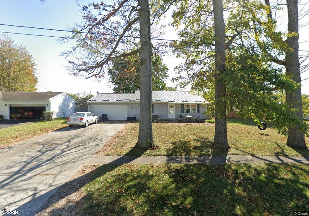
1031 Glendale Ave Marion, OH 43302
Estimated Value: $156,000 - $180,000
2
Beds
2
Baths
952
Sq Ft
$176/Sq Ft
Est. Value
About This Home
This home is located at 1031 Glendale Ave, Marion, OH 43302 and is currently estimated at $167,428, approximately $175 per square foot. 1031 Glendale Ave is a home located in Marion County with nearby schools including William McKinley Elementary School, Ulysses S. Grant Middle School, and Harding High School.
Ownership History
Date
Name
Owned For
Owner Type
Purchase Details
Closed on
Jan 5, 2023
Sold by
Lyman Rebecca
Bought by
Wood Michael
Current Estimated Value
Home Financials for this Owner
Home Financials are based on the most recent Mortgage that was taken out on this home.
Original Mortgage
$80,382
Interest Rate
7.22%
Mortgage Type
FHA
Purchase Details
Closed on
Feb 21, 2007
Sold by
Lyman Gerald D
Bought by
Wood Rebecca and Wood Michael
Home Financials for this Owner
Home Financials are based on the most recent Mortgage that was taken out on this home.
Original Mortgage
$89,221
Interest Rate
6.23%
Mortgage Type
FHA
Purchase Details
Closed on
Jul 26, 1999
Bought by
Wood Rebecca and Michael Surv
Create a Home Valuation Report for This Property
The Home Valuation Report is an in-depth analysis detailing your home's value as well as a comparison with similar homes in the area
Home Values in the Area
Average Home Value in this Area
Purchase History
| Date | Buyer | Sale Price | Title Company |
|---|---|---|---|
| Wood Michael | -- | None Listed On Document | |
| Wood Rebecca | $90,000 | A C S Title | |
| Wood Rebecca | $79,500 | -- |
Source: Public Records
Mortgage History
| Date | Status | Borrower | Loan Amount |
|---|---|---|---|
| Previous Owner | Wood Michael | $80,382 | |
| Previous Owner | Wood Rebecca | $89,221 |
Source: Public Records
Tax History Compared to Growth
Tax History
| Year | Tax Paid | Tax Assessment Tax Assessment Total Assessment is a certain percentage of the fair market value that is determined by local assessors to be the total taxable value of land and additions on the property. | Land | Improvement |
|---|---|---|---|---|
| 2024 | $1,724 | $44,950 | $8,180 | $36,770 |
| 2023 | $1,724 | $44,950 | $8,180 | $36,770 |
| 2022 | $1,601 | $44,950 | $8,180 | $36,770 |
| 2021 | $1,473 | $37,250 | $7,110 | $30,140 |
| 2020 | $1,477 | $37,250 | $7,110 | $30,140 |
| 2019 | $1,436 | $37,250 | $7,110 | $30,140 |
| 2018 | $1,265 | $32,830 | $7,150 | $25,680 |
| 2017 | $1,281 | $32,830 | $7,150 | $25,680 |
| 2016 | $1,274 | $32,830 | $7,150 | $25,680 |
| 2015 | $1,271 | $32,020 | $6,810 | $25,210 |
| 2014 | $1,272 | $32,020 | $6,810 | $25,210 |
| 2012 | $1,253 | $31,330 | $6,540 | $24,790 |
Source: Public Records
Map
Nearby Homes
- 1406 Plantation Dr
- 1133 Amherst Dr
- 786 Sheridan Rd
- 950 Oak Grove Ave
- 772 Sheridan Rd
- 889 Oak Grove Ave
- 0 Bellefontaine Ave
- 796 Woodrow Ave
- 757 Merkle Ave
- 720 Woodrow Ave
- 989 Davids St
- 625 Rochelle Dr
- 981 Davids St
- 668 Uncapher Ave
- 645 Henry St
- 681 Davids St
- 472 Clinton St
- 579 Henry St
- 1178 Cheney Ave
- 407 Latourette St
- 1021 Glendale Ave
- 990 Underwood South Dr
- 980 Underwood South Dr
- 1011 Glendale Ave
- 980 Underwood Dr S
- 990 Underwood Dr
- 998 Underwood South Dr
- 1008 Stonewall Ct
- 1032 Glendale Ave
- 1006 Underwood South Dr
- 1014 Glendale Ave
- 1014 Glendale Ave
- 995 Glendale Ave
- 1014 Underwood South Dr
- 979 Underwood Dr S
- 1016 Stonewall Ct
- 989 Underwood South Dr
- 979 Underwood South Dr
- 997 Underwood Dr S
- 1074 Glendale Ave