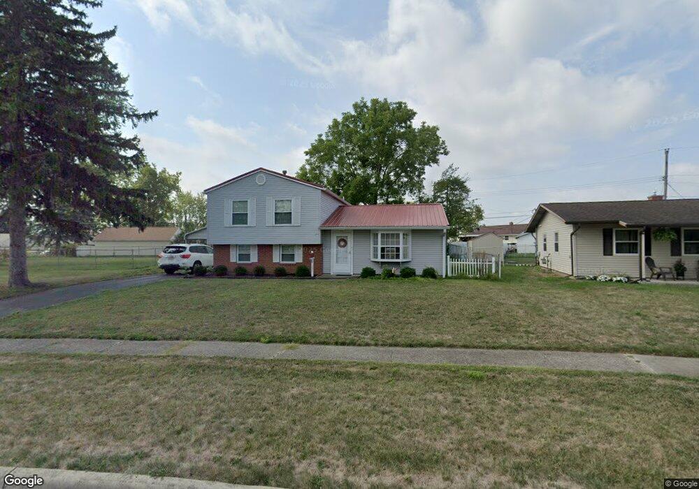
1031 Moncrief Ave Columbus, OH 43207
Obetz-Lockbourne NeighborhoodEstimated Value: $225,227 - $237,000
3
Beds
2
Baths
1,040
Sq Ft
$223/Sq Ft
Est. Value
About This Home
This home is located at 1031 Moncrief Ave, Columbus, OH 43207 and is currently estimated at $231,807, approximately $222 per square foot. 1031 Moncrief Ave is a home located in Franklin County with nearby schools including Hamilton Elementary School, Hamilton Intermediate School, and Hamilton Middle School.
Ownership History
Date
Name
Owned For
Owner Type
Purchase Details
Closed on
Mar 22, 1999
Sold by
Tennant Laurren J
Bought by
Huffman Timothy D and Huffman Sharon A
Current Estimated Value
Home Financials for this Owner
Home Financials are based on the most recent Mortgage that was taken out on this home.
Original Mortgage
$102,947
Outstanding Balance
$22,985
Interest Rate
6.85%
Mortgage Type
FHA
Estimated Equity
$208,822
Purchase Details
Closed on
Jul 20, 1998
Sold by
Tennant Laurren J
Bought by
Bandow Tennant Francis Louis and Bandow Tennant Doris
Create a Home Valuation Report for This Property
The Home Valuation Report is an in-depth analysis detailing your home's value as well as a comparison with similar homes in the area
Home Values in the Area
Average Home Value in this Area
Purchase History
| Date | Buyer | Sale Price | Title Company |
|---|---|---|---|
| Huffman Timothy D | $103,000 | Preferred Title Agency Inc | |
| Bandow Tennant Francis Louis | -- | -- |
Source: Public Records
Mortgage History
| Date | Status | Borrower | Loan Amount |
|---|---|---|---|
| Open | Huffman Timothy D | $102,947 |
Source: Public Records
Tax History
| Year | Tax Paid | Tax Assessment Tax Assessment Total Assessment is a certain percentage of the fair market value that is determined by local assessors to be the total taxable value of land and additions on the property. | Land | Improvement |
|---|---|---|---|---|
| 2025 | $3,232 | $70,740 | $18,590 | $52,150 |
| 2024 | $3,232 | $70,740 | $18,590 | $52,150 |
| 2023 | $3,215 | $70,735 | $18,585 | $52,150 |
| 2022 | $2,133 | $39,340 | $7,350 | $31,990 |
| 2021 | $2,162 | $39,340 | $7,350 | $31,990 |
| 2020 | $2,202 | $39,340 | $7,350 | $31,990 |
| 2019 | $2,072 | $32,800 | $6,130 | $26,670 |
| 2018 | $2,016 | $32,800 | $6,130 | $26,670 |
| 2017 | $1,956 | $32,800 | $6,130 | $26,670 |
| 2016 | $2,094 | $32,380 | $6,410 | $25,970 |
| 2015 | $1,987 | $32,380 | $6,410 | $25,970 |
| 2014 | $1,976 | $32,380 | $6,410 | $25,970 |
| 2013 | $1,057 | $35,945 | $7,105 | $28,840 |
Source: Public Records
Map
Nearby Homes
- 4926 Meadowbrook Dr
- 5220 Edgeview Rd
- 5076 Ranger Dr Unit Lot 100
- 863 Cherrydale Ave
- 1291 Webb Dr Unit Lot 90
- 1307 Webb Dr Unit Lot 92
- 1315 Webb Dr Unit Lot 93
- 908 Tecumseh Ave
- 5060 Ranger Dr Unit Lot 87
- 5018 Grimm Dr
- 4241 Gelbray Ct
- 1132 Ayrshire Dr
- 4436 Wesley Trail
- 4410 Holstein Dr
- 4344 Brett Ln
- 1962 Reese Ave
- 4455 Catamaran Dr
- 1987 Reese Ave
- 4412 Catamaran Dr
- 2027 Reese Ave
- 1023 Moncrief Ave
- 5119 Fairlane Rd
- 1051 Moncrief Ave
- 5117 Fairlane Rd
- 1008 Landou Way
- 1010 Landou Way
- 1032 Moncrief Ave
- 5070 Meadowbrook Dr
- 5115 Fairlane Rd
- 5121 Fairlane Rd
- 1059 Moncrief Ave
- 1040 Moncrief Ave
- 1048 Moncrief Ave
- 5113 Fairlane Rd
- 5040 Meadowbrook Dr
- 1067 Moncrief Ave
- 1056 Moncrief Ave
- 5053 Meadowbrook Dr
- 5061 Meadowbrook Dr
- 5111 Fairlane Rd
Your Personal Tour Guide
Ask me questions while you tour the home.