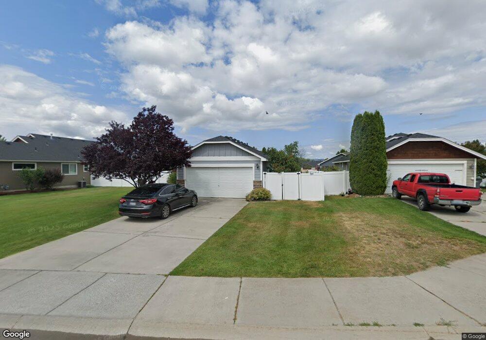
1031 N Oasis Ave Deer Park, WA 99006
Estimated Value: $349,000 - $402,000
3
Beds
2
Baths
1,292
Sq Ft
$292/Sq Ft
Est. Value
About This Home
This home is located at 1031 N Oasis Ave, Deer Park, WA 99006 and is currently estimated at $377,837, approximately $292 per square foot. 1031 N Oasis Ave is a home located in Spokane County with nearby schools including Deer Park Elementary School, Arcadia Elementary School, and Deer Park Home Link Program.
Ownership History
Date
Name
Owned For
Owner Type
Purchase Details
Closed on
Oct 24, 2014
Sold by
Ingram Trudy L
Bought by
The Amy L Ingram Irrevocable Trust
Current Estimated Value
Purchase Details
Closed on
Aug 12, 2014
Sold by
Ingram Trudy
Bought by
The Kierstyn Ingram Irrevocable Trust
Purchase Details
Closed on
Jul 26, 2007
Sold by
Harley C Douglass Inc
Bought by
Ingram Trudy
Home Financials for this Owner
Home Financials are based on the most recent Mortgage that was taken out on this home.
Original Mortgage
$75,000
Outstanding Balance
$47,486
Interest Rate
6.66%
Mortgage Type
New Conventional
Estimated Equity
$330,351
Create a Home Valuation Report for This Property
The Home Valuation Report is an in-depth analysis detailing your home's value as well as a comparison with similar homes in the area
Home Values in the Area
Average Home Value in this Area
Purchase History
| Date | Buyer | Sale Price | Title Company |
|---|---|---|---|
| The Amy L Ingram Irrevocable Trust | -- | None Available | |
| The Kierstyn Ingram Irrevocable Trust | -- | None Available | |
| Ingram Trudy | $196,450 | Transnation Title Ins Co |
Source: Public Records
Mortgage History
| Date | Status | Borrower | Loan Amount |
|---|---|---|---|
| Open | Ingram Trudy | $75,000 |
Source: Public Records
Tax History Compared to Growth
Tax History
| Year | Tax Paid | Tax Assessment Tax Assessment Total Assessment is a certain percentage of the fair market value that is determined by local assessors to be the total taxable value of land and additions on the property. | Land | Improvement |
|---|---|---|---|---|
| 2025 | $3,021 | $338,300 | $100,000 | $238,300 |
| 2024 | $3,021 | $342,200 | $100,000 | $242,200 |
| 2023 | $2,876 | $327,200 | $85,000 | $242,200 |
| 2022 | $2,514 | $319,200 | $82,000 | $237,200 |
| 2021 | $2,439 | $220,800 | $55,000 | $165,800 |
| 2020 | $2,236 | $193,900 | $52,000 | $141,900 |
| 2019 | $2,078 | $181,200 | $50,000 | $131,200 |
| 2018 | $2,210 | $177,000 | $43,000 | $134,000 |
| 2017 | $1,868 | $152,100 | $30,000 | $122,100 |
| 2016 | $1,725 | $135,900 | $30,000 | $105,900 |
| 2015 | $1,698 | $130,500 | $27,000 | $103,500 |
| 2014 | -- | $130,500 | $27,000 | $103,500 |
| 2013 | -- | $0 | $0 | $0 |
Source: Public Records
Map
Nearby Homes
- 1118 N Country Club Dr
- 937 N Oasis Ave
- 1109 N Country Club Dr Unit 29
- 1109 N Country Club Dr Unit 15
- 919 N Country Club Dr
- 1205 N Country Club Dr Unit 125
- 1402 E Sawgrass Ln
- 1234 Augusta St
- 1230 Augusta St
- 1226 Augusta St
- 1321 E 12th St
- 1216 High Desert Dr
- 1320 E Chelan Ct
- 1226 High Desert Dr
- 1321 E 4th St
- 1613 E 2nd St
- 1520 E First Ct
- 1821 E A St
- MAPLE Plan at Shamrock Glen
- SHERWOOD Plan at Shamrock Glen
- 1025 N Oasis Ave
- 1037 N Oasis Ave
- 1032 N Country Club Dr
- 1019 N Oasis Ave
- 1026 N Country Club Dr
- 1038 N Oasis Ave
- 1032 Oasis Ave
- 1038 Oasis Ave
- 1020 N Country Club Dr
- 1026 Oasis Ave
- 1044 Oasis Ave
- 1013 N Oasis Ave
- 1050 N Oasis Ave
- 1020 Oasis Ave
- 1014 N Country Club Dr
- 1050 Oasis Ave
- 1112 N Country Club Dr
- 1007 N Oasis Ave
- 1014 N Oasis Ave
- 1109 N Country Club Dr Unit #36