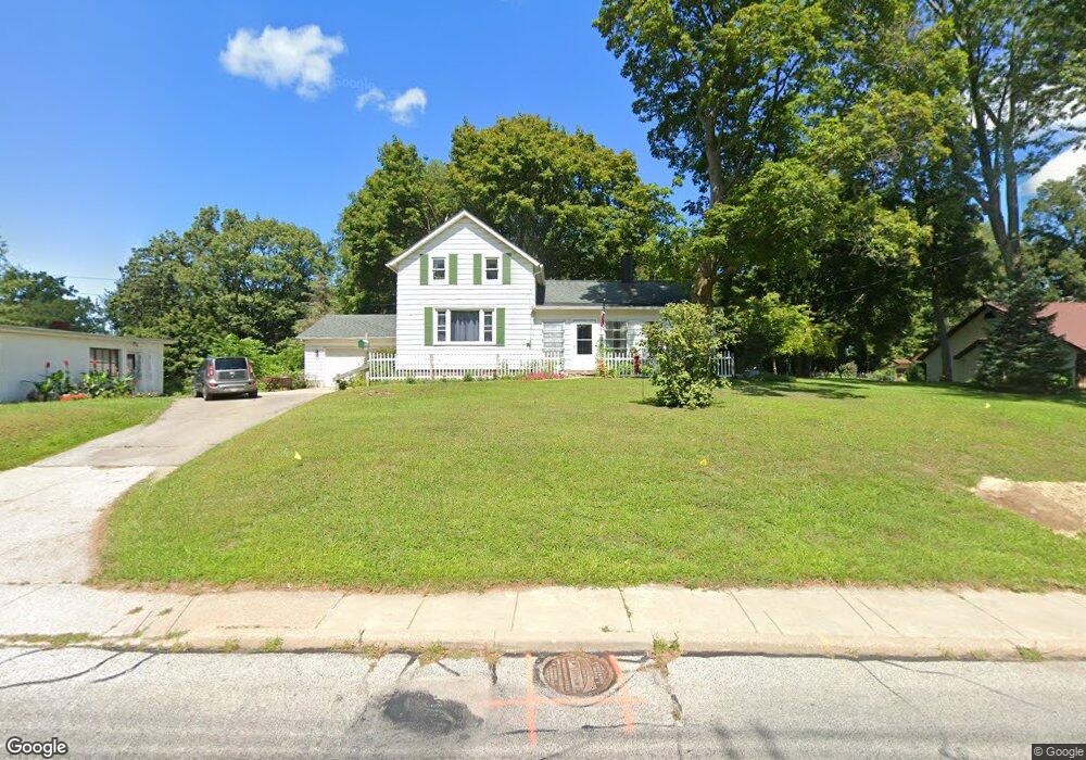
1031 Park Ave Amherst, OH 44001
Estimated Value: $224,000 - $298,000
3
Beds
3
Baths
2,002
Sq Ft
$137/Sq Ft
Est. Value
About This Home
This home is located at 1031 Park Ave, Amherst, OH 44001 and is currently estimated at $273,552, approximately $136 per square foot. 1031 Park Ave is a home located in Lorain County with nearby schools including Powers Elementary School, Walter G. Nord Middle School, and Amherst Junior High School.
Ownership History
Date
Name
Owned For
Owner Type
Purchase Details
Closed on
Jun 16, 2023
Sold by
Wohlever Elizabeth Ann
Bought by
Oconnor Lisa M
Current Estimated Value
Home Financials for this Owner
Home Financials are based on the most recent Mortgage that was taken out on this home.
Original Mortgage
$80,000
Outstanding Balance
$77,845
Interest Rate
6.35%
Mortgage Type
New Conventional
Estimated Equity
$195,707
Purchase Details
Closed on
Oct 14, 2021
Sold by
Wohlever William P
Bought by
Wohlever Elizabeth A
Create a Home Valuation Report for This Property
The Home Valuation Report is an in-depth analysis detailing your home's value as well as a comparison with similar homes in the area
Home Values in the Area
Average Home Value in this Area
Purchase History
| Date | Buyer | Sale Price | Title Company |
|---|---|---|---|
| Oconnor Lisa M | $80,000 | None Listed On Document | |
| Wohlever Elizabeth A | -- | -- |
Source: Public Records
Mortgage History
| Date | Status | Borrower | Loan Amount |
|---|---|---|---|
| Open | Oconnor Lisa M | $80,000 |
Source: Public Records
Tax History Compared to Growth
Tax History
| Year | Tax Paid | Tax Assessment Tax Assessment Total Assessment is a certain percentage of the fair market value that is determined by local assessors to be the total taxable value of land and additions on the property. | Land | Improvement |
|---|---|---|---|---|
| 2024 | $3,529 | $87,360 | $30,706 | $56,655 |
| 2023 | $2,569 | $53,610 | $15,565 | $38,045 |
| 2022 | $2,462 | $53,610 | $15,565 | $38,045 |
| 2021 | $2,066 | $53,610 | $15,565 | $38,045 |
| 2020 | $1,873 | $44,860 | $13,020 | $31,840 |
| 2019 | $1,836 | $44,860 | $13,020 | $31,840 |
| 2018 | $1,731 | $44,860 | $13,020 | $31,840 |
| 2017 | $1,616 | $38,430 | $11,160 | $27,270 |
| 2016 | $1,629 | $38,430 | $11,160 | $27,270 |
| 2015 | $1,620 | $38,430 | $11,160 | $27,270 |
| 2014 | $1,715 | $40,030 | $11,620 | $28,410 |
| 2013 | $1,721 | $40,030 | $11,620 | $28,410 |
Source: Public Records
Map
Nearby Homes
- 1140 Woodside Dr
- 891 Park Ave
- 179 Jackson St
- 825 Cleveland Ave
- 105 N Woodhill Dr
- 135 Ridgeland Dr
- 2176 Myla Way
- 653 Brennan Dr
- 0 Middle Ridge Rd Unit 5102632
- 0 Middle Ridge Rd Unit 5160578
- 726 Sunrise Dr
- 7475 S Dewey Rd
- 707 Greenlawn Dr
- 923 Longitude Ln
- 6394 Balsam Dr
- 812 Bearing Ct
- 574 Fieldstone Dr
- 8 Riviera Ave
- 7325 Hidden Glen Dr
- 60 Flamingo Ave
- 1021 Park Ave
- 1037 Park Ave
- 187 Orchard Hill Dr
- 1080 Park Ave
- 190 Orchard Hill Dr
- 1058 Park Ave
- 1042 Park Ave
- 1112 Park Ave
- 1020 Park Ave
- 240 Broadway St
- 186 Orchard Hill Dr
- 251 Taylor St
- 230 Taylor St
- 1115 Park Ave
- 185 Orchard Hill Dr
- 33 Hume Hill Dr
- 260 Broadway St
- 925 Park Ave
- 182 Orchard Hill Dr
- 35 Hume Hill Dr