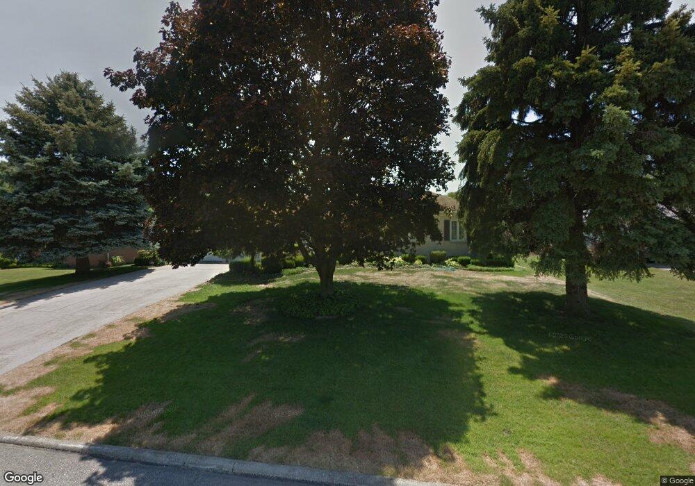
1031 Pearce Dr Mansfield, OH 44906
Estimated Value: $233,664 - $294,000
3
Beds
3
Baths
2,188
Sq Ft
$122/Sq Ft
Est. Value
About This Home
This home is located at 1031 Pearce Dr, Mansfield, OH 44906 and is currently estimated at $267,416, approximately $122 per square foot. 1031 Pearce Dr is a home located in Richland County with nearby schools including Mansfield Elective Academy, Mansfield Classical Academy, and Mansfield Seventh-day Adventist School.
Ownership History
Date
Name
Owned For
Owner Type
Purchase Details
Closed on
Jan 15, 2018
Sold by
Engel Katherina
Bought by
Adkins Wiliam D and Adkins Michelle A
Current Estimated Value
Home Financials for this Owner
Home Financials are based on the most recent Mortgage that was taken out on this home.
Original Mortgage
$147,283
Interest Rate
3.94%
Mortgage Type
FHA
Purchase Details
Closed on
Aug 17, 2011
Sold by
Engel Frank and Engel Katharina
Bought by
Engel Katharina
Create a Home Valuation Report for This Property
The Home Valuation Report is an in-depth analysis detailing your home's value as well as a comparison with similar homes in the area
Home Values in the Area
Average Home Value in this Area
Purchase History
| Date | Buyer | Sale Price | Title Company |
|---|---|---|---|
| Adkins Wiliam D | $150,000 | Chicago Title | |
| Engel Katharina | -- | Chicago Title |
Source: Public Records
Mortgage History
| Date | Status | Borrower | Loan Amount |
|---|---|---|---|
| Closed | Adkins Wiliam D | $147,283 |
Source: Public Records
Tax History Compared to Growth
Tax History
| Year | Tax Paid | Tax Assessment Tax Assessment Total Assessment is a certain percentage of the fair market value that is determined by local assessors to be the total taxable value of land and additions on the property. | Land | Improvement |
|---|---|---|---|---|
| 2024 | $2,469 | $62,520 | $7,250 | $55,270 |
| 2023 | $2,469 | $62,520 | $7,250 | $55,270 |
| 2022 | $2,113 | $46,560 | $6,220 | $40,340 |
| 2021 | $2,127 | $46,560 | $6,220 | $40,340 |
| 2020 | $2,175 | $46,560 | $6,220 | $40,340 |
| 2019 | $2,969 | $46,560 | $6,220 | $40,340 |
| 2018 | $2,378 | $46,560 | $6,220 | $40,340 |
| 2017 | $2,314 | $46,560 | $6,220 | $40,340 |
| 2016 | $2,151 | $42,830 | $6,560 | $36,270 |
| 2015 | $2,151 | $42,830 | $6,560 | $36,270 |
| 2014 | $2,028 | $42,830 | $6,560 | $36,270 |
| 2012 | $772 | $42,830 | $6,910 | $35,920 |
Source: Public Records
Map
Nearby Homes
- 1068 Linwood Place
- 244 S Trimble Rd Unit 246
- 232 S Trimble Rd Unit 234
- 216 S Trimble Rd Unit 218
- 142 Grasmere Ave
- 0 Old Mill Run Rd Unit 9067543
- 0 Old Mill Run Rd Unit 9067542
- 1157 Deer Run Rd
- 212 Marlow Rd
- 408 Fairlawn Ave
- 0 Deer Run Rd
- 191 Fairlawn Ave
- 143 Fairlawn Ave
- 135 Fairlawn Ave
- 0 Bally Row Unit Lot 22930 223011207
- 0 Bally Row Unit Lot 22929 223011206
- 0 Bally Row Unit Lot 22940 223011208
- 129 Fairlawn Ave
- 679 Coleman Rd
- 37 S Linden Rd
- 1025 Pearce Dr
- 1039 Pearce Dr
- 1047 Pearce Dr
- 1036 Pearce Dr
- 1020 Pearce Dr
- 1011 Pearce Dr
- 1010 Pearce Dr
- 1050 Pearce Dr
- 1055 Pearce Dr
- 1001 Pearce Dr
- 1035 Tangee Place
- 1034 Tangee Place
- 1060 Pearce Dr
- 1000 Pearce Dr Unit 1002
- 1025 Tangee Place
- 300 S Trimble Rd Unit 302
- 1024 Tangee Place
- 986 Millsboro Rd
- 1075 Linwood Place
- 1065 Linwood Place
