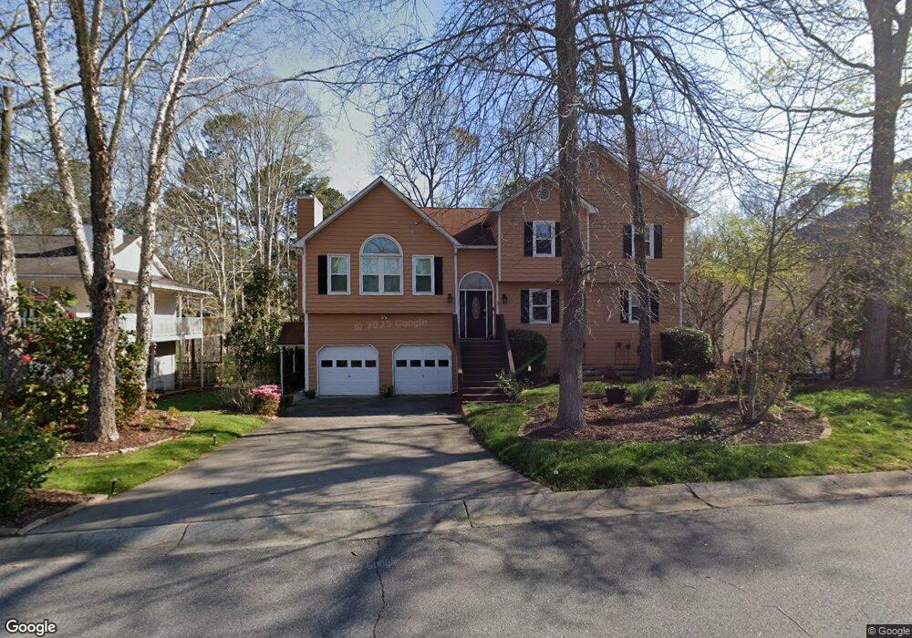
1031 Queensbury Run Unit 1 Acworth, GA 30102
Oak Grove NeighborhoodEstimated Value: $408,930 - $417,000
3
Beds
3
Baths
2,196
Sq Ft
$188/Sq Ft
Est. Value
About This Home
This home is located at 1031 Queensbury Run Unit 1, Acworth, GA 30102 and is currently estimated at $412,965, approximately $188 per square foot. 1031 Queensbury Run Unit 1 is a home located in Cherokee County with nearby schools including Oak Grove Elementary School, E. T. Booth Middle School, and Etowah High School.
Ownership History
Date
Name
Owned For
Owner Type
Purchase Details
Closed on
May 19, 2000
Sold by
Lanzone Philip R
Bought by
Finnegan Brian S and Finnegan Sybille C
Current Estimated Value
Home Financials for this Owner
Home Financials are based on the most recent Mortgage that was taken out on this home.
Original Mortgage
$112,425
Outstanding Balance
$38,267
Interest Rate
8.14%
Mortgage Type
New Conventional
Estimated Equity
$374,698
Purchase Details
Closed on
Nov 1, 1995
Sold by
Rjr Constr Co
Bought by
Lanzone Philip R
Create a Home Valuation Report for This Property
The Home Valuation Report is an in-depth analysis detailing your home's value as well as a comparison with similar homes in the area
Home Values in the Area
Average Home Value in this Area
Purchase History
| Date | Buyer | Sale Price | Title Company |
|---|---|---|---|
| Finnegan Brian S | $149,900 | -- | |
| Lanzone Philip R | $128,200 | -- |
Source: Public Records
Mortgage History
| Date | Status | Borrower | Loan Amount |
|---|---|---|---|
| Open | Finnegan Brian S | $112,425 | |
| Closed | Lanzone Philip R | $0 |
Source: Public Records
Tax History Compared to Growth
Tax History
| Year | Tax Paid | Tax Assessment Tax Assessment Total Assessment is a certain percentage of the fair market value that is determined by local assessors to be the total taxable value of land and additions on the property. | Land | Improvement |
|---|---|---|---|---|
| 2025 | $834 | $156,992 | $32,000 | $124,992 |
| 2024 | $807 | $152,516 | $28,000 | $124,516 |
| 2023 | $673 | $154,044 | $28,000 | $126,044 |
| 2022 | $2,750 | $114,732 | $18,800 | $95,932 |
| 2021 | $2,620 | $99,296 | $18,800 | $80,496 |
| 2020 | $2,483 | $93,304 | $17,600 | $75,704 |
| 2019 | $2,314 | $86,040 | $17,600 | $68,440 |
| 2018 | $2,031 | $73,360 | $14,400 | $58,960 |
| 2017 | $2,022 | $181,100 | $14,400 | $58,040 |
| 2016 | $1,844 | $164,100 | $14,400 | $51,240 |
| 2015 | $1,881 | $165,700 | $14,400 | $51,880 |
| 2014 | $1,798 | $158,300 | $13,760 | $49,560 |
Source: Public Records
Map
Nearby Homes
- 307 Queensbury Walk
- 6390 Woodstock Rd
- 222 Gallant Fox Way
- 302 Victory Commons Overlook
- 148 Sable Trace Trail
- 145 Winner St
- 585 Lee Dr
- The Fenton Plan at Buice Lake - Madison
- The Davis Plan at Buice Lake - Madison
- 6312 Woodstock Rd
- 400 Sable Trace Cove
- 1216 Marlo Way
- 3094 Cambridge Mill St
- 3070 Cambridge Mill St
- 849 York Alley
- 544 Aberdeen Meadow Ln
- 3086 Cambridge Mill St
- 648 Devon Alley
- 3061 Cambridge Mill St
- 1029 Queensbury Run Unit 1
- 1035 Queensbury Run Unit 1
- 1037 Queensbury Run
- 1027 Queensbury Run Unit 1
- 2020 Queensbury Dr
- 2018 Queensbury Dr
- 301 Queensbury Walk Unit 1
- 1039 Queensbury Run Unit 2
- 1025 Queensbury Run
- 2022 Queensbury Dr
- 300 Queensbury Walk
- 0 Queensbury Walk Unit 3229245
- 0 Queensbury Walk Unit 8881864
- 0 Queensbury Walk Unit 8905915
- 2024 Queensbury Dr Unit 2
- 2016 Queensbury Dr
- 1041 Queensbury Run
- 1034 Queensbury Run Unit 1
- 1023 Queensbury Run
- 1040 Queensbury Run Unit 2