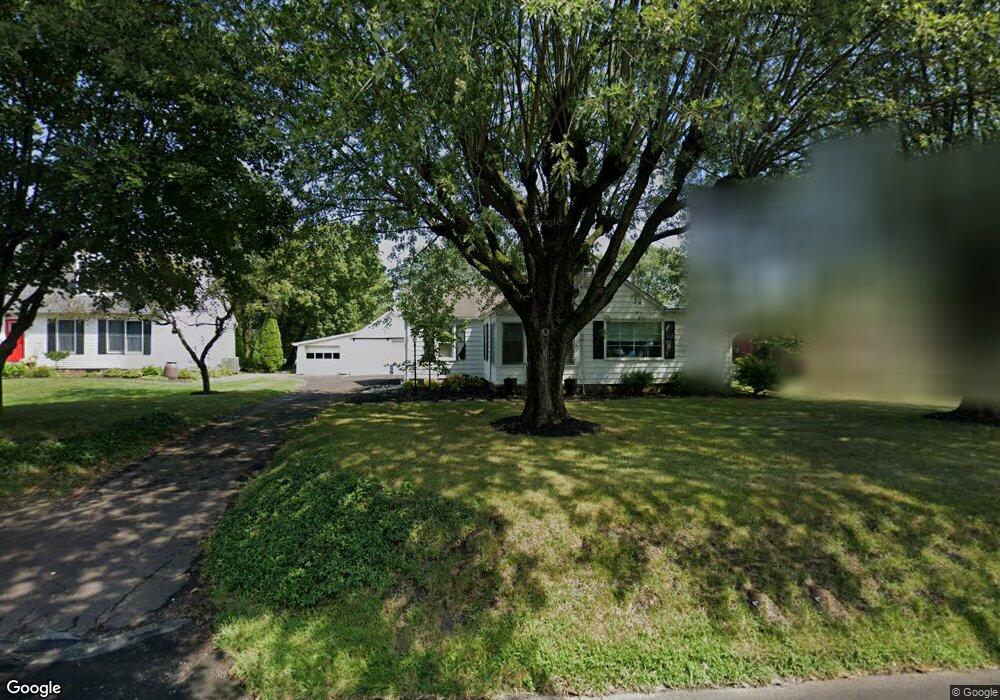
1031 Route 313 Perkasie, PA 18944
East Rockhill NeighborhoodEstimated Value: $308,000 - $356,126
3
Beds
1
Bath
979
Sq Ft
$340/Sq Ft
Est. Value
About This Home
This home is located at 1031 Route 313, Perkasie, PA 18944 and is currently estimated at $333,032, approximately $340 per square foot. 1031 Route 313 is a home located in Bucks County with nearby schools including Pennridge High School and Quakertown Christian School.
Ownership History
Date
Name
Owned For
Owner Type
Purchase Details
Closed on
Jul 29, 2015
Sold by
Brown Theresa M
Bought by
Bleam Thomas and Bleam Nanette
Current Estimated Value
Home Financials for this Owner
Home Financials are based on the most recent Mortgage that was taken out on this home.
Original Mortgage
$120,000
Outstanding Balance
$94,186
Interest Rate
3.97%
Mortgage Type
New Conventional
Estimated Equity
$238,846
Purchase Details
Closed on
Jan 25, 2012
Sold by
First Savings Bank Of Perkasie
Bought by
Brown Theresa M
Purchase Details
Closed on
Jan 10, 1995
Sold by
Stevenback Helen
Bought by
Stevenback Larry
Create a Home Valuation Report for This Property
The Home Valuation Report is an in-depth analysis detailing your home's value as well as a comparison with similar homes in the area
Home Values in the Area
Average Home Value in this Area
Purchase History
| Date | Buyer | Sale Price | Title Company |
|---|---|---|---|
| Bleam Thomas | $160,000 | None Available | |
| Brown Theresa M | -- | None Available | |
| Stevenback Larry | -- | -- |
Source: Public Records
Mortgage History
| Date | Status | Borrower | Loan Amount |
|---|---|---|---|
| Open | Bleam Thomas | $120,000 |
Source: Public Records
Tax History Compared to Growth
Tax History
| Year | Tax Paid | Tax Assessment Tax Assessment Total Assessment is a certain percentage of the fair market value that is determined by local assessors to be the total taxable value of land and additions on the property. | Land | Improvement |
|---|---|---|---|---|
| 2025 | $3,779 | $21,600 | $5,960 | $15,640 |
| 2024 | $3,779 | $21,600 | $5,960 | $15,640 |
| 2023 | $3,736 | $21,600 | $5,960 | $15,640 |
| 2022 | $3,736 | $21,600 | $5,960 | $15,640 |
| 2021 | $3,736 | $21,600 | $5,960 | $15,640 |
| 2020 | $3,736 | $21,600 | $5,960 | $15,640 |
| 2019 | $3,714 | $21,600 | $5,960 | $15,640 |
| 2018 | $3,671 | $21,600 | $5,960 | $15,640 |
| 2017 | $3,644 | $21,600 | $5,960 | $15,640 |
| 2016 | $3,644 | $21,600 | $5,960 | $15,640 |
| 2015 | -- | $21,600 | $5,960 | $15,640 |
| 2014 | -- | $21,600 | $5,960 | $15,640 |
Source: Public Records
Map
Nearby Homes
- 1720 Route 313
- 2345 N 5th St
- 45 Short Rd
- 1531 N Ridge Rd
- 1622 Branch Rd
- 28 Bryant Dr
- 588 Campus Dr
- 1323 N Ridge Rd
- 512 Campus Dr
- 1213 Three Mile Run Rd
- 1229 N Ridge Rd
- 1310 Branch Rd
- 805 Rock Hill Rd
- 1200 Branch Rd
- 1032 Mountainview Dr
- 4363 Axe Handle Rd
- Nottingham Plan at Everleigh Woods
- Hawthorne Plan at Everleigh Woods
- Devonshire Plan at Everleigh Woods
- Parker Plan at Everleigh Woods
- 1027 Route 313
- 1035 Route 313
- 1026 Dublin Pike
- 1028 Route 313
- 1038 Route 313
- 1039 Route 313
- 1026 Route 313
- 1024 Route 313
- 1024 Route 313
- 1024 Route 313
- 2300 Cattail Ln
- 1041 Route 313
- 2100B N Ridge Rd
- 2100C N Ridge Rd
- 2304 Cattail Ln
- 2309 Three Mile Run Rd
- Lot 003 Route 313
- 1043 Route 313
- 2302 Cattail Ln
- 1047 Route 313