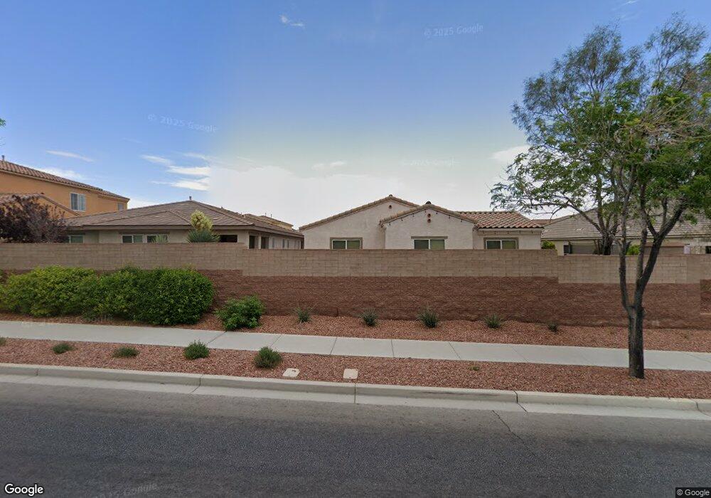
10312 Bush Mountain Ave Las Vegas, NV 89166
La Madre Foothills NeighborhoodEstimated Value: $460,000 - $655,000
3
Beds
3
Baths
1,877
Sq Ft
$280/Sq Ft
Est. Value
About This Home
This home is located at 10312 Bush Mountain Ave, Las Vegas, NV 89166 and is currently estimated at $524,796, approximately $279 per square foot. 10312 Bush Mountain Ave is a home located in Clark County with nearby schools including Henry & Evelyn Bozarth Elementary School, Edmundo "Eddie" Escobedo, Sr. Middle School, and Arbor View High School.
Ownership History
Date
Name
Owned For
Owner Type
Purchase Details
Closed on
Dec 18, 2024
Sold by
James And Carol Pombo Sanguinetti Family and Sanguinetti James G
Bought by
James And Carol Pombo Sanguinetti Family Trus and Sanguinetti
Current Estimated Value
Purchase Details
Closed on
May 23, 2012
Sold by
Bird Richard A and Bird Teresa J
Bought by
Sanguinetti James G and Sanguinetti Carol Pambo
Purchase Details
Closed on
Nov 17, 2010
Sold by
Estancia Desert Llc
Bought by
Bird Richard A and Bird Teresa J
Home Financials for this Owner
Home Financials are based on the most recent Mortgage that was taken out on this home.
Original Mortgage
$226,124
Interest Rate
2.5%
Mortgage Type
FHA
Create a Home Valuation Report for This Property
The Home Valuation Report is an in-depth analysis detailing your home's value as well as a comparison with similar homes in the area
Home Values in the Area
Average Home Value in this Area
Purchase History
| Date | Buyer | Sale Price | Title Company |
|---|---|---|---|
| James And Carol Pombo Sanguinetti Family Trus | -- | None Listed On Document | |
| Sanguinetti James G | $238,500 | Equity Title Of Nevada | |
| Bird Richard A | $232,007 | Chicago Title Las Vegas |
Source: Public Records
Mortgage History
| Date | Status | Borrower | Loan Amount |
|---|---|---|---|
| Previous Owner | Bird Richard A | $226,124 |
Source: Public Records
Tax History Compared to Growth
Tax History
| Year | Tax Paid | Tax Assessment Tax Assessment Total Assessment is a certain percentage of the fair market value that is determined by local assessors to be the total taxable value of land and additions on the property. | Land | Improvement |
|---|---|---|---|---|
| 2025 | $3,614 | $141,178 | $36,400 | $104,778 |
| 2024 | $3,419 | $141,178 | $36,400 | $104,778 |
| 2023 | $3,419 | $139,467 | $41,300 | $98,167 |
| 2022 | $3,480 | $122,547 | $32,900 | $89,647 |
| 2021 | $3,223 | $115,291 | $30,450 | $84,841 |
| 2020 | $2,989 | $113,707 | $30,100 | $83,607 |
| 2019 | $2,802 | $107,756 | $25,550 | $82,206 |
| 2018 | $2,673 | $95,987 | $21,700 | $74,287 |
| 2017 | $3,071 | $93,201 | $21,700 | $71,501 |
| 2016 | $2,502 | $87,138 | $18,550 | $68,588 |
| 2015 | $2,497 | $75,786 | $16,100 | $59,686 |
| 2014 | $2,419 | $71,185 | $8,750 | $62,435 |
Source: Public Records
Map
Nearby Homes
- 7607 Mount Princeton St
- 7643 Harmony Peak St
- 10419 Bush Mountain Ave
- 7431 Bretton Oaks St
- 10271 Headrick Dr
- 10140 Ocicat Ave
- 10256 Headrick Dr
- 10225 Headrick Dr
- 10424 Burkehaven Ave
- 10523 Laurel Mountain Ln
- 10614 Mount Blackburn Ave
- 7521 Tucker William St
- 10425 Mount Washington Ave
- 7925 Forspence Ct
- 7851 Torreys Peak St
- 7935 Forspence Ct
- 7342 Tanglewood Park St
- 10438 Mount Washington Ave
- 10635 Kearney Mountain Ave
- 10536 Laurelwood Lake Ave
- 10316 Bush Mountain Ave
- 10311 Mount Oxford Ave
- 10315 Mount Oxford Ave
- 10320 Bush Mountain Ave
- 7614 Storm Peak St
- 7610 Storm Peak St
- 10319 Mount Oxford Ave
- 7618 Storm Peak St
- 10311 Bush Mountain Ave
- 10315 Bush Mountain Ave
- 10307 Bush Mountain Ave
- 10324 Bush Mountain Ave Unit 3
- 7606 Storm Peak St
- 10323 Mount Oxford Ave
- 10319 Bush Mountain Ave
- 10323 Bush Mountain Ave Unit 3
- 10327 Mount Oxford Ave
- 7626 Storm Peak St
- 10328 Bush Mountain Ave Unit 3
- 10327 Bush Mountain Ave