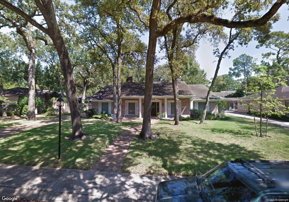
10318 Green Tree Rd Houston, TX 77042
Briar Forest NeighborhoodEstimated Value: $878,000 - $1,001,000
4
Beds
3
Baths
3,133
Sq Ft
$306/Sq Ft
Est. Value
About This Home
This home is located at 10318 Green Tree Rd, Houston, TX 77042 and is currently estimated at $958,643, approximately $305 per square foot. 10318 Green Tree Rd is a home located in Harris County with nearby schools including Walnut Bend Elementary School, Paul Revere Middle School, and Westside High School.
Ownership History
Date
Name
Owned For
Owner Type
Purchase Details
Closed on
Nov 8, 2012
Sold by
Meyer Karen Deyo and Meyer Karen Dale
Bought by
Deny Laurent Maurice and Guevara Aura Yadira
Current Estimated Value
Purchase Details
Closed on
Jun 24, 1997
Sold by
Spafford Donald W and Spafford Nancy O
Bought by
Meyer Thomas Buford and Meyer Karen Deyo
Home Financials for this Owner
Home Financials are based on the most recent Mortgage that was taken out on this home.
Original Mortgage
$200,200
Interest Rate
7.92%
Purchase Details
Closed on
Mar 31, 1994
Sold by
Moore James K
Bought by
Spafford Donald W and Spafford Nancy O
Home Financials for this Owner
Home Financials are based on the most recent Mortgage that was taken out on this home.
Original Mortgage
$100,000
Interest Rate
7.31%
Create a Home Valuation Report for This Property
The Home Valuation Report is an in-depth analysis detailing your home's value as well as a comparison with similar homes in the area
Home Values in the Area
Average Home Value in this Area
Purchase History
| Date | Buyer | Sale Price | Title Company |
|---|---|---|---|
| Deny Laurent Maurice | -- | None Available | |
| Meyer Thomas Buford | -- | Texas American Title Company | |
| Spafford Donald W | -- | First American Title |
Source: Public Records
Mortgage History
| Date | Status | Borrower | Loan Amount |
|---|---|---|---|
| Previous Owner | Meyer Thomas Buford | $200,200 | |
| Previous Owner | Spafford Donald W | $100,000 | |
| Closed | Meyer Thomas Buford | $40,000 |
Source: Public Records
Tax History Compared to Growth
Tax History
| Year | Tax Paid | Tax Assessment Tax Assessment Total Assessment is a certain percentage of the fair market value that is determined by local assessors to be the total taxable value of land and additions on the property. | Land | Improvement |
|---|---|---|---|---|
| 2025 | $13,711 | $932,602 | $463,725 | $468,877 |
| 2024 | $13,711 | $869,509 | $463,725 | $405,784 |
| 2023 | $13,711 | $841,073 | $463,725 | $377,348 |
| 2022 | $17,113 | $810,937 | $463,725 | $347,212 |
| 2021 | $16,467 | $706,538 | $463,725 | $242,813 |
| 2020 | $16,734 | $691,031 | $463,725 | $227,306 |
| 2019 | $17,213 | $680,226 | $463,725 | $216,501 |
| 2018 | $15,000 | $752,153 | $247,320 | $504,833 |
| 2017 | $19,019 | $752,153 | $247,320 | $504,833 |
| 2016 | $18,901 | $752,153 | $247,320 | $504,833 |
| 2015 | $12,591 | $817,654 | $247,320 | $570,334 |
| 2014 | $12,591 | $617,782 | $247,320 | $370,462 |
Source: Public Records
Map
Nearby Homes
- 10323 Pine Forest Rd
- 238 Litchfield Ln
- 246 Litchfield Ln
- 168 Litchfield Ln
- 10212 Longmont Dr Unit 44/7
- 171 Litchfield Ln
- 12625 Memorial Dr Unit 180
- 12625 Memorial Dr Unit 17
- 12625 Memorial Dr Unit 4
- 12625 Memorial Dr Unit 146
- 12625 Memorial Dr Unit 87
- 12625 Memorial Dr
- 12625 Memorial Dr Unit 11
- 201 Litchfield Ln
- 161 Litchfield Ln
- 152 Litchfield Ln
- 241 Litchfield Ln
- 259 Litchfield Ln Unit 66
- 10034 Bordley Dr
- 10602 Riverview Dr
- 10314 Green Tree Rd
- 10322 Green Tree Rd
- 10307 Shady River Dr
- 10311 Shady River Dr
- 10310 Green Tree Rd
- 10303 Shady River Dr
- 10326 Green Tree Rd
- 10319 Green Tree Rd
- 10315 Green Tree Rd
- 10315 Shady River Dr
- 10311 Green Tree Rd
- 10323 Green Tree Rd
- 10223 Shady River Dr
- 10302 Green Tree Rd
- 10330 Green Tree Rd
- 10319 Shady River Dr
- 10307 Green Tree Rd
- 10505 Deerwood Rd Unit 335
- 10505 Deerwood Rd Unit 446
- 10505 Deerwood Rd Unit 134