Estimated Value: $328,000 - $345,000
3
Beds
3
Baths
1,667
Sq Ft
$202/Sq Ft
Est. Value
About This Home
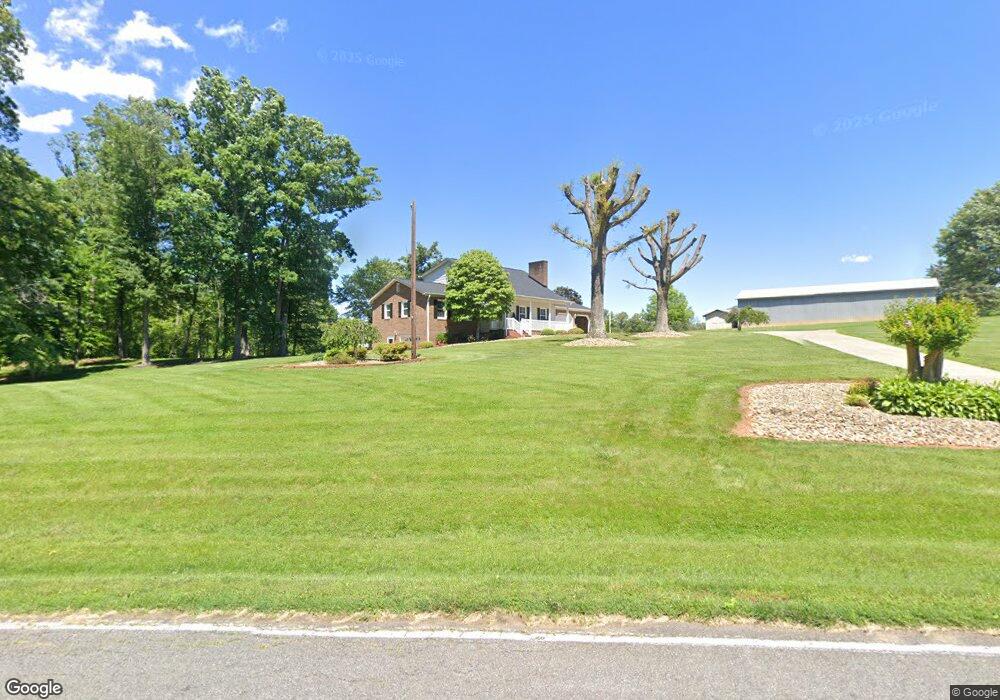
This home is located at 1032 Carson Watts Rd, King, NC 27021 and is currently estimated at $335,919, approximately $201 per square foot. 1032 Carson Watts Rd is a home located in Stokes County with nearby schools including Mount Olive Elementary School, Chestnut Grove Middle, and West Stokes High.
Ownership History
Date
Name
Owned For
Owner Type
Purchase Details
Closed on
Sep 10, 2020
Sold by
Barr Phyllis W and Barr Ralph Scott
Bought by
Watts Douglas H and Watts Cynthia D
Current Estimated Value
Home Financials for this Owner
Home Financials are based on the most recent Mortgage that was taken out on this home.
Original Mortgage
$330,000
Outstanding Balance
$67,035
Interest Rate
2.9%
Mortgage Type
New Conventional
Estimated Equity
$268,884
Create a Home Valuation Report for This Property
The Home Valuation Report is an in-depth analysis detailing your home's value as well as a comparison with similar homes in the area
Home Values in the Area
Average Home Value in this Area
Purchase History
| Date | Buyer | Sale Price | Title Company |
|---|---|---|---|
| Watts Douglas H | $330,000 | None Available |
Source: Public Records
Mortgage History
| Date | Status | Borrower | Loan Amount |
|---|---|---|---|
| Open | Watts Douglas H | $330,000 |
Source: Public Records
Tax History
| Year | Tax Paid | Tax Assessment Tax Assessment Total Assessment is a certain percentage of the fair market value that is determined by local assessors to be the total taxable value of land and additions on the property. | Land | Improvement |
|---|---|---|---|---|
| 2025 | $2,039 | $285,200 | $36,800 | $248,400 |
| 2024 | $2,039 | $207,200 | $27,200 | $180,000 |
| 2023 | $1,678 | $207,200 | $27,200 | $180,000 |
| 2022 | $1,533 | $207,200 | $27,200 | $180,000 |
| 2021 | $1,533 | $207,200 | $27,200 | $180,000 |
| 2020 | $1,370 | $185,100 | $26,200 | $158,900 |
| 2019 | $1,370 | $185,100 | $26,200 | $158,900 |
| 2018 | $1,370 | $185,100 | $26,200 | $158,900 |
| 2017 | $1,360 | $185,100 | $26,200 | $158,900 |
| 2016 | $1,318 | $179,300 | $26,200 | $153,100 |
| 2015 | $1,309 | $179,300 | $26,200 | $153,100 |
| 2014 | $1,324 | $179,300 | $26,200 | $153,100 |
Source: Public Records
Map
Nearby Homes
- 1880 Chestnut Grove Rd
- 1831 Chestnut Grove Rd
- Lot 10 Brown Rd
- Lot 9 Brown Rd
- 1040 Breezeway Dr
- 14.8 acres Rock Haven Dr
- 310 Cedardale Ln
- 1788 Bowen Rd
- 1671 Bowen Rd
- 209 Oakmont Ct
- 145 Oakmont Ln
- 216 Star View Dr
- 103 Jasper Ct
- 1110 Foxtrot Ct
- 1129 Kentland Dr
- 128 Provence Ct
- 109 Silver Maple Dr
- 108 Provence Ct
- 119 Brae Ridge Ln
- 100 Ridgecrest Dr
- 2414 Chestnut Grove Rd
- 2411 Chestnut Grove Rd
- 1015 Moo Cow Ln
- 2375 Chestnut Grove Rd
- 2521 Chestnut Grove Rd
- 1051 Volunteer Rd
- 2535 Chestnut Grove Rd
- 2359 Chestnut Grove Rd
- 1027 Volunteer Rd
- 2559 Chestnut Grove Rd
- 1151 Carson Watts Rd
- 2558 Chestnut Grove Rd
- 2309 Chestnut Grove Rd
- 1090 Moo Cow Ln
- 1070 Kimberly Dr
- 2576 Chestnut Grove Rd
- 1042 Kimberly Dr
- 2290 Chestnut Grove Rd
- 2287 Chestnut Grove Rd
Your Personal Tour Guide
Ask me questions while you tour the home.