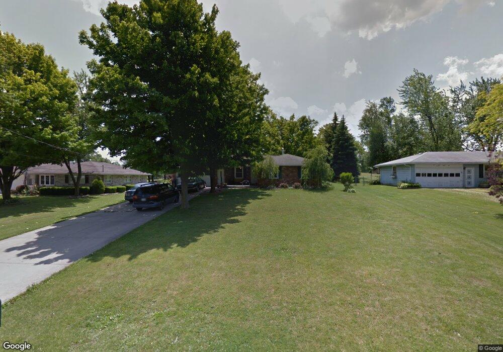
1032 Dianewood Dr Mansfield, OH 44903
Estimated Value: $118,000 - $217,000
2
Beds
2
Baths
1,104
Sq Ft
$166/Sq Ft
Est. Value
About This Home
This home is located at 1032 Dianewood Dr, Mansfield, OH 44903 and is currently estimated at $183,446, approximately $166 per square foot. 1032 Dianewood Dr is a home located in Richland County with nearby schools including Madison High School, Temple-Christian School, and St. Mary Catholic School.
Ownership History
Date
Name
Owned For
Owner Type
Purchase Details
Closed on
Jan 20, 2015
Sold by
Speelman James P and Speelman Deborah L
Bought by
Speelman Deborah L
Current Estimated Value
Home Financials for this Owner
Home Financials are based on the most recent Mortgage that was taken out on this home.
Original Mortgage
$44,948
Outstanding Balance
$15,388
Interest Rate
3.37%
Mortgage Type
FHA
Estimated Equity
$168,058
Purchase Details
Closed on
Dec 20, 1993
Sold by
Schneider Peter
Bought by
Speelman James P
Create a Home Valuation Report for This Property
The Home Valuation Report is an in-depth analysis detailing your home's value as well as a comparison with similar homes in the area
Home Values in the Area
Average Home Value in this Area
Purchase History
| Date | Buyer | Sale Price | Title Company |
|---|---|---|---|
| Speelman Deborah L | -- | Attorney | |
| Speelman James P | $77,500 | -- |
Source: Public Records
Mortgage History
| Date | Status | Borrower | Loan Amount |
|---|---|---|---|
| Open | Speelman Deborah L | $44,948 |
Source: Public Records
Tax History Compared to Growth
Tax History
| Year | Tax Paid | Tax Assessment Tax Assessment Total Assessment is a certain percentage of the fair market value that is determined by local assessors to be the total taxable value of land and additions on the property. | Land | Improvement |
|---|---|---|---|---|
| 2024 | $2,248 | $45,340 | $10,910 | $34,430 |
| 2023 | $2,248 | $45,340 | $10,910 | $34,430 |
| 2022 | $1,994 | $35,630 | $9,590 | $26,040 |
| 2021 | $1,974 | $35,630 | $9,590 | $26,040 |
| 2020 | $1,989 | $35,630 | $9,590 | $26,040 |
| 2019 | $1,898 | $30,200 | $8,130 | $22,070 |
| 2018 | $1,776 | $30,200 | $8,130 | $22,070 |
| 2017 | $1,761 | $30,200 | $8,130 | $22,070 |
| 2016 | $1,783 | $29,920 | $7,720 | $22,200 |
| 2015 | $1,783 | $29,920 | $7,720 | $22,200 |
| 2014 | $1,696 | $29,920 | $7,720 | $22,200 |
| 2012 | $801 | $29,920 | $8,130 | $21,790 |
Source: Public Records
Map
Nearby Homes
- 1245 N Stewart Rd
- 1158 Delwood Rd
- 1150 Delwood Dr
- 920 Piper Rd
- 1151 Beal Rd
- 1585 Beal Rd
- 1292 Wolford Rd
- 1106 Keller Dr Unit 1108
- 0 Hoover Rd
- 1171 Hoover Rd
- 1140 5th Ave
- 1791 Beal Rd
- 0 Wesley
- 735 Pennsylvania Ave
- 741 Yale Ave
- 903 Mayflower Ave
- 1199 Evergreen Ave W
- 1183 Evergreen Ave W
- 683 Coachman Rd
- 671 Coachman Rd
- 1040 Dianewood Dr
- 1022 Dianewood Dr
- 1050 Dianewood Dr
- 1014 Dianewood Dr
- 1041 Donnawood Dr
- 1031 Donnawood Dr
- 1029 Dianewood Dr
- 1039 Dianewood Dr
- 1051 Donnawood Dr
- 1004 Dianewood Dr
- 1051 Dianewood Dr
- 1013 Donnawood Dr
- 1009 Dianewood Dr
- 1009 Dianewood Dr
- 1349 N Stewart Rd
- 1359 N Stewart Rd
- 1005 Donnawood Dr
- 1341 N Stewart Rd
- 1001 Dianewood Dr Unit 1003
- 0 Annfield Donnawood Dr Unit 9055240