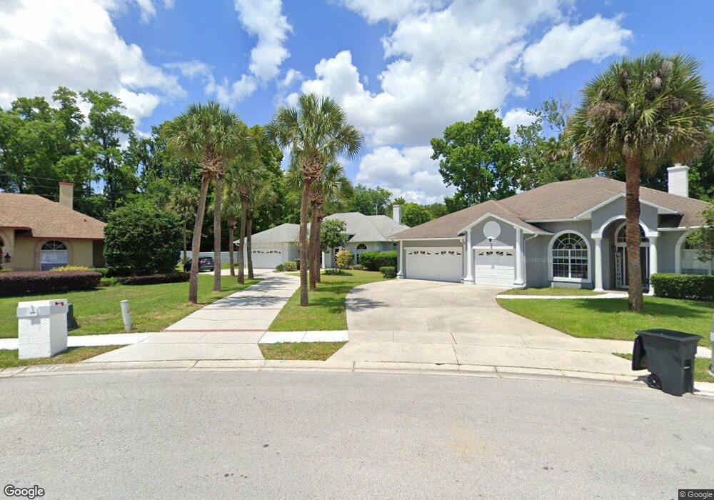
1032 High Point Loop Longwood, FL 32750
Estimated Value: $461,000 - $537,000
4
Beds
4
Baths
2,462
Sq Ft
$208/Sq Ft
Est. Value
About This Home
This home is located at 1032 High Point Loop, Longwood, FL 32750 and is currently estimated at $511,799, approximately $207 per square foot. 1032 High Point Loop is a home located in Seminole County with nearby schools including Highlands Elementary School, Greenwood Lakes Middle School, and Lake Mary High School.
Ownership History
Date
Name
Owned For
Owner Type
Purchase Details
Closed on
Jun 10, 1999
Sold by
Jawad Ali H and Jawad Lila M
Bought by
Munsey James W and Munsey Treacey H
Current Estimated Value
Home Financials for this Owner
Home Financials are based on the most recent Mortgage that was taken out on this home.
Original Mortgage
$142,400
Interest Rate
6.94%
Mortgage Type
New Conventional
Purchase Details
Closed on
Aug 10, 1993
Sold by
Hillcrest Homes & Dev Inc
Bought by
Jawad Ali H and Jawad Lila M
Home Financials for this Owner
Home Financials are based on the most recent Mortgage that was taken out on this home.
Original Mortgage
$118,300
Interest Rate
7.26%
Purchase Details
Closed on
Jun 1, 1989
Bought by
Munsey James W and Munsey Tracey H
Create a Home Valuation Report for This Property
The Home Valuation Report is an in-depth analysis detailing your home's value as well as a comparison with similar homes in the area
Home Values in the Area
Average Home Value in this Area
Purchase History
| Date | Buyer | Sale Price | Title Company |
|---|---|---|---|
| Munsey James W | $178,000 | -- | |
| Jawad Ali H | $169,000 | -- | |
| Munsey James W | $1,372,000 | -- |
Source: Public Records
Mortgage History
| Date | Status | Borrower | Loan Amount |
|---|---|---|---|
| Open | Munsey James W | $136,000 | |
| Closed | Munsey James W | $142,400 | |
| Previous Owner | Jawad Ali H | $118,300 |
Source: Public Records
Tax History
| Year | Tax Paid | Tax Assessment Tax Assessment Total Assessment is a certain percentage of the fair market value that is determined by local assessors to be the total taxable value of land and additions on the property. | Land | Improvement |
|---|---|---|---|---|
| 2025 | $2,395 | $191,350 | -- | -- |
| 2024 | $2,217 | $185,957 | -- | -- |
| 2023 | $2,227 | $180,541 | $0 | $0 |
| 2021 | $2,093 | $170,178 | $0 | $0 |
| 2020 | $2,073 | $167,828 | $0 | $0 |
| 2019 | $2,054 | $164,055 | $0 | $0 |
| 2018 | $2,027 | $160,996 | $0 | $0 |
| 2017 | $2,011 | $157,685 | $0 | $0 |
| 2016 | $2,052 | $155,523 | $0 | $0 |
| 2015 | $2,070 | $153,368 | $0 | $0 |
| 2014 | $1,784 | $152,151 | $0 | $0 |
Source: Public Records
Map
Nearby Homes
- 568 Tall Oaks Terrace
- 1901 Glen Mist Cove
- 649 Remington Oak Dr
- 1816 Covent Garden Ln
- 674 Joyful Blossom Place
- 766 Keeneland Pike
- 218 Leslie Ln
- 0 Marjorie Blvd Unit MFRO6388900
- 286 Howard Blvd
- 1554 Downy Birch Ln
- 601 Joyful Blossom Place
- 194 Leslie Ln
- 165 Leslie Ln
- 533 Remington Oak Dr
- 554 Eagles Crossing Place
- 464 Harvest Oak Ct
- 821 Raven Ave
- 1508 Meadowlark St
- 1506 Meadowlark St
- 3711 N Ronald Reagan Blvd
- 1028 High Point Loop
- 1036 High Point Loop
- 941 Caitlin Point
- 935 Caitlin Point Unit 2
- 1024 High Point Loop
- 1040 High Point Loop
- 931 Caitlin Point
- 1037 High Point Loop
- 1020 High Point Loop
- 944 Caitlin Point
- 1044 High Point Loop
- 929 Caitlin Point Unit 2
- 1041 High Point Loop
- 1016 High Point Loop
- 1017 High Point Loop
- 940 Caitlin Point
- 1045 High Point Loop
- 925 Caitlin Point
- 1048 High Point Loop
- 932 Caitlin Point
Your Personal Tour Guide
Ask me questions while you tour the home.