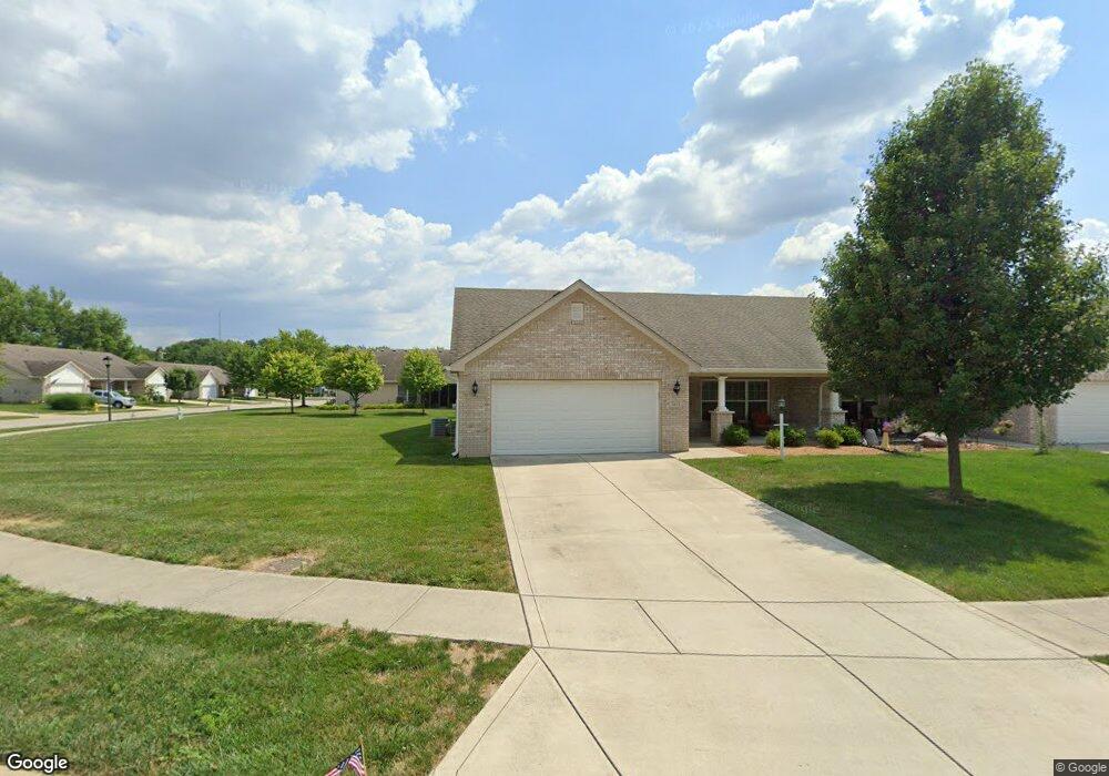
1032 Hilltop Commons Blvd Whiteland, IN 46184
Estimated Value: $252,000 - $277,000
3
Beds
2
Baths
1,478
Sq Ft
$181/Sq Ft
Est. Value
About This Home
This home is located at 1032 Hilltop Commons Blvd, Whiteland, IN 46184 and is currently estimated at $267,306, approximately $180 per square foot. 1032 Hilltop Commons Blvd is a home located in Johnson County with nearby schools including Break-O-Day Elementary School, Clark-Pleasant Middle School, and Whiteland Community High School.
Ownership History
Date
Name
Owned For
Owner Type
Purchase Details
Closed on
Oct 7, 2016
Sold by
Embrey Real Estates Llc
Bought by
Collier Susan M
Current Estimated Value
Purchase Details
Closed on
Sep 29, 2016
Sold by
Embrey Real Estate Llc
Bought by
Lott Jackie E and Lott Paulette L
Purchase Details
Closed on
Aug 24, 2015
Sold by
Embrey Anthony S and Embrey Deloris J
Bought by
Embry Real Estate Llc
Create a Home Valuation Report for This Property
The Home Valuation Report is an in-depth analysis detailing your home's value as well as a comparison with similar homes in the area
Home Values in the Area
Average Home Value in this Area
Purchase History
| Date | Buyer | Sale Price | Title Company |
|---|---|---|---|
| Collier Susan M | -- | None Available | |
| Lott Jackie E | $155,000 | -- | |
| Embry Real Estate Llc | -- | None Available |
Source: Public Records
Tax History Compared to Growth
Tax History
| Year | Tax Paid | Tax Assessment Tax Assessment Total Assessment is a certain percentage of the fair market value that is determined by local assessors to be the total taxable value of land and additions on the property. | Land | Improvement |
|---|---|---|---|---|
| 2025 | $2,276 | $261,300 | $45,000 | $216,300 |
| 2024 | $2,276 | $218,800 | $45,000 | $173,800 |
| 2023 | $2,224 | $213,900 | $45,000 | $168,900 |
| 2022 | $1,954 | $188,400 | $34,100 | $154,300 |
| 2021 | $1,723 | $165,800 | $31,000 | $134,800 |
| 2020 | $1,601 | $153,400 | $21,000 | $132,400 |
| 2019 | $1,601 | $153,400 | $21,000 | $132,400 |
| 2018 | $1,517 | $149,300 | $22,000 | $127,300 |
| 2017 | $1,487 | $147,700 | $22,000 | $125,700 |
| 2016 | $561 | $18,700 | $18,700 | $0 |
| 2014 | $21 | $800 | $800 | $0 |
| 2013 | $21 | $700 | $700 | $0 |
Source: Public Records
Map
Nearby Homes
- 106 Tracy Ridge Blvd
- 1119 Chateaugay Ct
- 190 Tracy Ridge Blvd
- 821 Princeton Dr
- 256 Bittersweet Dr
- 12 Rypma Row
- 250 Southlane Dr
- 53 Oakden Ct
- 57 Oakden Ct
- 731 W 600 N
- 840 Sweetbriar Ave
- 6540 N Us Highway 31
- 0 E 700 N Unit MBR22036500
- 239 Shelton Place
- 647 Bluestem Cir
- 230 Parkview Dr
- 539 Delbrook Dr
- 50 Meadow Creek Blvd
- 638 Harvest Meadow Way
- 624 Sweetbriar Ave
- 124 Arabian Ct
- 116 Arabian Ct
- 1052 Hilltop Commons Blvd
- 140 Arabian Ct
- 1043 Hilltop Commons Blvd
- 1047 Hilltop Commons Blvd
- 1031 Hilltop Commons Blvd
- 148 Arabian Ct
- 1039 Hilltop Commons Blvd
- 1060 Hilltop Commons Blvd
- 1023 Hilltop Commons Blvd
- 1051 Hilltop Commons Blvd
- 1027 Hilltop Commons Blvd
- 1019 Hilltop Commons Blvd
- 1055 Hilltop Commons Blvd
- 1035 Hilltop Commons Blvd
- 1015 Hilltop Commons Blvd
- 156 Arabian Ct
- 1064 Hilltop Commons Blvd
- 1059 Hilltop Commons Blvd