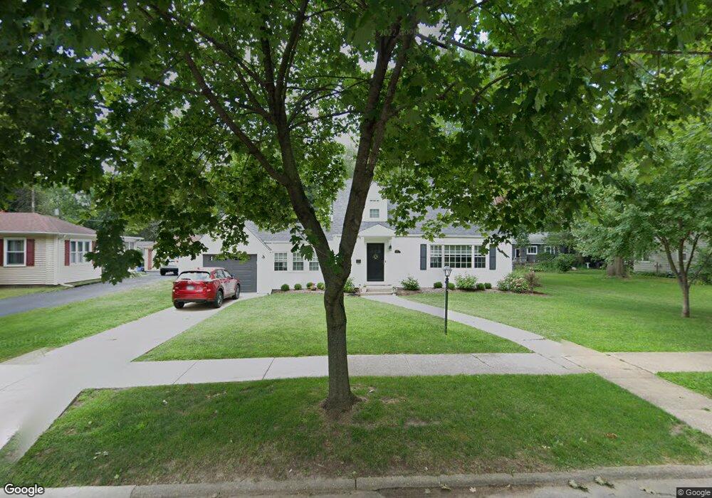
1032 James Ave Rockford, IL 61107
Estimated Value: $162,000 - $178,000
2
Beds
2
Baths
1,190
Sq Ft
$142/Sq Ft
Est. Value
About This Home
This home is located at 1032 James Ave, Rockford, IL 61107 and is currently estimated at $169,173, approximately $142 per square foot. 1032 James Ave is a home located in Winnebago County with nearby schools including Bloom Elementary School, Eisenhower Middle School, and Guilford High School.
Ownership History
Date
Name
Owned For
Owner Type
Purchase Details
Closed on
Oct 29, 2020
Sold by
Ichiban Properties Llc
Bought by
Smith Clifford L
Current Estimated Value
Purchase Details
Closed on
Mar 14, 2019
Sold by
Erwin Land Trust 2006
Bought by
Ichiban Properties Llc
Purchase Details
Closed on
Feb 25, 2019
Sold by
Erwin Land Trust 2006
Bought by
Ichiban Properties Llc
Purchase Details
Closed on
Oct 29, 2010
Bought by
Farr James
Create a Home Valuation Report for This Property
The Home Valuation Report is an in-depth analysis detailing your home's value as well as a comparison with similar homes in the area
Home Values in the Area
Average Home Value in this Area
Purchase History
| Date | Buyer | Sale Price | Title Company |
|---|---|---|---|
| Smith Clifford L | -- | Reno & Zahm Llp | |
| Ichiban Properties Llc | -- | Mta | |
| Ichiban Properties Llc | $55,000 | None Listed On Document | |
| Ichiban Properties Llc | -- | Mta | |
| Ichiban Properties Llc | $55,000 | None Listed On Document | |
| Farr James | $87,000 | -- |
Source: Public Records
Tax History Compared to Growth
Tax History
| Year | Tax Paid | Tax Assessment Tax Assessment Total Assessment is a certain percentage of the fair market value that is determined by local assessors to be the total taxable value of land and additions on the property. | Land | Improvement |
|---|---|---|---|---|
| 2024 | $4,278 | $45,147 | $6,662 | $38,485 |
| 2023 | $4,133 | $39,808 | $5,874 | $33,934 |
| 2022 | $4,065 | $35,581 | $5,250 | $30,331 |
| 2021 | $3,263 | $32,625 | $4,814 | $27,811 |
| 2020 | $3,194 | $30,842 | $4,551 | $26,291 |
| 2019 | $3,134 | $29,396 | $4,338 | $25,058 |
| 2018 | $3,150 | $29,180 | $4,089 | $25,091 |
| 2017 | $3,253 | $27,926 | $3,913 | $24,013 |
| 2016 | $3,233 | $27,403 | $3,840 | $23,563 |
| 2015 | $2,991 | $25,555 | $3,840 | $21,715 |
| 2014 | $2,832 | $24,687 | $4,789 | $19,898 |
Source: Public Records
Map
Nearby Homes
- 819 James Ave
- 2215 Guilford Rd
- 909 Woodlane Ave
- 2133 Guilford Rd
- 2224 Princeton Ave
- 701 Lundvall Ave
- 705 Woodlane Ave
- 1104 Winthrop Ln
- 2920 Buckingham Dr
- 641 Paris Ave
- 627 Paris Ave
- 2516 Highcrest Rd
- 422 N Rockford Ave
- 404 Vale Ave
- 504 Paris Ave
- 1419 Roncevalles Ave
- 233 N Calvin Park Blvd
- 215 Robert Ave
- 414 Hilton Ave
- 1026 James Ave
- 1211 Lundvall Ave
- 1034 James Ave
- 1205 Lundvall Ave
- 1020 James Ave
- 1017 Highview Ave
- 1133 Lundvall Ave
- 1025 James Ave
- 1015 James Ave
- 1014 James Ave
- 1031 James Ave
- 1127 Lundvall Ave
- 1030 Highview Ave
- 1212 Lundvall Ave
- 1220 Lundvall Ave
- 1037 James Ave
- 1011 Highview Ave
- 1011 James Ave
- 1106 James Ave
- 1206 Lundvall Ave