Estimated Value: $279,000 - $301,000
3
Beds
2
Baths
1,383
Sq Ft
$209/Sq Ft
Est. Value
About This Home
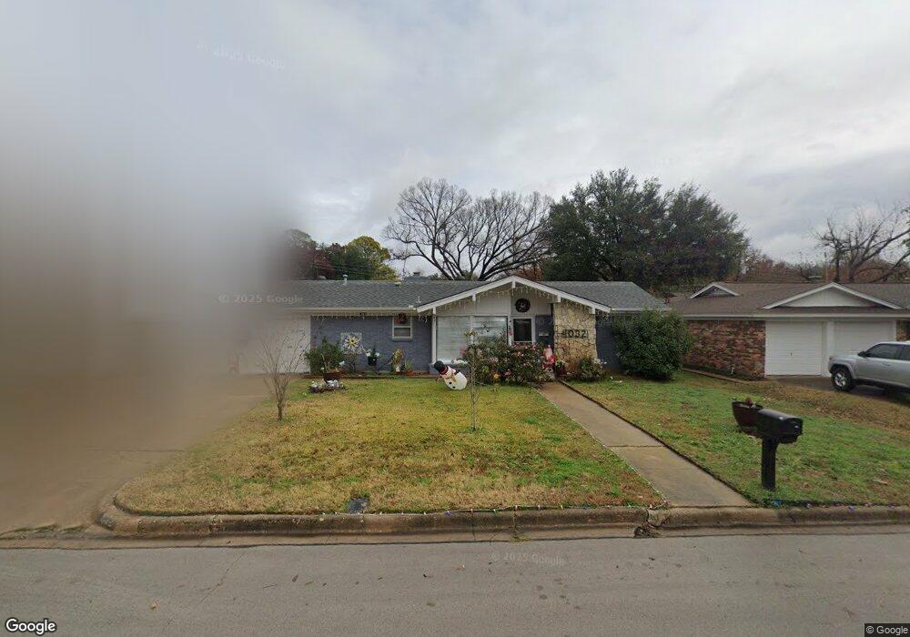
This home is located at 1032 Livingston Dr, Hurst, TX 76053 and is currently estimated at $289,415, approximately $209 per square foot. 1032 Livingston Dr is a home located in Tarrant County with nearby schools including Donna Park Elementary, Bedford Junior High School, and L.D. Bell High School.
Ownership History
Date
Name
Owned For
Owner Type
Purchase Details
Closed on
Feb 15, 2024
Sold by
Canales Carlos Ernesto
Bought by
Canales Maria Cristina
Current Estimated Value
Purchase Details
Closed on
Sep 25, 2007
Sold by
Linke Teresa Anne and Gagan Charles Robert
Bought by
Canales Carlos and Canales Maria
Home Financials for this Owner
Home Financials are based on the most recent Mortgage that was taken out on this home.
Original Mortgage
$114,098
Interest Rate
6.66%
Mortgage Type
Purchase Money Mortgage
Purchase Details
Closed on
Jul 19, 1995
Sold by
Brahm Michael G and Brahm Nancy D
Bought by
Gagan John J and Gagan Virginia M
Home Financials for this Owner
Home Financials are based on the most recent Mortgage that was taken out on this home.
Original Mortgage
$68,400
Interest Rate
7.49%
Create a Home Valuation Report for This Property
The Home Valuation Report is an in-depth analysis detailing your home's value as well as a comparison with similar homes in the area
Home Values in the Area
Average Home Value in this Area
Purchase History
| Date | Buyer | Sale Price | Title Company |
|---|---|---|---|
| Canales Maria Cristina | -- | None Listed On Document | |
| Canales Carlos | -- | Commonwealth Land | |
| Gagan John J | -- | First American Title Co |
Source: Public Records
Mortgage History
| Date | Status | Borrower | Loan Amount |
|---|---|---|---|
| Previous Owner | Canales Carlos | $114,098 | |
| Previous Owner | Gagan John J | $68,400 |
Source: Public Records
Tax History Compared to Growth
Tax History
| Year | Tax Paid | Tax Assessment Tax Assessment Total Assessment is a certain percentage of the fair market value that is determined by local assessors to be the total taxable value of land and additions on the property. | Land | Improvement |
|---|---|---|---|---|
| 2025 | $2,389 | $184,399 | $54,000 | $130,399 |
| 2024 | $2,389 | $184,399 | $54,000 | $130,399 |
| 2023 | $2,145 | $168,707 | $45,000 | $123,707 |
| 2022 | $3,712 | $174,314 | $45,000 | $129,314 |
| 2021 | $3,535 | $146,557 | $45,000 | $101,557 |
| 2020 | $3,247 | $150,279 | $45,000 | $105,279 |
| 2019 | $3,003 | $151,273 | $45,000 | $106,273 |
| 2018 | $2,219 | $111,538 | $20,000 | $91,538 |
| 2017 | $2,566 | $139,694 | $20,000 | $119,694 |
| 2016 | $2,333 | $122,450 | $20,000 | $102,450 |
| 2015 | $1,821 | $83,800 | $17,000 | $66,800 |
| 2014 | $1,821 | $83,800 | $17,000 | $66,800 |
Source: Public Records
Map
Nearby Homes
- 1108 Billie Ruth Ln
- 1016 Billie Ruth Ln
- 1001 Livingston Dr
- 853 Royal Terrace
- 916 Zelda Dr
- 820 Bedford Ct W
- 1220 Woodland Park Dr
- 1218 Wooded Trail
- 913 Zelda Dr
- 833 W Cheryl Ave
- 1230 Woodland Park Dr
- 1204 Princess Ln
- 1230 Wooded Trail
- 829 Joanna Dr
- 849 Wheelwood Dr
- 713 Edgehill Dr
- 649 Timberline Dr
- 1145 Terrace Trail
- 632 Forest Ln
- 1208 Birch St
- 1036 Livingston Dr
- 1129 Irwin Dr
- 1024 Livingston Dr
- 1037 Livingston Dr
- 909 Bedford Ct W
- 1033 Livingston Dr
- 1041 Livingston Dr
- 905 Bedford Ct W
- 1125 Irwin Dr
- 1029 Livingston Dr
- 901 Bedford Ct W
- 913 Bedford Ct W
- 1020 Livingston Dr
- 1121 Irwin Dr
- 1025 Livingston Dr
- 917 Bedford Ct W
- 1124 Irwin Dr
- 1104 Billie Ruth Ln
- 1100 Billie Ruth Ln
- 1117 Irwin Dr