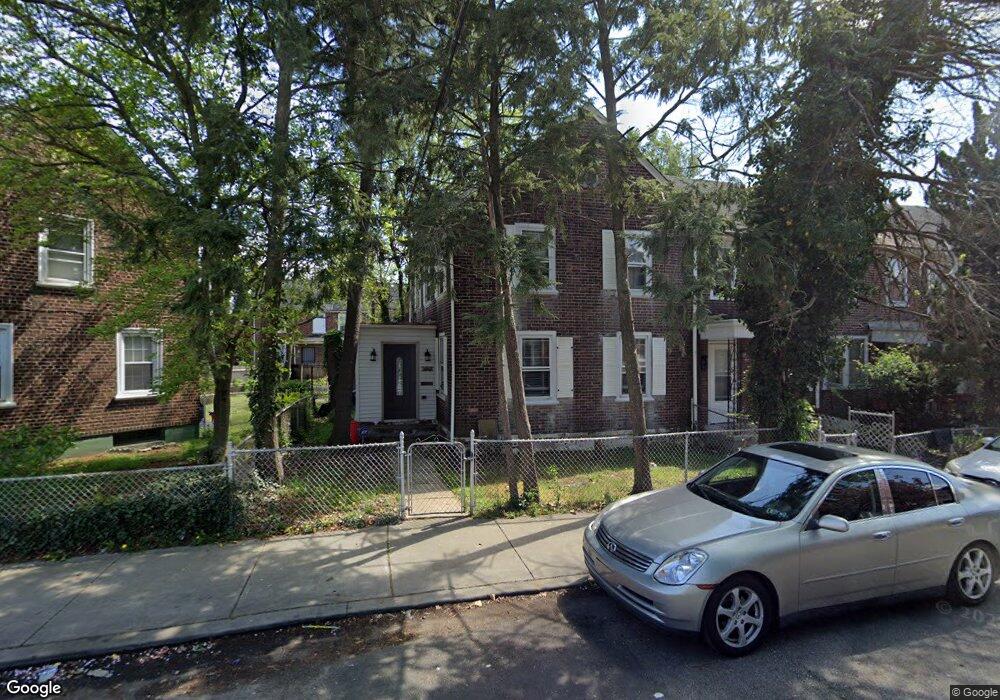
1032 Monitor Rd Camden, NJ 08104
Fairview NeighborhoodEstimated Value: $135,425 - $187,000
--
Bed
--
Bath
1,216
Sq Ft
$141/Sq Ft
Est. Value
About This Home
This home is located at 1032 Monitor Rd, Camden, NJ 08104 and is currently estimated at $171,356, approximately $140 per square foot. 1032 Monitor Rd is a home located in Camden County with nearby schools including Yorkship Elementary School, Camden High School, and Bishop Eustace Prep School.
Ownership History
Date
Name
Owned For
Owner Type
Purchase Details
Closed on
Apr 10, 2002
Sold by
Howell Robert R
Bought by
Taylor Katrina Z
Current Estimated Value
Home Financials for this Owner
Home Financials are based on the most recent Mortgage that was taken out on this home.
Original Mortgage
$48,615
Outstanding Balance
$20,684
Interest Rate
7.18%
Mortgage Type
FHA
Estimated Equity
$150,672
Create a Home Valuation Report for This Property
The Home Valuation Report is an in-depth analysis detailing your home's value as well as a comparison with similar homes in the area
Home Values in the Area
Average Home Value in this Area
Purchase History
| Date | Buyer | Sale Price | Title Company |
|---|---|---|---|
| Taylor Katrina Z | $49,000 | -- |
Source: Public Records
Mortgage History
| Date | Status | Borrower | Loan Amount |
|---|---|---|---|
| Open | Taylor Katrina Z | $48,615 |
Source: Public Records
Tax History Compared to Growth
Tax History
| Year | Tax Paid | Tax Assessment Tax Assessment Total Assessment is a certain percentage of the fair market value that is determined by local assessors to be the total taxable value of land and additions on the property. | Land | Improvement |
|---|---|---|---|---|
| 2025 | $2,615 | $73,800 | $15,300 | $58,500 |
| 2024 | $2,528 | $73,800 | $15,300 | $58,500 |
| 2023 | $2,528 | $73,800 | $15,300 | $58,500 |
| 2022 | $2,480 | $73,800 | $15,300 | $58,500 |
| 2021 | $2,472 | $73,800 | $15,300 | $58,500 |
| 2020 | $2,347 | $73,800 | $15,300 | $58,500 |
| 2019 | $2,247 | $73,800 | $15,300 | $58,500 |
| 2018 | $2,235 | $73,800 | $15,300 | $58,500 |
| 2017 | $2,181 | $73,800 | $15,300 | $58,500 |
| 2016 | $2,111 | $73,800 | $15,300 | $58,500 |
| 2015 | $2,032 | $73,800 | $15,300 | $58,500 |
| 2014 | $1,984 | $73,800 | $15,300 | $58,500 |
Source: Public Records
Map
Nearby Homes
- 1065 Ironside Rd
- 1072 Ironside Rd
- 1020 Niagara Rd
- 1029 Ironside Rd
- 1079 Trent Rd
- 3159 W Ironside Rd
- 3044 Fenwick Rd
- 1072 S Merrimac Rd
- 2909 Yorkship Rd
- 2870 Kansas Rd
- 2852 Idaho Rd
- 1261 S Merrimac Rd
- 3069 S Chesapeake Rd
- 2845 N Constitution Rd
- 2828 Yorkship Rd Unit 1
- 3075 Alabama Rd
- 3079 Alabama Rd
- 1300 S Merrimac Rd
- 1316 S Merrimac Rd
- 2931 N Constitution Rd
- 1030 Monitor Rd
- 1050 Monitor Rd
- 1028 Monitor Rd
- 1052 Monitor Rd
- 1026 Monitor Rd
- 1054 Monitor Rd
- 1024 Monitor Rd
- 1067 Collings Rd
- 1065 Collings Rd
- 1056 Monitor Rd
- 1063 Collings Rd
- 1022 Monitor Rd
- 1061 Collings Rd
- 1071 Collings Rd
- 1031 Monitor Rd
- 1059 Collings Rd
- 1058 Monitor Rd
- 1020 Monitor Rd
- 1057 Collings Rd
- 1027 Monitor Rd