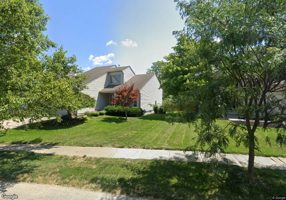
1032 Portlock Dr Columbus, OH 43228
Wexford-Thornapple NeighborhoodEstimated Value: $334,587 - $366,000
3
Beds
3
Baths
1,476
Sq Ft
$238/Sq Ft
Est. Value
About This Home
This home is located at 1032 Portlock Dr, Columbus, OH 43228 and is currently estimated at $351,147, approximately $237 per square foot. 1032 Portlock Dr is a home located in Franklin County with nearby schools including Galloway Ridge Intermediate School, Alton Hall Elementary School, and Norton Middle School.
Ownership History
Date
Name
Owned For
Owner Type
Purchase Details
Closed on
Aug 23, 1999
Sold by
Wihl John P and Wihl Marilyn J
Bought by
Wihl John P and Wihl Marilyn J
Current Estimated Value
Purchase Details
Closed on
May 9, 1995
Sold by
Centex Real Estate Corp
Bought by
Harding Paul A and Harding Michelle M
Home Financials for this Owner
Home Financials are based on the most recent Mortgage that was taken out on this home.
Original Mortgage
$115,050
Interest Rate
8.43%
Mortgage Type
New Conventional
Purchase Details
Closed on
Dec 28, 1993
Create a Home Valuation Report for This Property
The Home Valuation Report is an in-depth analysis detailing your home's value as well as a comparison with similar homes in the area
Home Values in the Area
Average Home Value in this Area
Purchase History
| Date | Buyer | Sale Price | Title Company |
|---|---|---|---|
| Wihl John P | -- | -- | |
| Harding Paul A | $121,137 | -- | |
| -- | -- | -- |
Source: Public Records
Mortgage History
| Date | Status | Borrower | Loan Amount |
|---|---|---|---|
| Closed | Harding Paul A | $115,050 |
Source: Public Records
Tax History
| Year | Tax Paid | Tax Assessment Tax Assessment Total Assessment is a certain percentage of the fair market value that is determined by local assessors to be the total taxable value of land and additions on the property. | Land | Improvement |
|---|---|---|---|---|
| 2025 | $3,248 | $98,880 | $30,100 | $68,780 |
| 2024 | $3,248 | $98,880 | $30,100 | $68,780 |
| 2023 | $3,213 | $98,875 | $30,100 | $68,775 |
| 2022 | $2,797 | $66,050 | $10,920 | $55,130 |
| 2021 | $2,853 | $66,050 | $10,920 | $55,130 |
| 2020 | $2,836 | $66,050 | $10,920 | $55,130 |
| 2019 | $2,619 | $55,440 | $9,100 | $46,340 |
| 2018 | $2,587 | $55,440 | $9,100 | $46,340 |
| 2017 | $2,581 | $55,440 | $9,100 | $46,340 |
| 2016 | $2,567 | $51,180 | $9,980 | $41,200 |
| 2015 | $2,567 | $51,180 | $9,980 | $41,200 |
| 2014 | $2,570 | $51,180 | $9,980 | $41,200 |
| 2013 | $1,355 | $53,865 | $10,500 | $43,365 |
Source: Public Records
Map
Nearby Homes
- 1041 Cape Charles Dr
- 1054 Shady Lake Dr Unit 1054
- 1024 Hartford Village Blvd Unit 1024
- 1010 Hartford Village Blvd Unit 1010
- 998 Hartford Village Blvd Unit 998
- 988 Hartford Village Blvd Unit 988
- 952 Hartford Village Blvd Unit 952
- 6037 Carmell Dr
- 824 Cape Henry Dr
- 6008 Wexford Park Dr
- 5536 Cedar Springs Unit 5536A
- 5621 Cedar Springs Unit 5621
- 6206 Feder Rd
- 991 Jimson Ct
- 5412 Cedar Springs Unit 5412A
- 5488 Cypress Chase Unit 5488
- 847 Claytonbend Dr
- 5724 Galveston Dr
- 112 Alton Darby Creek Rd
- 5762 Belmore Dr Unit 145E
- 1024 Portlock Dr
- 1040 Portlock Dr
- 1016 Portlock Dr
- 1039 Portlock Dr
- 1008 Portlock Dr
- 1053 Portlock Dr
- 1046 Portlock Dr
- 1027 Portlock Dr
- 1052 Portlock Dr
- 1058 Portlock Dr
- 1000 Portlock Dr
- 1015 Portlock Dr
- 1064 Portlock Dr
- 1014 Cape Charles Dr
- 1020 Cape Charles Dr
- 1003 Portlock Dr
- 994 Portlock Dr
- 1070 Portlock Dr
- 1008 Cape Charles Dr
- 997 Portlock Dr
Your Personal Tour Guide
Ask me questions while you tour the home.