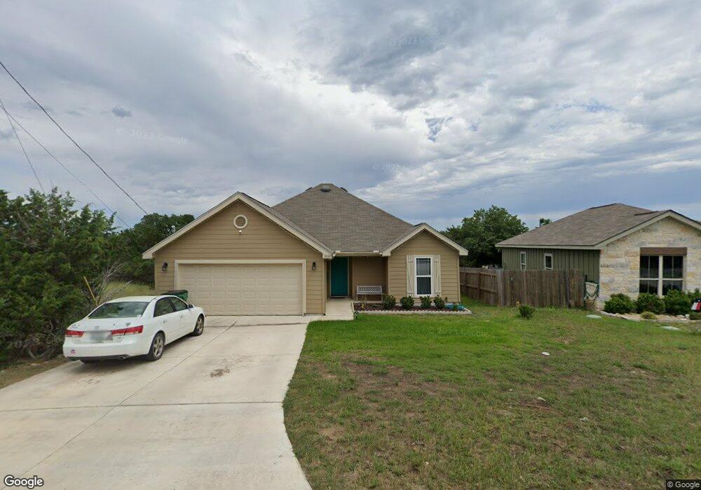
1032 Rim Rock Cove Spring Branch, TX 78070
Hill Country NeighborhoodEstimated Value: $293,888 - $363,000
--
Bed
2
Baths
1,429
Sq Ft
$226/Sq Ft
Est. Value
About This Home
This home is located at 1032 Rim Rock Cove, Spring Branch, TX 78070 and is currently estimated at $322,472, approximately $225 per square foot. 1032 Rim Rock Cove is a home located in Comal County with nearby schools including Rebecca Creek Elementary School, Mt Valley Middle School, and Canyon Lake High School.
Ownership History
Date
Name
Owned For
Owner Type
Purchase Details
Closed on
Aug 15, 2019
Sold by
Bedford Industries Llc
Bought by
Miller Dena Jo
Current Estimated Value
Home Financials for this Owner
Home Financials are based on the most recent Mortgage that was taken out on this home.
Original Mortgage
$94,118
Outstanding Balance
$82,294
Interest Rate
3.62%
Mortgage Type
FHA
Estimated Equity
$240,178
Purchase Details
Closed on
Feb 27, 2017
Sold by
Derrick Mark
Bought by
Bedford Industries Llc
Create a Home Valuation Report for This Property
The Home Valuation Report is an in-depth analysis detailing your home's value as well as a comparison with similar homes in the area
Home Values in the Area
Average Home Value in this Area
Purchase History
| Date | Buyer | Sale Price | Title Company |
|---|---|---|---|
| Miller Dena Jo | -- | Stc | |
| Bedford Industries Llc | -- | None Available |
Source: Public Records
Mortgage History
| Date | Status | Borrower | Loan Amount |
|---|---|---|---|
| Open | Miller Dena Jo | $94,118 |
Source: Public Records
Tax History Compared to Growth
Tax History
| Year | Tax Paid | Tax Assessment Tax Assessment Total Assessment is a certain percentage of the fair market value that is determined by local assessors to be the total taxable value of land and additions on the property. | Land | Improvement |
|---|---|---|---|---|
| 2025 | $1,979 | $287,900 | -- | -- |
| 2024 | $1,979 | $261,727 | -- | -- |
| 2023 | $1,979 | $237,934 | $0 | $0 |
| 2022 | $4,449 | $263,286 | $27,870 | $235,416 |
| 2021 | $3,503 | $196,640 | $9,490 | $187,150 |
| 2020 | $4,076 | $219,990 | $8,070 | $211,920 |
| 2019 | $3,830 | $201,770 | $6,620 | $195,150 |
| 2018 | $74 | $3,900 | $3,900 | $0 |
| 2017 | $70 | $3,730 | $3,730 | $0 |
| 2016 | $57 | $3,050 | $3,050 | $0 |
| 2015 | $57 | $3,050 | $3,050 | $0 |
| 2014 | $57 | $3,050 | $3,050 | $0 |
Source: Public Records
Map
Nearby Homes
- 1265 Bob White Dr
- 1229 Bob White Dr
- 1431 Cedar Grove Trail
- 890 Live Oak Dr
- 1556 Rimrock Cove
- 952 Rimrock Cove
- 866 Live Oak Dr
- 799 Mockingbird Cove
- 771 Mockingbird Cove
- 644 Cashew
- 1475 Echo Meadow Ln
- 1456 Green Meadow Ln
- 1053 Live Oak Dr
- 147 Juniper Cir
- 1230 Echo Meadow Ln
- 1637 Bob White Dr
- 1652 Bob White Dr
- 1071 Highpoint Ln
- 1107 Highpoint Ln
- 645 Jonquil Dr
- 1032 Rimrock Cove
- 1022 Rimrock Cove
- 1020 Rimrock Cove
- 1313 Bob White Dr
- 1059 Rimrock Cove
- 1003 Rimrock Cove
- 1260 Bob White Dr
- 1177 Bob White Dr
- 1301 Bob White Dr
- 0 Bob White Dr
- 1241 Bob White Dr
- 992 Rimrock Cove
- 122 Alpine Ct
- 1325 Bob White Dr
- 982 Rimrock Cove
- 1067 Rimrock Cove
- 938 Live Oak Dr
- 950 Live Oak Dr
- 1286 Bob White Dr
- 134 Alpine Ct