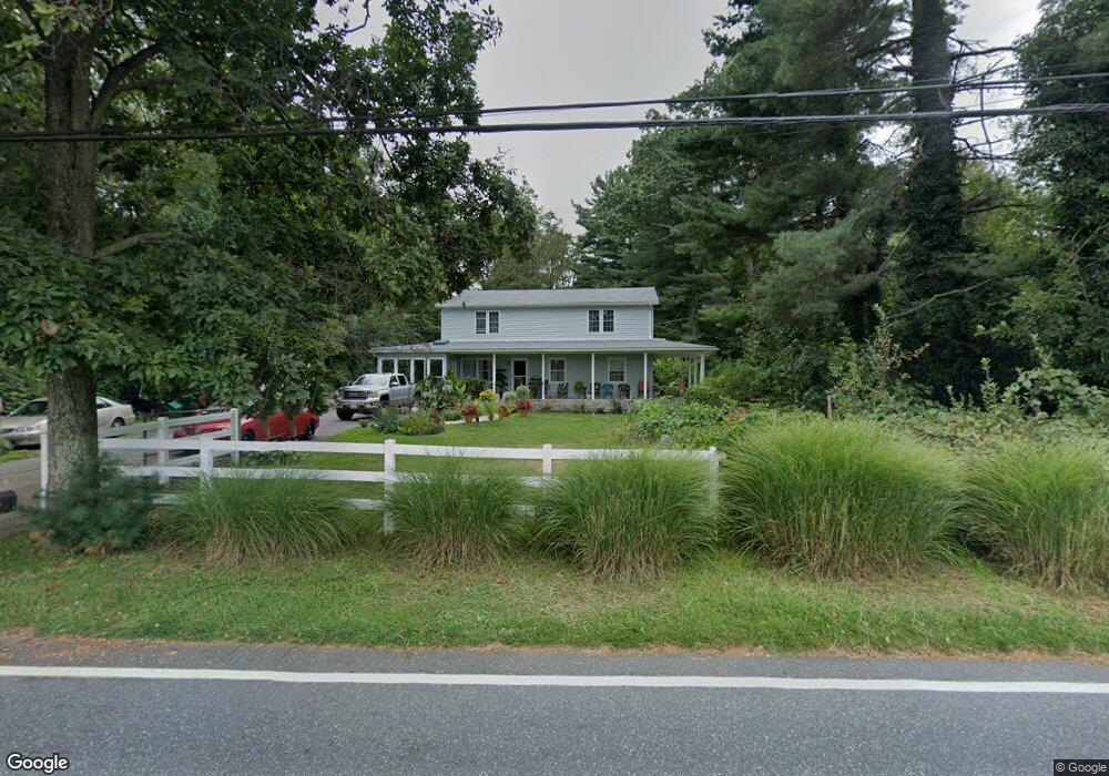
1032 Saint Michaels Rd Mount Airy, MD 21771
Estimated Value: $478,000 - $726,000
2
Beds
1
Bath
--
Sq Ft
2.5
Acres
About This Home
This home is located at 1032 Saint Michaels Rd, Mount Airy, MD 21771 and is currently estimated at $638,224. 1032 Saint Michaels Rd is a home located in Howard County with nearby schools including Lisbon Elementary School, Glenwood Middle School, and Glenelg High School.
Ownership History
Date
Name
Owned For
Owner Type
Purchase Details
Closed on
Jun 22, 2017
Sold by
Kelsey Gary and Kelsey Connie
Bought by
Kelsey Connie
Current Estimated Value
Purchase Details
Closed on
Nov 21, 2008
Sold by
Rouzer Harry E
Bought by
Kelsey Gary F and Kelsey Connie
Home Financials for this Owner
Home Financials are based on the most recent Mortgage that was taken out on this home.
Original Mortgage
$244,000
Outstanding Balance
$158,816
Interest Rate
5.91%
Mortgage Type
Purchase Money Mortgage
Estimated Equity
$479,408
Purchase Details
Closed on
May 1, 2008
Sold by
Rouzer Harry E
Bought by
Kelsey Gary F and Kelsey Connie
Home Financials for this Owner
Home Financials are based on the most recent Mortgage that was taken out on this home.
Original Mortgage
$244,000
Interest Rate
5.91%
Mortgage Type
Purchase Money Mortgage
Create a Home Valuation Report for This Property
The Home Valuation Report is an in-depth analysis detailing your home's value as well as a comparison with similar homes in the area
Home Values in the Area
Average Home Value in this Area
Purchase History
| Date | Buyer | Sale Price | Title Company |
|---|---|---|---|
| Kelsey Connie | -- | None Available | |
| Kelsey Gary F | $309,750 | -- | |
| Kelsey Gary F | $309,750 | -- |
Source: Public Records
Mortgage History
| Date | Status | Borrower | Loan Amount |
|---|---|---|---|
| Open | Kelsey Gary F | $244,000 | |
| Previous Owner | Kelsey Gary F | $244,000 |
Source: Public Records
Tax History Compared to Growth
Tax History
| Year | Tax Paid | Tax Assessment Tax Assessment Total Assessment is a certain percentage of the fair market value that is determined by local assessors to be the total taxable value of land and additions on the property. | Land | Improvement |
|---|---|---|---|---|
| 2025 | $7,419 | $527,200 | $226,200 | $301,000 |
| 2024 | $7,419 | $498,100 | $0 | $0 |
| 2023 | $6,864 | $469,000 | $0 | $0 |
| 2022 | $6,429 | $439,900 | $225,000 | $214,900 |
| 2021 | $6,149 | $419,233 | $0 | $0 |
| 2020 | $5,868 | $398,567 | $0 | $0 |
| 2019 | $5,588 | $377,900 | $215,000 | $162,900 |
| 2018 | $5,088 | $363,167 | $0 | $0 |
| 2017 | $4,879 | $377,900 | $0 | $0 |
| 2016 | -- | $333,700 | $0 | $0 |
| 2015 | -- | $316,467 | $0 | $0 |
| 2014 | -- | $299,233 | $0 | $0 |
Source: Public Records
Map
Nearby Homes
- 17263 Hardy Rd
- 16657 Frederick Rd
- 15904 Frederick Rd
- 921 Lady Anne Ct
- 16365 Camalo Dr
- 1629 Brittle Branch Way
- 7401 Watersville Rd
- 2305 Connor Cir
- 2016 Damon Dr
- 7460 Porter Dr
- 2408 Connor Cir
- 1718 Trestle St
- 1308 Crossbow Rd
- 3000 Flag Marsh Rd
- 7714 Walnut Ln
- 807 Kingsbridge Terrace
- 18389 New Cut Rd
- 0 Watersville Rd Unit MDCR2019316
- 0 Duvall Rd Unit MDHW2049414
- 1855 Long Corner Rd
- 1038 Saint Michaels Rd
- 1026 Saint Michaels Rd
- 1033 Saint Michaels Rd
- 1024 Saint Michaels Rd
- 1044 Saint Michaels Rd
- 1031 Saint Michaels Rd
- 1029 Saint Michaels Rd
- 1075 Saint Michaels Rd
- 1075 Saint Michaels Rd
- 1020 Saint Michaels Rd
- 1025 Saint Michaels Rd
- 1022 Saint Michaels Rd
- 1027 Saint Michaels Rd
- 1035 Saint Michaels Rd
- 1050 Saint Michaels Rd
- 1021 Saint Michaels Rd
- 1023 Saint Michaels Rd
- 1014 Saint Michaels Rd
- 1019 Saint Michaels Rd
- 1045 Saint Michaels Rd