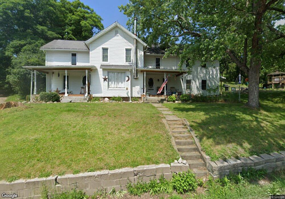
1032 State Route 364 Middlesex, NY 14507
Estimated Value: $80,000 - $218,000
3
Beds
2
Baths
1,770
Sq Ft
$93/Sq Ft
Est. Value
About This Home
This home is located at 1032 State Route 364, Middlesex, NY 14507 and is currently estimated at $165,392, approximately $93 per square foot. 1032 State Route 364 is a home located in Yates County with nearby schools including Middlesex Valley Elementary School, Gorham Elementary School, and Marcus Whitman Middle/ High School.
Ownership History
Date
Name
Owned For
Owner Type
Purchase Details
Closed on
Dec 22, 2006
Sold by
Dunton Wayne
Bought by
Dunton Benjamin
Current Estimated Value
Home Financials for this Owner
Home Financials are based on the most recent Mortgage that was taken out on this home.
Original Mortgage
$76,000
Interest Rate
6.24%
Mortgage Type
New Conventional
Create a Home Valuation Report for This Property
The Home Valuation Report is an in-depth analysis detailing your home's value as well as a comparison with similar homes in the area
Home Values in the Area
Average Home Value in this Area
Purchase History
| Date | Buyer | Sale Price | Title Company |
|---|---|---|---|
| Dunton Benjamin | $80,000 | Carl Schwartz |
Source: Public Records
Mortgage History
| Date | Status | Borrower | Loan Amount |
|---|---|---|---|
| Closed | Dunton Benjamin | $76,000 |
Source: Public Records
Tax History Compared to Growth
Tax History
| Year | Tax Paid | Tax Assessment Tax Assessment Total Assessment is a certain percentage of the fair market value that is determined by local assessors to be the total taxable value of land and additions on the property. | Land | Improvement |
|---|---|---|---|---|
| 2024 | $3,603 | $109,700 | $35,100 | $74,600 |
| 2023 | $3,603 | $109,700 | $35,100 | $74,600 |
| 2022 | $3,247 | $109,700 | $35,100 | $74,600 |
| 2021 | $3,269 | $109,700 | $35,100 | $74,600 |
| 2020 | $2,721 | $98,000 | $25,100 | $72,900 |
| 2019 | $2,605 | $98,000 | $25,100 | $72,900 |
| 2018 | $2,605 | $98,000 | $25,100 | $72,900 |
| 2017 | $2,606 | $87,200 | $20,200 | $67,000 |
| 2016 | $2,400 | $87,200 | $20,200 | $67,000 |
| 2015 | -- | $87,200 | $20,200 | $67,000 |
| 2014 | -- | $87,200 | $20,200 | $67,000 |
Source: Public Records
Map
Nearby Homes
- 1060 State Route 364
- 1136 Lincoln Ave
- 941 State Route 245
- 205 Charles Herrmann Way Unit 205
- 681 State Route 364
- 1221 Garden Ln
- 223 N Vine Valley Rd
- 2190 Warren Rd
- 6351 N Vine Valley Rd
- 316 Gray Rd
- 6355 Glenn Ave
- 1571 Emerson Rd
- 855 State Route 247
- 0 Warren Rd Unit R1582687
- 1267 and 1265 S Lake Rd
- 0 Town Line Rd
- 0 E Lake Rd Unit R1621968
- 7 Cliffside Dr
- 3 Cliffside Dr
- 23 Cliffside Dr
- 1078 Lincoln Avenue Extension
- 1002 Elwell Rd
- 1080 State Route 364
- 1106 Lincoln Ave
- 1086 State Route 364
- 1102 State Route 364
- 1007 Elwell Rd
- 5628 Water St
- 1141 Lincoln Ave
- 1140 State Route 364
- 5612 Water St
- 1145 Lincoln Ave
- 948 Elwell Rd
- 1147 Lincoln Ave
- 913 Hadsell Rd
- 5602 Water St
- 5598 Water St
- 5621 Water St
- 959 Hadsell Rd
- 5609 Water St