1032 SW 10th Dr Unit I45 Gresham, OR 97080
Gresham Butte NeighborhoodEstimated Value: $526,000 - $599,000
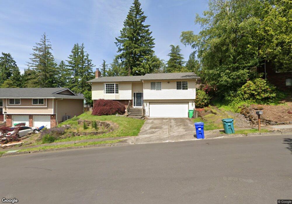
About This Home
This home is located at 1032 SW 10th Dr Unit I45, Gresham, OR 97080 and is currently estimated at $560,007, approximately $200 per square foot. 1032 SW 10th Dr Unit I45 is a home located in Multnomah County with nearby schools including Dexter McCarty Middle School, Gresham High School, and Portland Adventist Elementary School.
Ownership History
We collect this data history from publicly available records. To have your information removed, we recommend requesting removal directly through your county’s website.
Purchase Details
Purchase Details
Home Financials for this Owner
Home Financials are based on the most recent Mortgage that was taken out on this home.Purchase Details
Home Financials for this Owner
Home Financials are based on the most recent Mortgage that was taken out on this home.Purchase Details
Home Values in the Area
Average Home Value in this Area
Purchase History
We collect this data history from publicly available records. To have your information removed, we recommend requesting removal directly through your county’s website.
| Date | Buyer | Sale Price | Title Company |
|---|---|---|---|
| -- | None Listed On Document | ||
| $385,000 | Fidelity Natl Title Co Of Or | ||
| -- | Transamerica Title Insurance | ||
| $57,000 | Oregon Title Insurance Compa |
Mortgage History
We collect this data history from publicly available records. To have your information removed, we recommend requesting removal directly through your county’s website.
| Date | Status | Borrower | Loan Amount |
|---|---|---|---|
| Previous Owner | $308,000 | ||
| Previous Owner | $65,000 |
Tax History
We collect this data history from publicly available records. To have your information removed, we recommend requesting removal directly through your county’s website.
| Year | Tax Paid | Tax Assessment Tax Assessment Total Assessment is a certain percentage of the fair market value that is determined by local assessors to be the total taxable value of land and additions on the property. | Land | Improvement |
|---|---|---|---|---|
| 2025 | $6,969 | $342,440 | -- | -- |
| 2024 | $6,671 | $332,470 | -- | -- |
| 2023 | $6,671 | $322,790 | -- | -- |
| 2022 | $5,907 | $313,390 | $0 | $0 |
| 2021 | $5,759 | $304,270 | $0 | $0 |
| 2020 | $5,418 | $295,410 | $0 | $0 |
| 2019 | $5,277 | $286,810 | $0 | $0 |
| 2018 | $5,031 | $278,460 | $0 | $0 |
| 2017 | $4,827 | $270,350 | $0 | $0 |
| 2016 | $4,256 | $262,480 | $0 | $0 |
| 2015 | $3,703 | $231,350 | $0 | $0 |
| 2014 | $3,588 | $224,610 | $0 | $0 |
Map
- 1413 SW 14th St
- 828 SW Wilson Ct
- 1472 SW 14th St
- 1488 SW 17th Ct
- 1488 SW 17th Ct Unit N
- 1454 SW 4th St
- 632 SW Willowbrook Ave
- 1407 SW Walters Dr
- 1960 SW 13th Ct
- 1479 SW Willowbrook Ct
- 1333 SW 19th Dr
- 407 SW 7th St
- 1859 SW Angeline Ave
- 1910 SW 3rd Dr
- 159 SW Florence Ave Unit 26
- 2156 SW 14th Dr
- 1113 W Powell Blvd
- 1944 SW 20th Ct
- 1363 SW Binford Lake Pkwy
- 0 SW Miller Ct Unit 470855683
- 1060 SW 10th Dr
- 958 SW Florence Ct
- 970 SW Florence Ct
- 1012 SW 10th Dr
- 972 SW Florence Ct
- 1041 SW 10th Dr
- 1078 SW 10th Dr
- 982 SW Florence Ct
- 1083 SW 10th Dr
- 946 SW Florence Ct
- 1222 SW 10th Dr
- 1102 SW 10th Dr
- 938 SW Florence Ct
- 971 SW Florence Ct
- 999 SW Florence Ct
- 1105 SW 10th Dr
- 942 SW Florence Ct
- 969 SW Florence Ct
- 1248 SW 10th Dr
- 922 SW Florence Ct
Ask me questions while you tour the home.