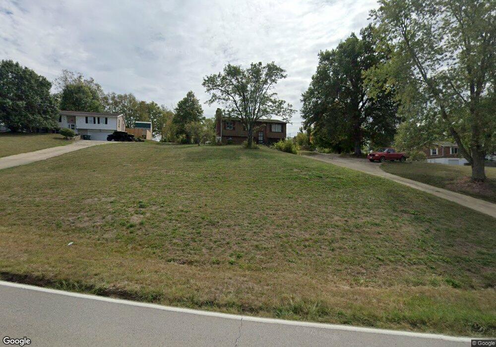
10329 Banklick Rd Walton, KY 41094
Estimated Value: $195,000 - $272,000
3
Beds
2
Baths
1,152
Sq Ft
$212/Sq Ft
Est. Value
About This Home
This home is located at 10329 Banklick Rd, Walton, KY 41094 and is currently estimated at $244,522, approximately $212 per square foot. 10329 Banklick Rd is a home located in Kenton County with nearby schools including Kenton Elementary School, Twenhofel Middle School, and Simon Kenton High School.
Ownership History
Date
Name
Owned For
Owner Type
Purchase Details
Closed on
Aug 27, 2024
Sold by
Brock Matthew
Bought by
Brock Matthew and Brock Aaron
Current Estimated Value
Home Financials for this Owner
Home Financials are based on the most recent Mortgage that was taken out on this home.
Original Mortgage
$101,000
Outstanding Balance
$99,974
Interest Rate
7%
Mortgage Type
New Conventional
Estimated Equity
$144,548
Create a Home Valuation Report for This Property
The Home Valuation Report is an in-depth analysis detailing your home's value as well as a comparison with similar homes in the area
Home Values in the Area
Average Home Value in this Area
Purchase History
| Date | Buyer | Sale Price | Title Company |
|---|---|---|---|
| Brock Matthew | -- | None Listed On Document | |
| Brock Matthew | -- | None Listed On Document |
Source: Public Records
Mortgage History
| Date | Status | Borrower | Loan Amount |
|---|---|---|---|
| Open | Brock Matthew | $101,000 | |
| Closed | Brock Matthew | $101,000 |
Source: Public Records
Tax History Compared to Growth
Tax History
| Year | Tax Paid | Tax Assessment Tax Assessment Total Assessment is a certain percentage of the fair market value that is determined by local assessors to be the total taxable value of land and additions on the property. | Land | Improvement |
|---|---|---|---|---|
| 2024 | $905 | $120,200 | $25,000 | $95,200 |
| 2023 | $931 | $120,200 | $25,000 | $95,200 |
| 2022 | $1,075 | $120,200 | $25,000 | $95,200 |
| 2021 | $1,090 | $120,200 | $25,000 | $95,200 |
| 2020 | $923 | $104,500 | $20,000 | $84,500 |
| 2019 | $926 | $104,500 | $20,000 | $84,500 |
| 2018 | $953 | $104,500 | $20,000 | $84,500 |
| 2017 | $928 | $104,500 | $20,000 | $84,500 |
| 2015 | $1,361 | $104,500 | $22,000 | $82,500 |
| 2014 | $1,343 | $104,500 | $22,000 | $82,500 |
Source: Public Records
Map
Nearby Homes
- 1095 Audas Ct
- 570 Old Bristow Rd
- 1119 Brigade Rd
- 10452 Calvary Rd
- The Westchester Plan at The Greens of Glenhurst
- The Ella Marie Plan at The Greens of Glenhurst
- The Jefferson Plan at The Greens of Glenhurst
- The Leighann Plan at The Greens of Glenhurst
- The Waterson Plan at The Greens of Glenhurst
- The Lancaster Plan at The Greens of Glenhurst
- The Austin Plan at The Greens of Glenhurst
- The Morgan Plan at The Greens of Glenhurst
- The Marietta Plan at The Greens of Glenhurst
- The Camden Plan at The Greens of Glenhurst
- The Lincoln Plan at The Greens of Glenhurst
- The Bristol Plan at The Greens of Glenhurst
- The Livingston Plan at The Greens of Glenhurst
- The Madison Plan at The Greens of Glenhurst
- The Verona Plan at The Greens of Glenhurst
- The Courtney Plan at The Greens of Glenhurst
- 10321 Banklick Rd
- 10337 Banklick Rd
- 10347 Banklick Rd
- 10305 Banklick
- 10289 Banklick Rd
- 10305 Banklick Rd
- 10540 Pepperwood Dr
- 10540 Pepperwood Dr Unit 22BL
- 10536 Pepperwood Dr
- 10536 Pepperwood Dr Unit 21BL
- 10357 Banklick Rd
- 10544 Pepperwood Dr
- 10548 Pepperwood Dr
- 10289 Banklick Rd
- 10367 Banklick Rd
- 10541 Pepperwood Dr
- 10552 Pepperwood Dr
- 10281 Old Banklick Rd
- 10545 Pepperwood Dr
- 10545 Pepperwood Dr Unit 19BL