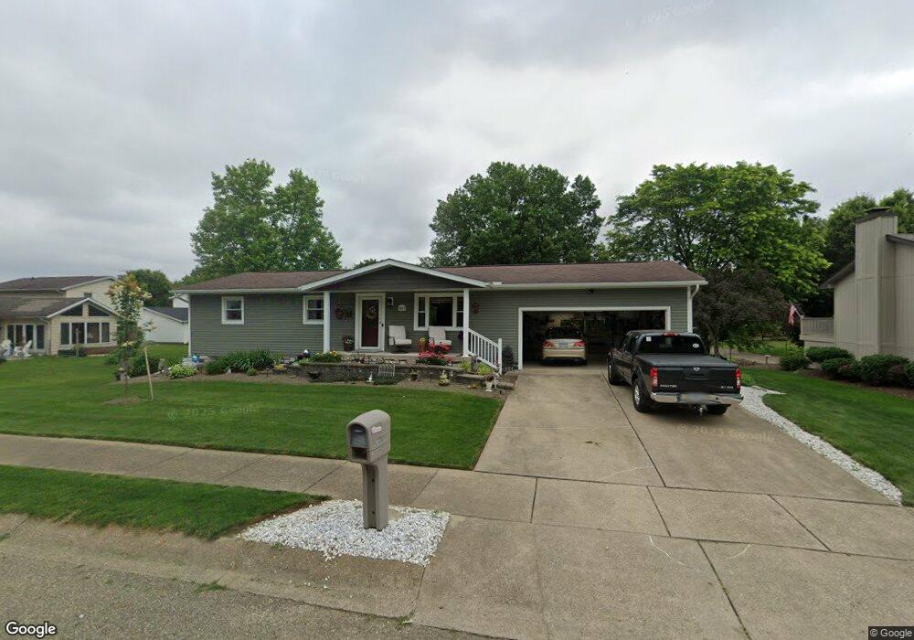
1033 5th St SW New Philadelphia, OH 44663
Estimated Value: $215,000 - $273,541
3
Beds
2
Baths
1,188
Sq Ft
$212/Sq Ft
Est. Value
About This Home
This home is located at 1033 5th St SW, New Philadelphia, OH 44663 and is currently estimated at $252,385, approximately $212 per square foot. 1033 5th St SW is a home located in Tuscarawas County with nearby schools including New Philadelphia High School, Quaker Preparatory Academy, and Quaker Digital Academy.
Ownership History
Date
Name
Owned For
Owner Type
Purchase Details
Closed on
Feb 25, 2004
Sold by
Hawkins Kenneth Gene and Crile Joeleen K
Bought by
May Charles T and May Peggy J
Current Estimated Value
Home Financials for this Owner
Home Financials are based on the most recent Mortgage that was taken out on this home.
Original Mortgage
$72,000
Interest Rate
5.01%
Mortgage Type
Purchase Money Mortgage
Purchase Details
Closed on
Apr 28, 1994
Sold by
Turner Todd R and Hawkins Eleanor
Bought by
Hawkins Kenneth G and Hawkins Eleanor
Purchase Details
Closed on
Apr 15, 1993
Sold by
Turner Todd R and Joan Patricia
Bought by
May Charles T
Purchase Details
Closed on
Jun 1, 1990
Sold by
Parker Michael G and Parker Lori A
Bought by
Turner Todd R and Patricia Joan
Create a Home Valuation Report for This Property
The Home Valuation Report is an in-depth analysis detailing your home's value as well as a comparison with similar homes in the area
Home Values in the Area
Average Home Value in this Area
Purchase History
| Date | Buyer | Sale Price | Title Company |
|---|---|---|---|
| May Charles T | $112,000 | -- | |
| Hawkins Kenneth G | $78,000 | -- | |
| May Charles T | -- | -- | |
| Turner Todd R | $66,000 | -- |
Source: Public Records
Mortgage History
| Date | Status | Borrower | Loan Amount |
|---|---|---|---|
| Closed | May Charles T | $72,000 |
Source: Public Records
Tax History Compared to Growth
Tax History
| Year | Tax Paid | Tax Assessment Tax Assessment Total Assessment is a certain percentage of the fair market value that is determined by local assessors to be the total taxable value of land and additions on the property. | Land | Improvement |
|---|---|---|---|---|
| 2024 | $2,437 | $63,310 | $10,300 | $53,010 |
| 2023 | $4,269 | $180,900 | $29,440 | $151,460 |
| 2022 | $2,452 | $63,315 | $10,304 | $53,011 |
| 2021 | $2,089 | $50,719 | $8,127 | $42,592 |
| 2020 | $2,100 | $50,719 | $8,127 | $42,592 |
| 2019 | $2,098 | $50,719 | $8,127 | $42,592 |
| 2018 | $1,933 | $44,220 | $7,080 | $37,140 |
| 2017 | $1,901 | $44,220 | $7,080 | $37,140 |
| 2016 | $1,946 | $44,220 | $7,080 | $37,140 |
| 2014 | $1,832 | $40,400 | $6,440 | $33,960 |
| 2013 | $1,511 | $40,400 | $6,440 | $33,960 |
Source: Public Records
Map
Nearby Homes
- 1024 Thomas Dr SW
- 471 Snazzy Cir SW
- 236 Myers Ave SW
- 1166 S Broadway St
- 1149 Jefferson St SE
- 161 York Dr SE
- 427 Sycamore Cir SE
- 1354 Independence Cir SE
- 1273 Concord Cir SE
- 1224 Goshen Ave SE
- 241 Saint Clair Ave SW
- 451 Mill Ave SE
- 514 Front Ave SW
- 405 Front Ave SW
- 651 Front Ave SW
- 231 4th St SE
- 902 W High Ave
- 344 Fair Ave NW
- 239 E High Ave Unit A
- 221 Sea Gull Dr SE
- 1041 5th St SW
- 498 Lockport Ave SW
- 479 Rosch Ct SW
- 490 Lockport Ave SW
- 1034 5th St SW
- 471 Rosch Ct SW
- 484 Lockport Ave SW
- 1057 5th St SW
- 1052 5th St SW
- 476 Lockport Ave SW
- 515 Rankin Ct SW
- 463 Rosch Ct SW
- 499 Lockport Ave SW
- 469 Stratton Ave SW
- 516 Lockport Ave SW
- 491 Lockport Ave SW
- 461 Stratton Ave SW
- 483 Lockport Ave SW
- 516 Rankin Ct SW
- 468 Lockport Ave SW