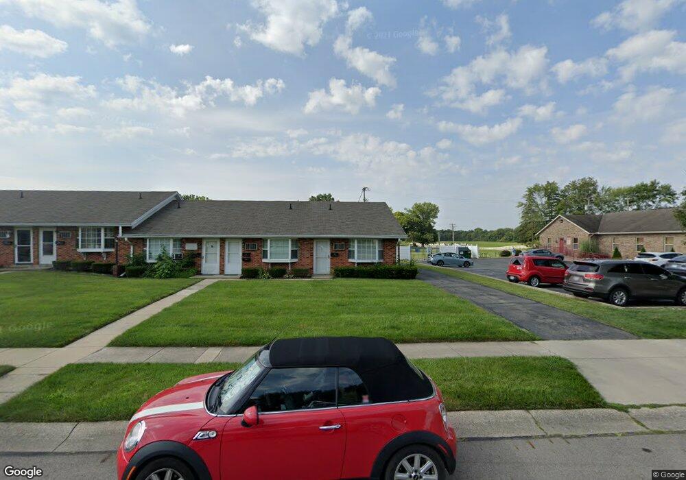
1033 Cheyenne Ave Springfield, OH 45503
Estimated Value: $102,779 - $108,000
1
Bed
1
Bath
629
Sq Ft
$168/Sq Ft
Est. Value
About This Home
This home is located at 1033 Cheyenne Ave, Springfield, OH 45503 and is currently estimated at $105,945, approximately $168 per square foot. 1033 Cheyenne Ave is a home located in Clark County with nearby schools including Northridge Elementary School, Kenton Ridge Middle & High School, and Emmanuel Christian Academy.
Ownership History
Date
Name
Owned For
Owner Type
Purchase Details
Closed on
Mar 21, 2016
Sold by
Lemmons Robert J and Robert J Lemmons Sr Family Tru
Bought by
Lemmons Elaine
Current Estimated Value
Purchase Details
Closed on
Dec 27, 2002
Sold by
Anne Franzen Jeannette and Anne Mary
Bought by
Lemmons Elaine and Lemmons Robert
Home Financials for this Owner
Home Financials are based on the most recent Mortgage that was taken out on this home.
Original Mortgage
$49,400
Outstanding Balance
$20,078
Interest Rate
5.87%
Estimated Equity
$85,867
Create a Home Valuation Report for This Property
The Home Valuation Report is an in-depth analysis detailing your home's value as well as a comparison with similar homes in the area
Home Values in the Area
Average Home Value in this Area
Purchase History
| Date | Buyer | Sale Price | Title Company |
|---|---|---|---|
| Lemmons Elaine | -- | None Available | |
| Lemmons Elaine | $52,000 | -- |
Source: Public Records
Mortgage History
| Date | Status | Borrower | Loan Amount |
|---|---|---|---|
| Open | Lemmons Elaine | $49,400 |
Source: Public Records
Tax History
| Year | Tax Paid | Tax Assessment Tax Assessment Total Assessment is a certain percentage of the fair market value that is determined by local assessors to be the total taxable value of land and additions on the property. | Land | Improvement |
|---|---|---|---|---|
| 2025 | $4,292 | $29,130 | $7,500 | $21,630 |
| 2024 | $5,774 | $22,220 | $6,830 | $15,390 |
| 2023 | $3,098 | $22,220 | $6,830 | $15,390 |
| 2022 | $3,463 | $22,220 | $6,830 | $15,390 |
| 2021 | $830 | $16,580 | $5,250 | $11,330 |
| 2020 | $831 | $16,580 | $5,250 | $11,330 |
| 2019 | $847 | $16,580 | $5,250 | $11,330 |
| 2018 | $851 | $16,000 | $4,940 | $11,060 |
| 2017 | $730 | $15,999 | $4,935 | $11,064 |
| 2016 | $725 | $15,999 | $4,935 | $11,064 |
| 2015 | $1,234 | $16,933 | $5,250 | $11,683 |
| 2014 | $796 | $16,933 | $5,250 | $11,683 |
| 2013 | $389 | $16,933 | $5,250 | $11,683 |
Source: Public Records
Map
Nearby Homes
- 4733 Curtis Dr
- 4741 Cullen Ave
- 1341 Student Ave
- 4802 Willowbrook Dr
- 4322 Midfield St Unit 15
- 4256 Midfield St Unit 9
- 4446 Ridgewood Rd E Unit 3
- 4577 Reno Ln Unit 2
- 4652 Reno Ln Unit 15
- 1162 Kingsgate Rd
- 1201 Kingsgate Rd
- 3942 Harris Ln
- 1644 Delmar Dr
- 5033 Ridgewood Rd E
- 5300 Brookshire Ln
- 5235 W Ridgewood Rd
- 4732 Lehigh Dr
- 1521 Erika Dr
- 1500 Kingsgate Rd Unit 19430
- 1502 Kingsgate Rd Unit 19432
- 1035 Cheyenne Ave
- 1037 Cheyenne Ave Unit 1037
- 1041 Cheyenne Ave Unit 1041
- 1043 Cheyenne Ave Unit 1043
- 1045 Cheyenne Ave Unit 1045
- 1045 Cheyenne Ave
- 1047 Cheyenne Ave
- 4494 Derr Rd
- 1051 Cheyenne Ave
- 1053 Cheyenne Ave Unit 1053
- 1055 Cheyenne Ave
- 1032 Cheyenne Ave Unit 1032
- 1036 Cheyenne Ave
- 1036 Cheyenne Ave
- 1040 Cheyenne Ave Unit 1040
- 1044 Cheyenne Ave Unit 1044
- 1048 Cheyenne Ave Unit 1048
- 1048 Cheyenne Ave
- 1050 Cheyenne Ave Unit 1050
- 1050 Cheyenne Ave
Your Personal Tour Guide
Ask me questions while you tour the home.