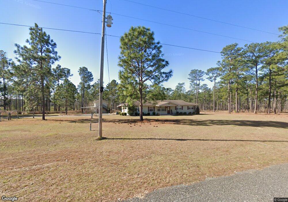
1033 Clarence M Rd Whigham, GA 39897
Estimated Value: $112,956 - $256,000
3
Beds
2
Baths
1,796
Sq Ft
$90/Sq Ft
Est. Value
About This Home
This home is located at 1033 Clarence M Rd, Whigham, GA 39897 and is currently estimated at $162,319, approximately $90 per square foot. 1033 Clarence M Rd is a home located in Grady County.
Ownership History
Date
Name
Owned For
Owner Type
Purchase Details
Closed on
Jul 17, 2025
Sold by
Mobley Benjamin F
Bought by
Big Creek Land & Timber Llc
Current Estimated Value
Purchase Details
Closed on
Oct 28, 2024
Sold by
Maxwell John Steven
Bought by
Big Creek Land & Timber Llc
Purchase Details
Closed on
Jul 18, 2024
Sold by
Mobley Benjamin F
Bought by
Maxwell John Steven and Maxwell Susan B
Home Financials for this Owner
Home Financials are based on the most recent Mortgage that was taken out on this home.
Original Mortgage
$107,422
Interest Rate
6.87%
Mortgage Type
New Conventional
Purchase Details
Closed on
Apr 9, 1965
Bought by
Mobley Benjamin F
Create a Home Valuation Report for This Property
The Home Valuation Report is an in-depth analysis detailing your home's value as well as a comparison with similar homes in the area
Home Values in the Area
Average Home Value in this Area
Purchase History
| Date | Buyer | Sale Price | Title Company |
|---|---|---|---|
| Big Creek Land & Timber Llc | $135,000 | -- | |
| Big Creek Land & Timber Llc | $110,983 | -- | |
| Maxwell John Steven | $106,590 | -- | |
| Mobley Benjamin F | -- | -- |
Source: Public Records
Mortgage History
| Date | Status | Borrower | Loan Amount |
|---|---|---|---|
| Previous Owner | Maxwell John Steven | $107,422 |
Source: Public Records
Tax History Compared to Growth
Tax History
| Year | Tax Paid | Tax Assessment Tax Assessment Total Assessment is a certain percentage of the fair market value that is determined by local assessors to be the total taxable value of land and additions on the property. | Land | Improvement |
|---|---|---|---|---|
| 2024 | $1,887 | $78,891 | $27,128 | $51,763 |
| 2023 | $1,105 | $53,106 | $23,860 | $29,246 |
| 2022 | $1,099 | $53,106 | $23,860 | $29,246 |
| 2021 | $1,099 | $52,148 | $22,902 | $29,246 |
| 2020 | $980 | $53,106 | $23,860 | $29,246 |
| 2019 | $976 | $53,106 | $23,860 | $29,246 |
| 2018 | $913 | $53,106 | $23,860 | $29,246 |
| 2017 | $865 | $53,106 | $23,860 | $29,246 |
| 2016 | $750 | $48,894 | $23,860 | $25,034 |
| 2015 | $738 | $48,894 | $23,860 | $25,034 |
| 2014 | -- | $48,894 | $23,860 | $25,034 |
| 2013 | -- | $50,522 | $26,938 | $23,584 |
Source: Public Records
Map
Nearby Homes
- 2033 Old 179 N
- 0 Earl Hester Rd
- 0 Cal Thomas Rd
- 206 Lodge Ln
- 165 Larkin St
- Harrell Mill Rd
- 267 Providence Rd
- 0 Eddie Avery Rd Unit 14399
- 0 Pelham Rd Unit 23706472
- 114 Pr Harrell Rd
- 292 Sykes Mill Rd
- 231 Mcintyre Ln
- 421 Antioch Church Rd
- 317 Palmer Rd
- 141 Covey Rise Rd
- 547 Eddie Avery Rd
- 1741 Georgia 112
- 723 Providence Rd
- 0 Harrell Rd
- 1718 Old 179 S
- 1038 Clarence M Rd
- 1001 Clarence M Rd
- 992 Clarence M Rd
- 1108 Clarence M Rd
- 1117 Clarence M Rd
- 921 Clarence M Rd
- 696 Union Springs Rd
- 872 Clarence M Rd
- 1018 Maxwell Rd
- 630 Union Springs Rd
- 596 Union Springs Rd
- 993 Maxwell Rd
- 720 Union Springs Rd
- 749 Clarence M Rd
- 964 Maxwell Rd
- 737 Clarence M Rd
- 948 Maxwell Rd
- 576 Union Springs Rd
- 798 Mobley Rd
- 898 Maxwell Rd