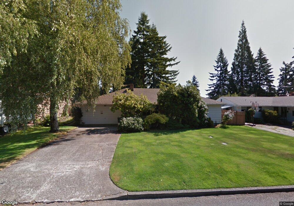
1033 Daniels Dr Fircrest, WA 98466
Estimated Value: $494,000 - $684,000
3
Beds
2
Baths
1,699
Sq Ft
$350/Sq Ft
Est. Value
About This Home
This home is located at 1033 Daniels Dr, Fircrest, WA 98466 and is currently estimated at $594,724, approximately $350 per square foot. 1033 Daniels Dr is a home located in Pierce County with nearby schools including Whittier Elementary School, Wainwright Intermediate School, and Foss High School.
Ownership History
Date
Name
Owned For
Owner Type
Purchase Details
Closed on
Dec 20, 2024
Sold by
Parker Keith L and Parker Michele L
Bought by
Parker Cole H
Current Estimated Value
Home Financials for this Owner
Home Financials are based on the most recent Mortgage that was taken out on this home.
Original Mortgage
$486,000
Outstanding Balance
$482,178
Interest Rate
6.79%
Mortgage Type
Seller Take Back
Estimated Equity
$112,546
Purchase Details
Closed on
Dec 4, 2024
Sold by
Reich Shizuko Hogan
Bought by
Parker Keith S and Parker Michele L
Home Financials for this Owner
Home Financials are based on the most recent Mortgage that was taken out on this home.
Original Mortgage
$486,000
Outstanding Balance
$482,178
Interest Rate
6.79%
Mortgage Type
Seller Take Back
Estimated Equity
$112,546
Create a Home Valuation Report for This Property
The Home Valuation Report is an in-depth analysis detailing your home's value as well as a comparison with similar homes in the area
Home Values in the Area
Average Home Value in this Area
Purchase History
| Date | Buyer | Sale Price | Title Company |
|---|---|---|---|
| Parker Cole H | $486,000 | Puget Sound Title Company | |
| Parker Cole H | $486,000 | Puget Sound Title Company | |
| Parker Keith S | -- | None Listed On Document | |
| Parker Keith S | -- | None Listed On Document |
Source: Public Records
Mortgage History
| Date | Status | Borrower | Loan Amount |
|---|---|---|---|
| Open | Parker Cole H | $486,000 | |
| Closed | Parker Cole H | $486,000 |
Source: Public Records
Tax History Compared to Growth
Tax History
| Year | Tax Paid | Tax Assessment Tax Assessment Total Assessment is a certain percentage of the fair market value that is determined by local assessors to be the total taxable value of land and additions on the property. | Land | Improvement |
|---|---|---|---|---|
| 2025 | $5,328 | $558,000 | $301,400 | $256,600 |
| 2024 | $5,328 | $551,700 | $283,700 | $268,000 |
| 2023 | $5,328 | $558,600 | $289,800 | $268,800 |
| 2022 | $4,913 | $559,500 | $298,000 | $261,500 |
| 2021 | $1,312 | $401,700 | $199,600 | $202,100 |
| 2019 | $1,376 | $369,400 | $170,900 | $198,500 |
| 2018 | $1,459 | $344,100 | $151,600 | $192,500 |
| 2017 | $1,593 | $304,800 | $123,000 | $181,800 |
| 2016 | $3,431 | $243,200 | $89,400 | $153,800 |
| 2014 | $3,130 | $232,100 | $85,800 | $146,300 |
| 2013 | $3,130 | $206,200 | $77,200 | $129,000 |
Source: Public Records
Map
Nearby Homes
- 6320 Gregory St W
- 1203 Contra Costa Ave
- 3529 67th Ave W
- 3619 67th Ave W
- 106 Holly Ct
- 445 Buena Vista Ave
- 1322 W Mount Dr
- 1310 Boise St Unit 2
- 1324 Boise St
- 1327 1333 Contra Costa Ave
- 1340 Coral Dr
- 3827 67th Avenue Ct W
- 1450 Alameda Ave Unit 1
- 4003 Flora Dr
- 306 Stanford St
- 4211 Shoshone St W
- 1407 Cherry Ave
- 4311 67th Ave W Unit B
- 214 Summit Ave
- 702 Yale St
- 1025 Daniels Dr
- 1041 Daniels Dr
- 1034 Haven Ct
- 1028 Haven Ct
- 1019 Daniels Dr
- 1045 Daniels Dr
- 1033 Bel Aire Ct
- 1036 Daniels Dr
- 1015 Daniels Dr
- 1037 Haven Ct
- 1022 Haven Ct
- 1042 Daniels Dr
- 1049 Daniels Dr
- 1007 Daniels Dr
- 1024 Daniels Dr
- 1050 Daniels Dr
- 920 Daniels Dr
- 1031 Haven Ct
- 1016 Haven Ct
- 1020 Daniels Dr