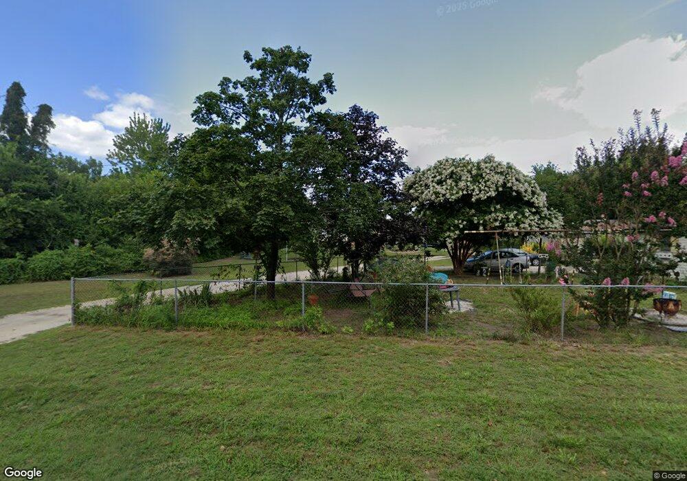
1033 Dragston Rd Port Norris, NJ 08349
Estimated Value: $163,000 - $258,000
--
Bed
--
Bath
936
Sq Ft
$205/Sq Ft
Est. Value
About This Home
This home is located at 1033 Dragston Rd, Port Norris, NJ 08349 and is currently estimated at $192,086, approximately $205 per square foot. 1033 Dragston Rd is a home located in Cumberland County with nearby schools including Downe Township Elementary School.
Ownership History
Date
Name
Owned For
Owner Type
Purchase Details
Closed on
May 13, 2009
Sold by
Keen Gary W
Bought by
Keen Gary W and Keen Evalinda
Current Estimated Value
Home Financials for this Owner
Home Financials are based on the most recent Mortgage that was taken out on this home.
Original Mortgage
$144,434
Outstanding Balance
$91,355
Interest Rate
4.87%
Mortgage Type
Purchase Money Mortgage
Estimated Equity
$100,731
Purchase Details
Closed on
Jan 13, 2009
Sold by
Williams Ruth and Keen Edward
Bought by
Keen Gary W
Purchase Details
Closed on
Apr 21, 2008
Sold by
Keen Edward Lewis
Bought by
Keen Gary W
Create a Home Valuation Report for This Property
The Home Valuation Report is an in-depth analysis detailing your home's value as well as a comparison with similar homes in the area
Home Values in the Area
Average Home Value in this Area
Purchase History
| Date | Buyer | Sale Price | Title Company |
|---|---|---|---|
| Keen Gary W | -- | -- | |
| Keen Gary W | -- | -- | |
| Keen Gary W | -- | -- |
Source: Public Records
Mortgage History
| Date | Status | Borrower | Loan Amount |
|---|---|---|---|
| Open | Keen Gary W | $144,434 |
Source: Public Records
Tax History Compared to Growth
Tax History
| Year | Tax Paid | Tax Assessment Tax Assessment Total Assessment is a certain percentage of the fair market value that is determined by local assessors to be the total taxable value of land and additions on the property. | Land | Improvement |
|---|---|---|---|---|
| 2025 | $3,943 | $136,100 | $36,000 | $100,100 |
| 2024 | $3,943 | $136,100 | $36,000 | $100,100 |
| 2023 | $3,635 | $136,100 | $36,000 | $100,100 |
| 2022 | $3,533 | $136,100 | $36,000 | $100,100 |
| 2021 | $3,181 | $136,100 | $36,000 | $100,100 |
| 2020 | $3,294 | $136,100 | $36,000 | $100,100 |
| 2019 | $3,245 | $136,100 | $36,000 | $100,100 |
| 2018 | $3,299 | $136,100 | $36,000 | $100,100 |
| 2017 | $3,172 | $136,100 | $36,000 | $100,100 |
| 2016 | $3,175 | $136,100 | $36,000 | $100,100 |
| 2015 | $2,993 | $136,100 | $36,000 | $100,100 |
| 2014 | $2,779 | $136,100 | $36,000 | $100,100 |
Source: Public Records
Map
Nearby Homes
- 1029 Dragston Rd
- 1062 Hanseys Creek Rd
- 1073 Dragston Rd
- 938 Union St
- 914 Main St
- 912 Main St
- 898 Main St
- 467 Hickman Ave Unit 469
- 1802 Strawberry Ave
- 0 James Moore Rd Unit 603001
- 0 James Moore Rd Unit NJCB2027772
- 2529 Milbourne Dr
- 554 Old Beaver Dam Rd
- 6216 Brown St
- 0 Relm Ave Unit NJCB2022890
- 0 Keln Ave Unit NJCB2022904
- 2311 Church St
- 6502 Yock Wock Rd
- 2600 Church St
- 6303 Walnut St
- 1035 Dragston Rd
- 1027 Dragston Rd
- 1031 Main St
- 1039 Dragston Rd
- 1041 Dragston Rd
- 1045 Dragston Rd
- 1050 Dragston Rd
- 1051 Dragston Rd
- 1054 Dragston Rd
- 1051 Main St
- 1053 Main St
- 1060 Dragston Rd
- 1057 Dragston Rd
- 1052 Main St
- 1002 Main St
- 1055 Main St
- 1062 Hansey Creek Rd
- 1059 Main St
- 1064 Dragston Rd
- 996 Main St
