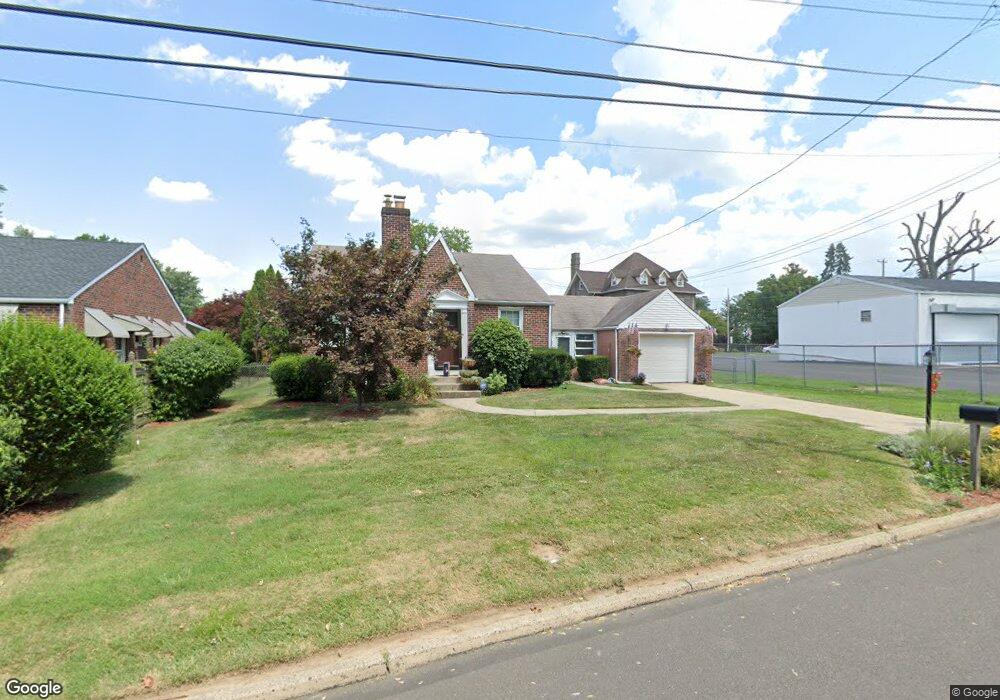
1033 Emerson Ln Bensalem, PA 19020
Estimated Value: $353,157 - $403,000
2
Beds
1
Bath
1,098
Sq Ft
$345/Sq Ft
Est. Value
About This Home
This home is located at 1033 Emerson Ln, Bensalem, PA 19020 and is currently estimated at $378,289, approximately $344 per square foot. 1033 Emerson Ln is a home located in Bucks County with nearby schools including Robert K. Shafer Middle School, School Lane Charter School, and St Charles Borromeo School.
Ownership History
Date
Name
Owned For
Owner Type
Purchase Details
Closed on
Aug 15, 2012
Sold by
Rothwell Susan T
Bought by
Siemion Patricia and Siemion William E
Current Estimated Value
Home Financials for this Owner
Home Financials are based on the most recent Mortgage that was taken out on this home.
Original Mortgage
$184,400
Outstanding Balance
$127,744
Interest Rate
3.67%
Mortgage Type
New Conventional
Estimated Equity
$250,545
Purchase Details
Closed on
Mar 7, 1973
Bought by
Fricker Albert E and Fricker Eleanor M
Create a Home Valuation Report for This Property
The Home Valuation Report is an in-depth analysis detailing your home's value as well as a comparison with similar homes in the area
Home Values in the Area
Average Home Value in this Area
Purchase History
| Date | Buyer | Sale Price | Title Company |
|---|---|---|---|
| Siemion Patricia | $209,000 | None Available | |
| Fricker Albert E | -- | -- |
Source: Public Records
Mortgage History
| Date | Status | Borrower | Loan Amount |
|---|---|---|---|
| Open | Siemion Patricia | $184,400 |
Source: Public Records
Tax History Compared to Growth
Tax History
| Year | Tax Paid | Tax Assessment Tax Assessment Total Assessment is a certain percentage of the fair market value that is determined by local assessors to be the total taxable value of land and additions on the property. | Land | Improvement |
|---|---|---|---|---|
| 2025 | $3,755 | $17,200 | $3,640 | $13,560 |
| 2024 | $3,755 | $17,200 | $3,640 | $13,560 |
| 2023 | $3,649 | $17,200 | $3,640 | $13,560 |
| 2022 | $3,627 | $17,200 | $3,640 | $13,560 |
| 2021 | $3,627 | $17,200 | $3,640 | $13,560 |
| 2020 | $3,591 | $17,200 | $3,640 | $13,560 |
| 2019 | $3,511 | $17,200 | $3,640 | $13,560 |
| 2018 | $3,430 | $17,200 | $3,640 | $13,560 |
| 2017 | $3,408 | $17,200 | $3,640 | $13,560 |
| 2016 | $3,408 | $17,200 | $3,640 | $13,560 |
| 2015 | -- | $17,200 | $3,640 | $13,560 |
| 2014 | -- | $17,200 | $3,640 | $13,560 |
Source: Public Records
Map
Nearby Homes
- 1126 Evelyn Ave
- 1202 Clinton Ave
- 1080 Buttonwood Ave
- 1039 Clinton Ave
- 1236 Whittier Ave
- 4161 Orchard Ln
- 827 Mitchell Ave
- 1103 Colonial Ave
- 124 Meadow Ln
- 4471 Ernie Davis Cir
- 227 Dimarco Dr
- 4374 Deerpath Ln
- 102 Village Ln
- 1155 Regina Ave
- 4274 Lawnside Rd
- 3727 Pitt Place
- 4208 Greenmount Rd
- 1742 Paradise Ln
- 4207 Fairdale Rd
- 3750 00 Clarendon Unit 221
- 1041 Emerson Ln
- 1060 Elwood Ave
- 1047 Emerson Ln
- 1053 Emerson Ln
- 1061 Emerson Ln
- 1034 Lowell Ave
- 1030 Emerson Ln
- 1067 Emerson Ln
- 1188 Bristol Pike
- 1116 Bristol Pike
- 1046 Lowell Ave
- 1075 Emerson Ln
- 1155 Bristol Pike
- 1167 Bristol Pike
- 1184 Camac St
- 1181 Bristol Pike
- 1081 Emerson Ln
- 1056 Lowell Ave
- 1106 Bristol Pike Unit SF
- 1106 Bristol Pike Unit SF R