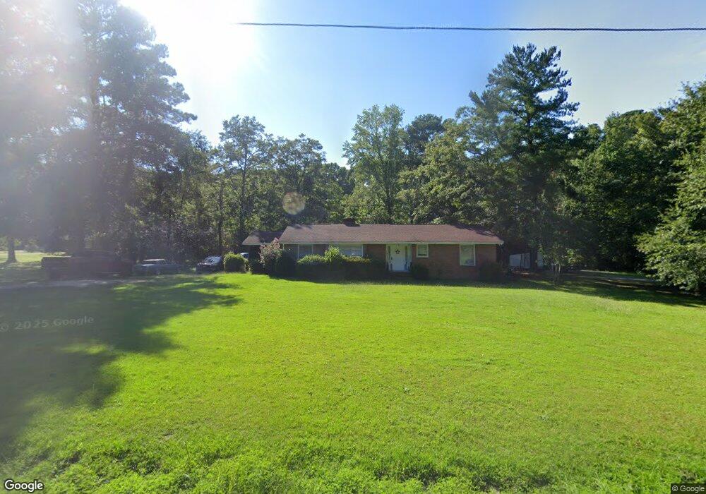
1033 Hook Ave West Columbia, SC 29169
Estimated Value: $138,000 - $248,000
2
Beds
2
Baths
1,679
Sq Ft
$120/Sq Ft
Est. Value
About This Home
This home is located at 1033 Hook Ave, West Columbia, SC 29169 and is currently estimated at $201,186, approximately $119 per square foot. 1033 Hook Ave is a home located in Lexington County with nearby schools including Riverbank Elementary, Northside Middle, and Brookland-Cayce High School.
Ownership History
Date
Name
Owned For
Owner Type
Purchase Details
Closed on
Oct 8, 2019
Sold by
Hook Gary Martin and The Gray Martin Hook Revocable
Bought by
Haworth Bryan Talmadge
Current Estimated Value
Purchase Details
Closed on
Jul 18, 2018
Sold by
Hook Gary Martin
Bought by
Hook Gary Martin and The Gary Martin Hook Revocable
Purchase Details
Closed on
Oct 11, 2012
Sold by
Hook Gary Martin and Liles Sherelyn Kay
Bought by
Hook Gary Martin and Liles Sherelyn Kay
Purchase Details
Closed on
May 8, 2007
Sold by
Hook James B and Hook Willeen H
Bought by
Hook James B and Hook Willeen H
Create a Home Valuation Report for This Property
The Home Valuation Report is an in-depth analysis detailing your home's value as well as a comparison with similar homes in the area
Home Values in the Area
Average Home Value in this Area
Purchase History
| Date | Buyer | Sale Price | Title Company |
|---|---|---|---|
| Haworth Bryan Talmadge | $81,500 | None Available | |
| Hook Gary Martin | -- | None Available | |
| Hook Gary Martin | -- | -- | |
| Hook Gary Martin | -- | -- | |
| Hook Gary Martin | -- | -- | |
| Hook James B | -- | None Available |
Source: Public Records
Tax History Compared to Growth
Tax History
| Year | Tax Paid | Tax Assessment Tax Assessment Total Assessment is a certain percentage of the fair market value that is determined by local assessors to be the total taxable value of land and additions on the property. | Land | Improvement |
|---|---|---|---|---|
| 2024 | $2,768 | $7,010 | $780 | $6,230 |
| 2023 | $2,768 | $7,010 | $780 | $6,230 |
| 2022 | $2,621 | $7,010 | $780 | $6,230 |
| 2020 | $865 | $4,673 | $520 | $4,153 |
| 2019 | $2,507 | $6,997 | $780 | $6,217 |
| 2018 | $2,944 | $8,287 | $2,070 | $6,217 |
| 2017 | $2,889 | $8,287 | $2,070 | $6,217 |
| 2016 | $2,923 | $8,286 | $2,070 | $6,216 |
| 2014 | $2,540 | $8,287 | $2,484 | $5,803 |
| 2013 | -- | $8,290 | $2,480 | $5,810 |
Source: Public Records
Map
Nearby Homes
- 0 Sunset Blvd Unit 553428
- 328 Brookland Way
- 206 New Brookland Place Unit 206
- 402 New Brookland Place
- 500 Finnegan Ln
- 623 Hook Ave
- 0 Platt Springs Rd Unit 606355
- 292 Marabou Cir
- 1005 Crestwater Ct
- 110 Sabal Dr
- 1025 Carrolton St
- 111 Double Branch Ct
- 161 Weeping Oak Ln
- 108 Double Branch Ct
- 629 Spanish Oak Dr
- 2004 Dew Ave
- 913 Harper Rose Ct
- 700 Blackjack Ct
- 108 Harvest Glen Ln
- 144 Wainscot Oak Ln
- 1025 Hook Ave
- 2201 Sunset Blvd
- 1023 Hook Ave
- 1021 Hook Ave
- 0 Sunset Blvd Unit 454888
- 0 Sunset Blvd Unit 364317
- 0 Sunset Blvd Unit 433447
- 0 Sunset Blvd Unit 561829
- 0 Sunset Blvd Unit 541887
- 0 Sunset Blvd Unit 537514
- 0 Sunset Blvd Unit 530540
- 0 Sunset Blvd Unit 478995
- 0 Sunset Blvd Unit 478938
- 1019 Hook Ave
- 2225 Sunset Blvd
- 2136 Sunset Blvd
- 1002 Hook Ave
- 2119 Sunset Blvd
- 914 Hook Ave
- 901 New Brookland Place