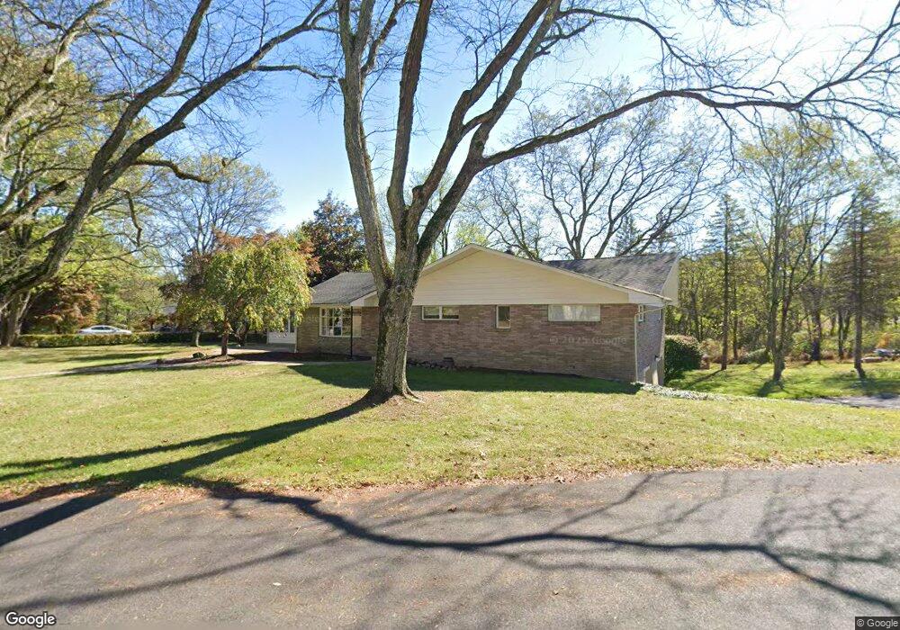
1033 Locust Ln Stroudsburg, PA 18360
Estimated Value: $354,000 - $482,000
4
Beds
3
Baths
2,886
Sq Ft
$145/Sq Ft
Est. Value
About This Home
This home is located at 1033 Locust Ln, Stroudsburg, PA 18360 and is currently estimated at $418,043, approximately $144 per square foot. 1033 Locust Ln is a home located in Monroe County with nearby schools including Stroudsburg Junior High School, Stroudsburg High School, and Stroudsburg Seventh-day Adventist School.
Ownership History
Date
Name
Owned For
Owner Type
Purchase Details
Closed on
Dec 19, 2017
Sold by
Abbruzzese John A
Bought by
Taylor John David
Current Estimated Value
Home Financials for this Owner
Home Financials are based on the most recent Mortgage that was taken out on this home.
Original Mortgage
$112,000
Outstanding Balance
$94,197
Interest Rate
3.9%
Mortgage Type
New Conventional
Estimated Equity
$323,846
Purchase Details
Closed on
Oct 11, 2006
Sold by
Abbruzzese John A and Abbruzzese Jean
Bought by
Abbruzzese John A and Abbruzzese John A
Create a Home Valuation Report for This Property
The Home Valuation Report is an in-depth analysis detailing your home's value as well as a comparison with similar homes in the area
Home Values in the Area
Average Home Value in this Area
Purchase History
| Date | Buyer | Sale Price | Title Company |
|---|---|---|---|
| Taylor John David | $140,000 | Pocono Property Abstract | |
| Abbruzzese John A | -- | None Available |
Source: Public Records
Mortgage History
| Date | Status | Borrower | Loan Amount |
|---|---|---|---|
| Open | Taylor John David | $112,000 |
Source: Public Records
Tax History Compared to Growth
Tax History
| Year | Tax Paid | Tax Assessment Tax Assessment Total Assessment is a certain percentage of the fair market value that is determined by local assessors to be the total taxable value of land and additions on the property. | Land | Improvement |
|---|---|---|---|---|
| 2025 | $1,814 | $220,070 | $32,200 | $187,870 |
| 2024 | $1,484 | $220,070 | $32,200 | $187,870 |
| 2023 | $7,346 | $220,070 | $32,200 | $187,870 |
| 2022 | $7,501 | $220,070 | $32,200 | $187,870 |
| 2021 | $7,270 | $220,070 | $32,200 | $187,870 |
| 2020 | $7,171 | $220,070 | $32,200 | $187,870 |
| 2019 | $5,574 | $29,560 | $5,800 | $23,760 |
| 2018 | $5,946 | $29,560 | $5,800 | $23,760 |
| 2017 | $5,946 | $29,560 | $5,800 | $23,760 |
| 2016 | $1,119 | $29,560 | $5,800 | $23,760 |
| 2015 | -- | $29,560 | $5,800 | $23,760 |
| 2014 | -- | $29,560 | $5,800 | $23,760 |
Source: Public Records
Map
Nearby Homes
- 2204 Hallmark Dr
- 108 Holmgren Dr
- 0 Werkheiser Ln Unit 723191
- 0 Werkheiser Ln Unit PAMR2003624
- 0 Werkheiser Ln Unit PM-121046
- 314 White Stone Corner Rd
- 259 Tanite Rd
- 0 Marshall Dr
- 448 Bernadine Dr
- 916 Mt Zion Ave
- 127 Kirkwood Rd
- 810 Church St
- 2215 Sutton Dr
- 0 Eagle Drive (Bush) Ct
- 772 Mohawk Trail
- LOT Edgemont Rd
- 0 Seneca Way
- 6284 Cardinal Dr
- 120 Jane St
- 116 Ridgeview Rd
- 1031 Locust Ln
- 1036 Locust Ln
- 1030 Locust Ln
- 1040 Locust Ln
- 1807 Chipperfield Dr
- 1816 Chipperfield Dr
- 1810 Chipperfield Dr
- 1805 Chipperfield Dr
- 1803 Chipperfield Dr
- 1145 Crestview Dr
- 1145 Crestview Dr
- 931 Acker Rd
- 1709 Chipperfield Dr
- 1905 Chipperfield Dr
- 1143 Crestview Dr
- 1911 Chipperfield Dr
- 926 Acker Rd
- 919 Acker Rd
- 919 Acker Rd
- 1144 Crestview Dr