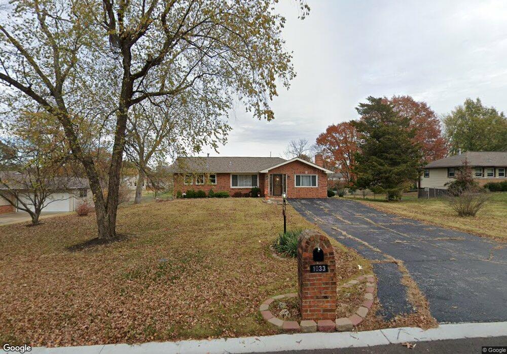
1033 Poplar Dr Saint Louis, MO 63125
Mehlville NeighborhoodEstimated Value: $258,197 - $323,000
3
Beds
1
Bath
1,625
Sq Ft
$175/Sq Ft
Est. Value
About This Home
This home is located at 1033 Poplar Dr, Saint Louis, MO 63125 and is currently estimated at $284,799, approximately $175 per square foot. 1033 Poplar Dr is a home located in St. Louis County with nearby schools including Beasley Elementary School, Margaret Buerkle Middle School, and Mehlville High School.
Ownership History
Date
Name
Owned For
Owner Type
Purchase Details
Closed on
Jun 17, 2015
Sold by
Trapp Anthony L
Bought by
Rogers Cathleen M
Current Estimated Value
Home Financials for this Owner
Home Financials are based on the most recent Mortgage that was taken out on this home.
Original Mortgage
$130,952
Outstanding Balance
$101,136
Interest Rate
3.75%
Mortgage Type
FHA
Estimated Equity
$183,663
Purchase Details
Closed on
Aug 7, 2001
Sold by
Trapp Wilbert A and Trapp Rita M
Bought by
Trapp Rita M and Trapp Anthony L
Create a Home Valuation Report for This Property
The Home Valuation Report is an in-depth analysis detailing your home's value as well as a comparison with similar homes in the area
Home Values in the Area
Average Home Value in this Area
Purchase History
| Date | Buyer | Sale Price | Title Company |
|---|---|---|---|
| Rogers Cathleen M | $143,000 | Us Title Main | |
| Trapp Rita M | -- | -- |
Source: Public Records
Mortgage History
| Date | Status | Borrower | Loan Amount |
|---|---|---|---|
| Open | Rogers Cathleen M | $130,952 |
Source: Public Records
Tax History Compared to Growth
Tax History
| Year | Tax Paid | Tax Assessment Tax Assessment Total Assessment is a certain percentage of the fair market value that is determined by local assessors to be the total taxable value of land and additions on the property. | Land | Improvement |
|---|---|---|---|---|
| 2025 | $2,707 | $47,560 | $18,580 | $28,980 |
| 2024 | $2,707 | $39,840 | $11,340 | $28,500 |
| 2023 | $2,707 | $39,840 | $11,340 | $28,500 |
| 2022 | $2,471 | $34,180 | $11,340 | $22,840 |
| 2021 | $2,193 | $34,180 | $11,340 | $22,840 |
| 2020 | $2,253 | $33,420 | $13,150 | $20,270 |
| 2019 | $2,247 | $33,420 | $13,150 | $20,270 |
| 2018 | $2,122 | $28,480 | $7,520 | $20,960 |
| 2017 | $2,119 | $28,480 | $7,520 | $20,960 |
| 2016 | $2,123 | $27,380 | $7,130 | $20,250 |
| 2015 | $1,990 | $27,380 | $7,130 | $20,250 |
| 2014 | -- | $25,330 | $3,570 | $21,760 |
Source: Public Records
Map
Nearby Homes
- 1104 Brookville Ct
- 904 Victory Dr
- 851 Poplar Dr
- 725 Buckley Rd
- 3724 Southern Manor Dr
- 3301 Avenue H
- 2959 Annunciation Dr
- 1 Berview Cir Unit B
- 35 Berview Cir Unit E
- 3808 Southern Manor Dr
- 4248 Kingbolt Blvd Unit D
- 9 Berview Cir Unit H
- 701 Chevron Dr
- 1141 Sunbolt Dr Unit C
- 2907 Hubert Dr
- 3700 Andora Place
- 4298 Chateau de Ville Dr Unit A
- 4061 Morningview Ct
- 1020 Mersey Bend Dr Unit 1D
- 1057 Mersey Bend Dr Unit C
- 1025 Poplar Dr
- 1041 Poplar Dr
- 1049 Poplar Dr
- 1017 Poplar Dr
- 1018 Victory Dr
- 1022 Victory Dr
- 1016 Victory Dr
- 1026 Victory Dr
- 1028 Poplar Dr
- 1036 Poplar Dr
- 1010 Victory Dr
- 1032UC Victory Dr
- 1057 Poplar Dr
- 1020 Poplar Dr
- 1044 Poplar Dr
- 935 Poplar Dr
- 1012 Poplar Dr
- 1006 Victory Dr
- 1052 Poplar Dr
- 1036 Victory Dr