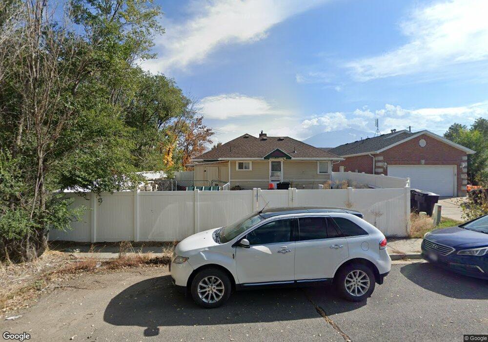
1033 S 530 W Payson, UT 84651
Estimated Value: $424,858 - $453,000
5
Beds
2
Baths
2,150
Sq Ft
$205/Sq Ft
Est. Value
About This Home
This home is located at 1033 S 530 W, Payson, UT 84651 and is currently estimated at $439,715, approximately $204 per square foot. 1033 S 530 W is a home located in Utah County with nearby schools including Wilson Elementary School, Payson Junior High School, and Payson High School.
Ownership History
Date
Name
Owned For
Owner Type
Purchase Details
Closed on
Feb 7, 2022
Sold by
Adams Jerry R and Adams Diane M
Bought by
Jerry R And Diane M Adams Revocable Family Tr
Current Estimated Value
Purchase Details
Closed on
Feb 22, 2019
Sold by
Adams Jerry R and Adams Diane M
Bought by
Adams Jerry R and Adams Diane M
Home Financials for this Owner
Home Financials are based on the most recent Mortgage that was taken out on this home.
Original Mortgage
$194,100
Interest Rate
4.4%
Mortgage Type
New Conventional
Purchase Details
Closed on
Sep 10, 2013
Sold by
Godbold Jonathan and Godbold Kelley Jo
Bought by
Adams Jerry R and Adams Diane M
Home Financials for this Owner
Home Financials are based on the most recent Mortgage that was taken out on this home.
Original Mortgage
$168,392
Interest Rate
4.25%
Mortgage Type
FHA
Purchase Details
Closed on
Feb 20, 2007
Sold by
Godbold Jonathon
Bought by
Godbold Jonathon and Godbold Kelley Jo
Home Financials for this Owner
Home Financials are based on the most recent Mortgage that was taken out on this home.
Original Mortgage
$9,806
Interest Rate
6.23%
Mortgage Type
Stand Alone Second
Purchase Details
Closed on
Apr 29, 2002
Sold by
Peterson Todd M and Peterson Shelly A
Bought by
Erb Christopher
Home Financials for this Owner
Home Financials are based on the most recent Mortgage that was taken out on this home.
Original Mortgage
$122,900
Interest Rate
7.13%
Purchase Details
Closed on
Apr 19, 1999
Sold by
Bucksin Land & Livestock Llc
Bought by
Peterson Todd M and Peterson Shelly A
Home Financials for this Owner
Home Financials are based on the most recent Mortgage that was taken out on this home.
Original Mortgage
$112,700
Interest Rate
7.1%
Create a Home Valuation Report for This Property
The Home Valuation Report is an in-depth analysis detailing your home's value as well as a comparison with similar homes in the area
Home Values in the Area
Average Home Value in this Area
Purchase History
| Date | Buyer | Sale Price | Title Company |
|---|---|---|---|
| Jerry R And Diane M Adams Revocable Family Tr | -- | None Listed On Document | |
| Adams Jerry R | -- | Us Title Insurance Agency | |
| Adams Jerry R | -- | Bartlett Title Insurance Age | |
| Godbold Jonathon | -- | Bartlett Title Insurance Ag | |
| Godbold Jonathon | -- | Wasatch Land & Title | |
| Erb Christopher | -- | First American Title Co | |
| Peterson Todd M | -- | First American Title Co |
Source: Public Records
Mortgage History
| Date | Status | Borrower | Loan Amount |
|---|---|---|---|
| Previous Owner | Adams Jerry R | $194,100 | |
| Previous Owner | Adams Jerry R | $168,392 | |
| Previous Owner | Godbold Jonathon | $9,806 | |
| Previous Owner | Godbold Jonathon | $163,435 | |
| Previous Owner | Erb Christopher | $122,900 | |
| Previous Owner | Peterson Todd M | $112,700 |
Source: Public Records
Tax History Compared to Growth
Tax History
| Year | Tax Paid | Tax Assessment Tax Assessment Total Assessment is a certain percentage of the fair market value that is determined by local assessors to be the total taxable value of land and additions on the property. | Land | Improvement |
|---|---|---|---|---|
| 2025 | $1,541 | $187,935 | $142,100 | $199,600 |
| 2024 | $1,541 | $156,805 | $0 | $0 |
| 2023 | $1,485 | $151,525 | $0 | $0 |
| 2022 | $1,416 | $142,120 | $0 | $0 |
| 2021 | $1,181 | $190,100 | $93,300 | $96,800 |
| 2020 | $1,090 | $171,700 | $81,100 | $90,600 |
| 2019 | $1,044 | $168,500 | $81,100 | $87,400 |
| 2018 | $966 | $150,300 | $62,900 | $87,400 |
| 2017 | $958 | $80,190 | $0 | $0 |
| 2016 | $872 | $72,490 | $0 | $0 |
| 2015 | $843 | $69,630 | $0 | $0 |
| 2014 | -- | $69,630 | $0 | $0 |
Source: Public Records
Map
Nearby Homes
- 1087 S 680 W
- 1161 Utah 198
- 1163 S 730 W
- 1172 S 880 W
- 513 W 600 S
- 588 W 1450 S
- 626 S 800 W Unit 32
- 610 S 800 W Unit 30
- 533 S 700 W
- 802 Brookside Ct
- 1408 S 30 E
- 1287 S 1080 W
- 288 E 950 S
- 1128 W 1150 S Unit 9
- 528 S 800 W
- 1872 100 E Unit 6
- 1216 S 1150 W Unit 19
- 1192 W 1130 St S Unit 202
- 598 W Saddlebrook Dr
- 1002 W Temple Rim Ln