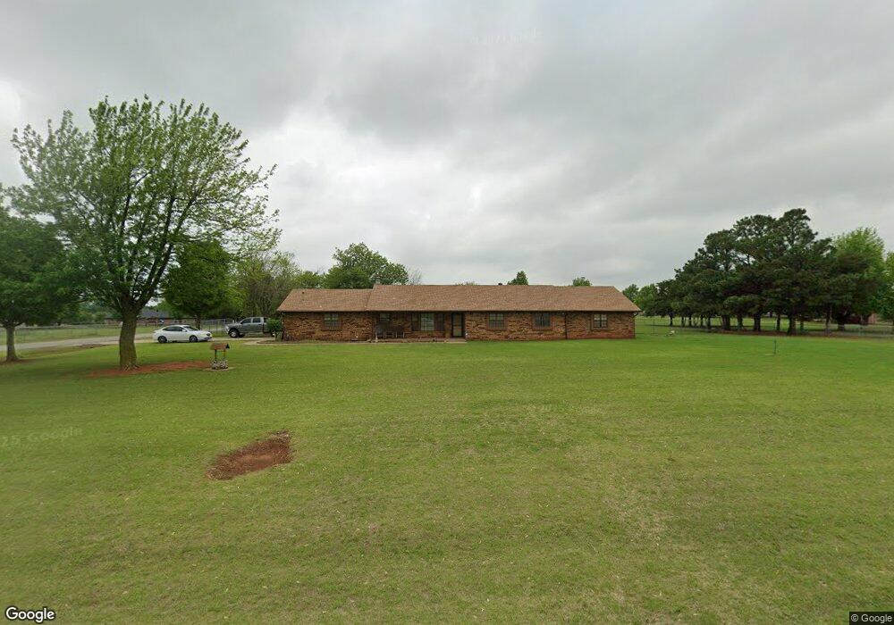
1033 S Chuckwagon Dr Mustang, OK 73064
Estimated Value: $330,625 - $450,000
3
Beds
2
Baths
2,465
Sq Ft
$149/Sq Ft
Est. Value
About This Home
This home is located at 1033 S Chuckwagon Dr, Mustang, OK 73064 and is currently estimated at $366,656, approximately $148 per square foot. 1033 S Chuckwagon Dr is a home located in Canadian County with nearby schools including Mustang Centennial Elementary School, Mustang Horizon Intermediate School, and Mustang Middle School.
Ownership History
Date
Name
Owned For
Owner Type
Purchase Details
Closed on
Sep 8, 2005
Sold by
Weidner Vaughncille
Bought by
Carroll Michael and Carroll Carrie R
Current Estimated Value
Home Financials for this Owner
Home Financials are based on the most recent Mortgage that was taken out on this home.
Original Mortgage
$179,900
Outstanding Balance
$95,823
Interest Rate
5.78%
Estimated Equity
$270,833
Purchase Details
Closed on
Oct 26, 2004
Sold by
Weidner Alan and Weidner Denise
Purchase Details
Closed on
Oct 4, 2004
Sold by
Weidner Alfred Jr~
Create a Home Valuation Report for This Property
The Home Valuation Report is an in-depth analysis detailing your home's value as well as a comparison with similar homes in the area
Home Values in the Area
Average Home Value in this Area
Purchase History
| Date | Buyer | Sale Price | Title Company |
|---|---|---|---|
| Carroll Michael | $135,000 | None Available | |
| -- | -- | -- | |
| -- | -- | -- |
Source: Public Records
Mortgage History
| Date | Status | Borrower | Loan Amount |
|---|---|---|---|
| Open | Carroll Michael | $179,900 |
Source: Public Records
Tax History Compared to Growth
Tax History
| Year | Tax Paid | Tax Assessment Tax Assessment Total Assessment is a certain percentage of the fair market value that is determined by local assessors to be the total taxable value of land and additions on the property. | Land | Improvement |
|---|---|---|---|---|
| 2024 | $2,368 | $25,480 | $6,000 | $19,480 |
| 2023 | $2,368 | $24,738 | $6,000 | $18,738 |
| 2022 | $2,324 | $24,018 | $6,000 | $18,018 |
| 2021 | $2,303 | $23,718 | $6,000 | $17,718 |
| 2020 | $2,342 | $23,956 | $6,000 | $17,956 |
| 2019 | $2,291 | $23,454 | $6,000 | $17,454 |
| 2018 | $1,994 | $20,127 | $6,000 | $14,127 |
| 2017 | $1,989 | $20,305 | $6,000 | $14,305 |
| 2016 | $1,953 | $20,074 | $6,000 | $14,074 |
| 2015 | $1,991 | $19,338 | $6,000 | $13,338 |
| 2014 | $1,991 | $20,177 | $3,000 | $17,177 |
Source: Public Records
Map
Nearby Homes
- 10009 SW 39th St
- 10013 SW 39th St
- 1405 S Dean Dr
- 1315 S Grace Dr
- 525 W Ava Dr
- 1302 S Silver Dr
- 850 W Forest Dr
- 844 W Forest Dr
- 632 W Carson Dr
- 12100 SW 36th St
- 520 S Owen Dr
- 635 W Hillcrest Dr
- 613 W Greenwood Ct
- 12116 36th St
- 12112 36th St
- 12108 36th St
- 12104 36th St
- 425 W Linden Dr
- 1035 W Windsor Way
- 313 N Shannon Way
- 10009 39th St
- 10013 39th St
- 1001 S Chuckwagon Dr
- 12001 SW 50th St
- 12105 SW 50th St
- 12012 SW 50th St
- 12128 SW 50th St
- 12008 SW 50th St
- 12004 SW 50th St
- 12120 SW 50th St
- 12124 SW 50th St
- 12013 SW 50th St
- 12129 SW 50th St
- 12133 SW 50th St
- 12125 SW 50th St
- 12009 SW 50th St
- 12005 SW 50th St
- 12121 SW 50th St
- 12017 SW 50th St
- 12112 SW 50th St