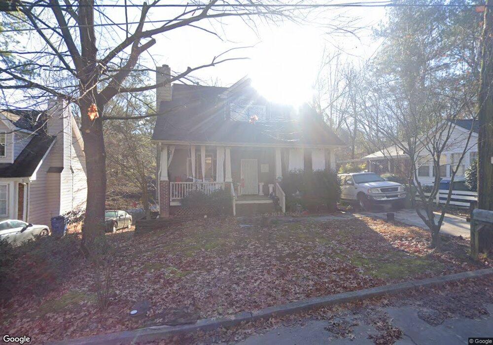
1033 Sims Ave NW Atlanta, GA 30318
Grove Park NeighborhoodEstimated Value: $291,134 - $379,000
3
Beds
3
Baths
1,838
Sq Ft
$183/Sq Ft
Est. Value
About This Home
This home is located at 1033 Sims Ave NW, Atlanta, GA 30318 and is currently estimated at $335,534, approximately $182 per square foot. 1033 Sims Ave NW is a home located in Fulton County with nearby schools including Frederick Douglass High School, Westside Atlanta Charter School, and KIPP Atlanta Collegiate.
Ownership History
Date
Name
Owned For
Owner Type
Purchase Details
Closed on
Jul 28, 2003
Sold by
R/M Const/Remodeling Inc
Bought by
England Jared
Current Estimated Value
Home Financials for this Owner
Home Financials are based on the most recent Mortgage that was taken out on this home.
Original Mortgage
$168,353
Outstanding Balance
$72,081
Interest Rate
5.24%
Mortgage Type
FHA
Estimated Equity
$263,453
Purchase Details
Closed on
Aug 29, 2002
Sold by
Freeman Shirley A
Bought by
R & M Construction & Remodeling In
Create a Home Valuation Report for This Property
The Home Valuation Report is an in-depth analysis detailing your home's value as well as a comparison with similar homes in the area
Home Values in the Area
Average Home Value in this Area
Purchase History
| Date | Buyer | Sale Price | Title Company |
|---|---|---|---|
| England Jared | $170,000 | -- | |
| R & M Construction & Remodeling In | $10,700 | -- |
Source: Public Records
Mortgage History
| Date | Status | Borrower | Loan Amount |
|---|---|---|---|
| Open | England Jared | $168,353 |
Source: Public Records
Tax History Compared to Growth
Tax History
| Year | Tax Paid | Tax Assessment Tax Assessment Total Assessment is a certain percentage of the fair market value that is determined by local assessors to be the total taxable value of land and additions on the property. | Land | Improvement |
|---|---|---|---|---|
| 2025 | $1,703 | $133,240 | $34,320 | $98,920 |
| 2023 | $1,703 | $105,080 | $49,400 | $55,680 |
| 2022 | $1,894 | $105,080 | $49,400 | $55,680 |
| 2021 | $1,951 | $106,760 | $52,120 | $54,640 |
| 2020 | $1,627 | $91,840 | $26,120 | $65,720 |
| 2019 | $485 | $44,440 | $16,560 | $27,880 |
| 2018 | $48 | $22,760 | $4,200 | $18,560 |
| 2017 | $35 | $20,080 | $3,840 | $16,240 |
| 2016 | $35 | $20,080 | $3,840 | $16,240 |
| 2015 | $506 | $20,080 | $3,840 | $16,240 |
| 2014 | $30 | $18,080 | $7,400 | $10,680 |
Source: Public Records
Map
Nearby Homes
- 1039 Margaret Place NW
- 923 N Eugenia Place NW
- 1886 Charles Place NW
- 30 Johnson Rd NW
- 75 Johnson Rd NW
- 0 Newman Place NW Unit 7480374
- 1974 Lois Place NW
- 37 Johnson Rd NW
- 25 Johnson Rd NW
- 1981 Lois Place NW
- 856 Margaret Place NW
- 15 Johnson Rd NW
- 1985 Lois Place NW
- 2015 Lois Place NW
- 0 Cato St NW Unit 7588989
- 888 Hollywood Rd NW
- 965 Cato St NW
- 1987 Ruth St NW
- 1055 Johnson Grove
- 1037 Sims Ave NW
- 1027 Sims Ave NW
- 1025 Sims Ave NW
- 1043 Sims Ave NW
- 1016 Sims Ave NW
- 1036 Sims Ave NW
- 1032 Sims Ave NW
- 1015 Sims Ave NW
- 1026 Sims Ave NW Unit B
- 1026 Sims Ave NW Unit A
- 1026 Sims Ave NW Unit A
- 1020 Sims Ave NW Unit B
- 1020 Sims Ave NW
- 1042 Sims Ave NW
- 1013 Sims Ave NW
- 1006 Sims Ave NW
- 995 N Eugenia Place NW
- 974 N Eugenia Place NW
- 74 Johnson Rd NW
- 72 Johnson Rd NW