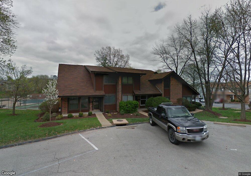
1033 Tavistock Cir Saint Louis, MO 63129
Mehlville NeighborhoodEstimated Value: $176,203 - $190,000
3
Beds
2
Baths
1,116
Sq Ft
$163/Sq Ft
Est. Value
About This Home
This home is located at 1033 Tavistock Cir, Saint Louis, MO 63129 and is currently estimated at $182,301, approximately $163 per square foot. 1033 Tavistock Cir is a home located in St. Louis County with nearby schools including Blades Elementary School, Bernard Middle School, and Oakville Senior High School.
Ownership History
Date
Name
Owned For
Owner Type
Purchase Details
Closed on
Jan 2, 2020
Sold by
Gateway North Redevelopment Group Llc
Bought by
Denic Halid and Denic Draguna
Current Estimated Value
Home Financials for this Owner
Home Financials are based on the most recent Mortgage that was taken out on this home.
Original Mortgage
$119,250
Outstanding Balance
$105,362
Interest Rate
3.6%
Mortgage Type
New Conventional
Estimated Equity
$76,939
Purchase Details
Closed on
May 8, 2012
Sold by
Rea John P
Bought by
Gateway North Redevelopment Group Llc
Create a Home Valuation Report for This Property
The Home Valuation Report is an in-depth analysis detailing your home's value as well as a comparison with similar homes in the area
Home Values in the Area
Average Home Value in this Area
Purchase History
| Date | Buyer | Sale Price | Title Company |
|---|---|---|---|
| Denic Halid | $133,500 | Investors Title Co Clayton | |
| Gateway North Redevelopment Group Llc | $20,000 | None Available |
Source: Public Records
Mortgage History
| Date | Status | Borrower | Loan Amount |
|---|---|---|---|
| Open | Denic Halid | $119,250 |
Source: Public Records
Tax History Compared to Growth
Tax History
| Year | Tax Paid | Tax Assessment Tax Assessment Total Assessment is a certain percentage of the fair market value that is determined by local assessors to be the total taxable value of land and additions on the property. | Land | Improvement |
|---|---|---|---|---|
| 2025 | $1,736 | $28,950 | $6,990 | $21,960 |
| 2024 | $1,736 | $25,610 | $3,400 | $22,210 |
| 2023 | $1,714 | $25,610 | $3,400 | $22,210 |
| 2022 | $1,388 | $20,770 | $5,300 | $15,470 |
| 2021 | $1,343 | $20,770 | $5,300 | $15,470 |
| 2020 | $1,290 | $18,950 | $4,240 | $14,710 |
| 2019 | $1,286 | $18,950 | $4,240 | $14,710 |
| 2018 | $1,215 | $16,150 | $2,220 | $13,930 |
| 2017 | $1,214 | $16,150 | $2,220 | $13,930 |
| 2016 | $1,091 | $13,890 | $2,960 | $10,930 |
| 2015 | $1,003 | $13,890 | $2,960 | $10,930 |
| 2014 | $1,017 | $14,350 | $4,070 | $10,280 |
Source: Public Records
Map
Nearby Homes
- 4363 Tavistock Cir Unit 22C
- 4376 Tavistock Cir Unit 18D
- 1076 Humber Cir
- 1057 Mersey Bend Dr Unit C
- 1084 Mersey Bend Dr Unit F
- 4347 Chateau de Ville Dr Unit G
- 4374 Forest de Ville Dr Unit 32A
- 4353 Chateau de Ville Dr Unit D
- 4298 Chateau de Ville Dr Unit A
- 4343 Chateau de Ville Dr
- 9 Berview Cir Unit H
- 4248 Kingbolt Blvd Unit D
- 4300 Forder Gardens Place Unit G
- 1141 Sunbolt Dr Unit C
- 1207 Saltash Ct
- 4314 Forder Gardens Place Unit B
- 1 Berview Cir Unit B
- 4329 Forder Gardens Place Unit A
- 35 Berview Cir Unit E
- 4101 Forder Circle Dr
- 1035 Tavistock Cir Unit 25C
- 1031 Tavistock Cir Unit 25A
- 1041 Tavistock Cir
- 1043 Tavistock Cir
- 1019 Mersey Bend Dr
- 1015 Mersey Bend Dr
- 1021 Mersey Bend Dr Unit 5D
- 1049 Tavistock Cir Unit 24A
- 1017 Mersey Bend Dr Unit 5B
- 1003 Mersey Bend Dr
- 1047 Tavistock Cir
- 1040 Tavistock Cir Unit 22F
- 1044 Tavistock Cir
- 1005 Mersey Bend Dr Unit 4C
- 1001 Mersey Bend Dr
- 1007 Mersey Bend Dr Unit 4D
- 1046 Tavistock Cir
- 4360 Tavistock Cir
- 4357 Tavistock Cir
- 4365 Tavistock Cir