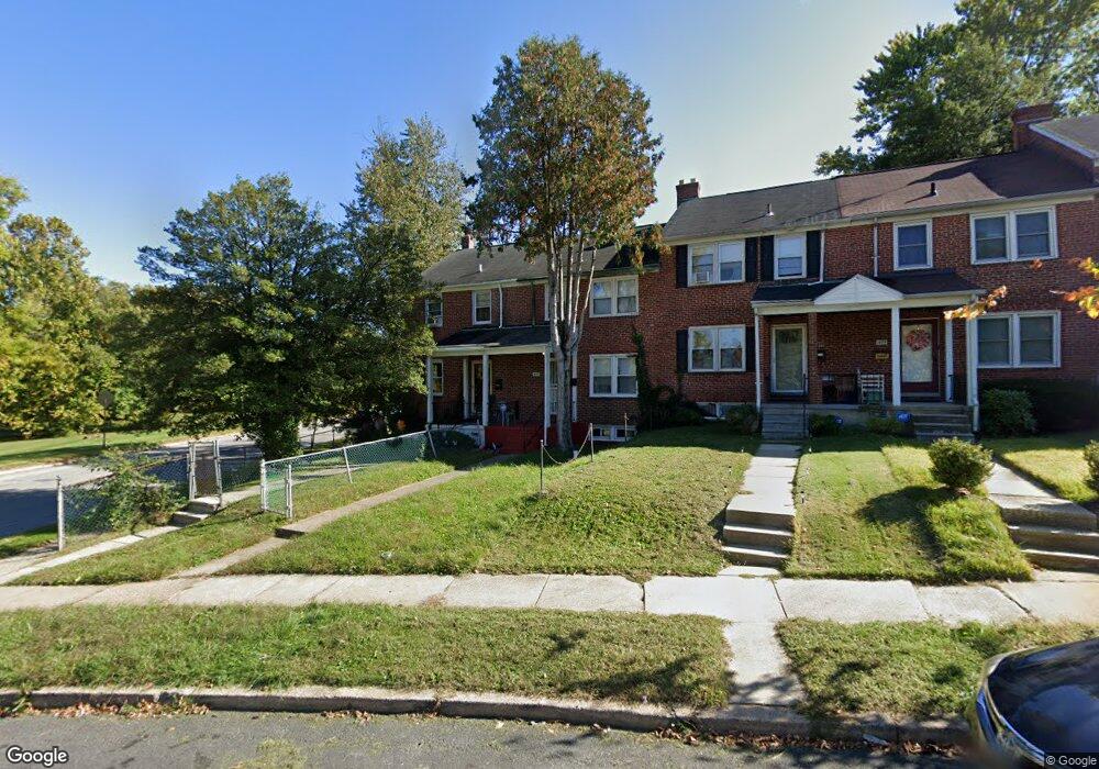
1033 Witherspoon Rd Baltimore, MD 21212
Cameron Village NeighborhoodEstimated Value: $179,350 - $183,000
Studio
2
Baths
1,008
Sq Ft
$180/Sq Ft
Est. Value
About This Home
This home is located at 1033 Witherspoon Rd, Baltimore, MD 21212 and is currently estimated at $181,175, approximately $179 per square foot. 1033 Witherspoon Rd is a home located in Baltimore City with nearby schools including Booker T. Washington Middle School, Reginald F. Lewis High School, and Paul Laurence Dunbar High School.
Ownership History
Date
Name
Owned For
Owner Type
Purchase Details
Closed on
Oct 5, 2017
Sold by
Brown Michelle W
Bought by
Bown Michelle W and Mcqueen Jerry
Current Estimated Value
Purchase Details
Closed on
Jul 10, 2001
Sold by
Secretary Of Housing & Urban
Bought by
Brown Michelle
Purchase Details
Closed on
Feb 22, 2001
Sold by
Brown Harold G
Bought by
Secretary Of Housing & Urban and Development , The
Purchase Details
Closed on
Jul 28, 1995
Sold by
Hall Tennessee Delmarvia G
Bought by
Brown Harold G
Home Financials for this Owner
Home Financials are based on the most recent Mortgage that was taken out on this home.
Original Mortgage
$59,950
Interest Rate
7.56%
Create a Home Valuation Report for This Property
The Home Valuation Report is an in-depth analysis detailing your home's value as well as a comparison with similar homes in the area
Home Values in the Area
Average Home Value in this Area
Purchase History
| Date | Buyer | Sale Price | Title Company |
|---|---|---|---|
| Bown Michelle W | -- | None Available | |
| Brown Michelle | $49,900 | -- | |
| Secretary Of Housing & Urban | $62,644 | -- | |
| Brown Harold G | $60,000 | -- |
Source: Public Records
Mortgage History
| Date | Status | Borrower | Loan Amount |
|---|---|---|---|
| Previous Owner | Brown Harold G | $59,950 |
Source: Public Records
Tax History
| Year | Tax Paid | Tax Assessment Tax Assessment Total Assessment is a certain percentage of the fair market value that is determined by local assessors to be the total taxable value of land and additions on the property. | Land | Improvement |
|---|---|---|---|---|
| 2025 | $2,230 | $116,133 | -- | -- |
| 2024 | $2,230 | $104,200 | $20,000 | $84,200 |
| 2023 | $2,163 | $101,633 | $0 | $0 |
| 2022 | $2,105 | $99,067 | $0 | $0 |
| 2021 | $2,277 | $96,500 | $20,000 | $76,500 |
| 2020 | $2,061 | $96,500 | $20,000 | $76,500 |
| 2019 | $1,990 | $96,500 | $20,000 | $76,500 |
| 2018 | $1,940 | $99,800 | $20,000 | $79,800 |
| 2017 | $1,881 | $93,267 | $0 | $0 |
| 2016 | $1,904 | $86,733 | $0 | $0 |
| 2015 | $1,904 | $80,200 | $0 | $0 |
| 2014 | $1,904 | $80,200 | $0 | $0 |
Source: Public Records
Map
Nearby Homes
- 1025 Witherspoon Rd
- 1014 Upnor Rd
- 1018 Cameron Rd
- 5638 Midwood Ave
- 1027 Evesham Ave
- 5516 Midwood Ave
- 830 Saint Dunstans Rd
- 1200 Woodbourne Ave
- 912 Evesham Ave
- 1101 Woodbourne Ave
- 5320 The Alameda
- 5701 The Alameda
- 5315 Midwood Ave
- 1231 Sheridan Ave
- 608 Harwood Ave
- 1033 Marlau Dr
- 1241 E Belvedere Ave
- 5302 Saint Georges Ave
- 853 Lenton Ave
- 810 E Belvedere Ave
- 1031 Witherspoon Rd
- 1035 Witherspoon Rd
- 1029 Witherspoon Rd
- 1027 Witherspoon Rd
- 1023 Witherspoon Rd
- 5616 Northwood Dr
- 5614 Northwood Dr
- 5612 Northwood Dr
- 1019 Witherspoon Rd
- 1032 Witherspoon Rd
- 5610 Northwood Dr
- 1030 Witherspoon Rd
- 1017 Witherspoon Rd
- 5608 Northwood Dr
- 1028 Witherspoon Rd
- 5606 Northwood Dr
- 1015 Witherspoon Rd
- 1026 Witherspoon Rd
- 1013 Witherspoon Rd
- 5604 Northwood Dr
Your Personal Tour Guide
Ask me questions while you tour the home.