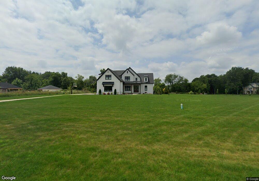
10330 Quail Lake Cir Doylestown, OH 44230
Estimated Value: $639,000 - $1,017,146
4
Beds
4
Baths
3,349
Sq Ft
$254/Sq Ft
Est. Value
About This Home
This home is located at 10330 Quail Lake Cir, Doylestown, OH 44230 and is currently estimated at $851,037, approximately $254 per square foot. 10330 Quail Lake Cir is a home located in Medina County with nearby schools including Franklin Elementary School, Wadsworth Middle School, and Central Intermediate School.
Ownership History
Date
Name
Owned For
Owner Type
Purchase Details
Closed on
Mar 18, 2019
Sold by
Bae Holdings Inc
Bought by
Gluck Michael D and Gluck Anna M
Current Estimated Value
Purchase Details
Closed on
Mar 5, 2004
Sold by
Eastern Sales Development Inc
Bought by
Bae Holdings Inc
Create a Home Valuation Report for This Property
The Home Valuation Report is an in-depth analysis detailing your home's value as well as a comparison with similar homes in the area
Home Values in the Area
Average Home Value in this Area
Purchase History
| Date | Buyer | Sale Price | Title Company |
|---|---|---|---|
| Gluck Michael D | $120,000 | None Available | |
| Bae Holdings Inc | $85,900 | Bond & Associates Title Agen |
Source: Public Records
Tax History Compared to Growth
Tax History
| Year | Tax Paid | Tax Assessment Tax Assessment Total Assessment is a certain percentage of the fair market value that is determined by local assessors to be the total taxable value of land and additions on the property. | Land | Improvement |
|---|---|---|---|---|
| 2024 | $12,930 | $296,760 | $44,630 | $252,130 |
| 2023 | $12,930 | $296,760 | $44,630 | $252,130 |
| 2022 | $12,991 | $296,760 | $44,630 | $252,130 |
| 2021 | $12,324 | $29,750 | $29,750 | $0 |
| 2020 | $1,443 | $29,750 | $29,750 | $0 |
| 2019 | $1,446 | $29,750 | $29,750 | $0 |
| 2018 | $1,533 | $29,590 | $29,590 | $0 |
| 2017 | $1,534 | $29,590 | $29,590 | $0 |
| 2016 | $1,565 | $29,590 | $29,590 | $0 |
| 2015 | $1,572 | $27,650 | $27,650 | $0 |
| 2014 | $1,538 | $27,650 | $27,650 | $0 |
| 2013 | $1,539 | $27,650 | $27,650 | $0 |
Source: Public Records
Map
Nearby Homes
- 678 Wall Rd
- 970 Eastern Rd
- 9900 Homestead Rd
- 1112 Wall Rd
- 785 Queens Gate Way
- V/L approx 67.56ac Gates St
- 15500 Freedom Dr
- 195 Johnson Rd
- 1014 Marissa Dr
- 500 W Clinton St
- 228 Country Meadow Ln
- 243 Chelley Ln
- 1008 Barn Swallow Cir
- 0 Akron Rd Unit 5123781
- 104 Homan Dr
- 77 Koehler Ave
- 340 Gates St
- V/L 1050 Melanie Ln
- VL 1067 Homan Dr
- 660 Oakcrest Dr
- 10313 Quail Lake Cir
- 10350 Quail Lake Cir
- 650 Madison Trail
- 10313 Quail Lakes
- 10333 Quail Lake Cir
- 10333 Quail Lake Cir
- 645 Madison Trail
- 625 Madison Trail
- 10353 Quail Lake Cir
- 670 Madison Trail
- 665 Madison Trail
- 605 Madison Trail
- 685 Madison Trail
- 10370 Quail Lake Cir
- 585 Madison Trail
- 705 S/L 34 Madison Trail
- 690 Madison Trail
- 690 Madison Trail
- 10363 Quail Lake Cir
- 565 Madison Trail