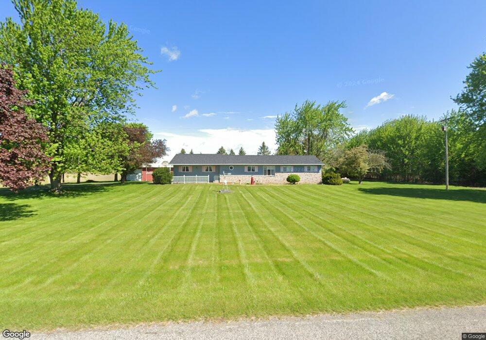
10330 W Burt Rd Saint Charles, MI 48655
Estimated Value: $210,000 - $253,000
3
Beds
2
Baths
1,456
Sq Ft
$161/Sq Ft
Est. Value
About This Home
This home is located at 10330 W Burt Rd, Saint Charles, MI 48655 and is currently estimated at $234,195, approximately $160 per square foot. 10330 W Burt Rd is a home located in Saginaw County with nearby schools including Big Rock Elementary School, Chesaning Middle School, and Chesaning Union High School.
Ownership History
Date
Name
Owned For
Owner Type
Purchase Details
Closed on
Jul 5, 2024
Sold by
Birchmeier Norbert W and Birchmeier Norbert W
Bought by
Dunham Todd R
Current Estimated Value
Home Financials for this Owner
Home Financials are based on the most recent Mortgage that was taken out on this home.
Original Mortgage
$195,183
Outstanding Balance
$192,870
Interest Rate
7.03%
Mortgage Type
New Conventional
Estimated Equity
$41,325
Purchase Details
Closed on
Jan 18, 1985
Sold by
Reid Larry E and Reid Ann M
Bought by
Birchmeier Norbert W and Birchmeier Joan M
Create a Home Valuation Report for This Property
The Home Valuation Report is an in-depth analysis detailing your home's value as well as a comparison with similar homes in the area
Home Values in the Area
Average Home Value in this Area
Purchase History
| Date | Buyer | Sale Price | Title Company |
|---|---|---|---|
| Dunham Todd R | $215,000 | None Listed On Document | |
| Birchmeier Norbert W | $58,000 | -- |
Source: Public Records
Mortgage History
| Date | Status | Borrower | Loan Amount |
|---|---|---|---|
| Open | Dunham Todd R | $195,183 |
Source: Public Records
Tax History Compared to Growth
Tax History
| Year | Tax Paid | Tax Assessment Tax Assessment Total Assessment is a certain percentage of the fair market value that is determined by local assessors to be the total taxable value of land and additions on the property. | Land | Improvement |
|---|---|---|---|---|
| 2025 | $2,410 | $92,500 | $0 | $0 |
| 2024 | $705 | $88,800 | $0 | $0 |
| 2023 | $672 | $78,700 | $0 | $0 |
| 2022 | $2,119 | $66,700 | $0 | $0 |
| 2021 | $1,896 | $62,900 | $0 | $0 |
| 2020 | $1,832 | $61,600 | $0 | $0 |
| 2019 | $1,788 | $61,600 | $0 | $0 |
| 2018 | $586 | $54,300 | $0 | $0 |
| 2017 | $1,606 | $54,600 | $0 | $0 |
| 2016 | $1,587 | $52,600 | $0 | $0 |
| 2014 | -- | $51,200 | $0 | $46,700 |
| 2013 | -- | $50,100 | $0 | $0 |
Source: Public Records
Map
Nearby Homes
- 12034 Carr Rd
- 14600 Corunna Rd
- 0 Arrowhead 1-A Dr Unit 50184284
- 0 Arrowhead 1-A Dr Unit 50184274
- 1017 N Line St
- V/L #4 Brookshire Dr
- V/L #5 Brookshire Dr
- 603 N Line St
- 0 N 4th St
- V/L W Liberty St
- 0 N 1st St
- 829 Brady St
- 300 Brady St
- 910 W Brady Rd
- 202 S Clark St
- 128 Pearl St
- 317 S Clark St
- 119 Andres St
- 423 S Line St
- 631 Center St
- 12952 Sharon Rd
- 12952 Sharon Rd
- 10554 W Burt Rd
- 12888 Sharon Rd
- 13104 Sharon Rd
- 12774 Sharon Rd
- 13300 Sharon Rd
- 13327 Sharon Rd
- 13380 Sharon Rd
- 13395 Sharon Rd
- 12701 McKeighan Rd
- 0 W Burt Unit 30065444
- 0 W Burt Unit G31315348
- 0 W Burt Unit G21274052
- 0 W Burt Unit G50051884
- 0 W Burt
- 12745 McKeighan Rd
- 12530 Sharon Rd
- 12530 Sharon Rd
- 12750 McKeighan Rd