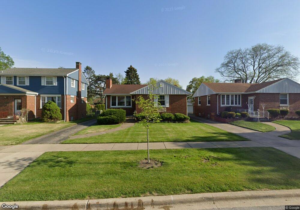
10331 Kent St Westchester, IL 60154
Estimated Value: $326,000 - $350,292
3
Beds
2
Baths
1,121
Sq Ft
$303/Sq Ft
Est. Value
About This Home
This home is located at 10331 Kent St, Westchester, IL 60154 and is currently estimated at $339,573, approximately $302 per square foot. 10331 Kent St is a home located in Cook County with nearby schools including Westchester Primary School, Westchester Intermediate School, and Westchester Middle School.
Ownership History
Date
Name
Owned For
Owner Type
Purchase Details
Closed on
Sep 16, 2003
Sold by
Gut Harriet
Bought by
Gut Harriet and The Harriet Gut Revocable Living Trust
Current Estimated Value
Purchase Details
Closed on
Apr 26, 2001
Sold by
Santore Benjamin P and Santore Nancy Sue
Bought by
Gut Harriet
Home Financials for this Owner
Home Financials are based on the most recent Mortgage that was taken out on this home.
Original Mortgage
$115,000
Outstanding Balance
$42,909
Interest Rate
7.02%
Estimated Equity
$296,664
Create a Home Valuation Report for This Property
The Home Valuation Report is an in-depth analysis detailing your home's value as well as a comparison with similar homes in the area
Home Values in the Area
Average Home Value in this Area
Purchase History
| Date | Buyer | Sale Price | Title Company |
|---|---|---|---|
| Gut Harriet | -- | -- | |
| Gut Harriet | $175,000 | Stewart Title |
Source: Public Records
Mortgage History
| Date | Status | Borrower | Loan Amount |
|---|---|---|---|
| Open | Gut Harriet | $115,000 |
Source: Public Records
Tax History Compared to Growth
Tax History
| Year | Tax Paid | Tax Assessment Tax Assessment Total Assessment is a certain percentage of the fair market value that is determined by local assessors to be the total taxable value of land and additions on the property. | Land | Improvement |
|---|---|---|---|---|
| 2024 | $3,227 | $25,538 | $4,620 | $20,918 |
| 2023 | $3,871 | $25,538 | $4,620 | $20,918 |
| 2022 | $3,871 | $21,325 | $3,960 | $17,365 |
| 2021 | $3,835 | $21,324 | $3,960 | $17,364 |
| 2020 | $4,541 | $21,324 | $3,960 | $17,364 |
| 2019 | $3,787 | $19,579 | $3,630 | $15,949 |
| 2018 | $4,501 | $19,579 | $3,630 | $15,949 |
| 2017 | $4,920 | $21,367 | $3,630 | $17,737 |
| 2016 | $4,092 | $16,528 | $3,300 | $13,228 |
| 2015 | $4,003 | $16,528 | $3,300 | $13,228 |
| 2014 | $4,285 | $17,805 | $3,300 | $14,505 |
| 2013 | $4,288 | $19,686 | $3,300 | $16,386 |
Source: Public Records
Map
Nearby Homes
- 10324 Wight St
- 1803 Balmoral Ave
- 1908 Belleview Ave
- 10567 Waterford Dr
- 1847 Newcastle Ave
- 10461 Dorchester St
- 10531 Camelot St
- 10524 Camelot St
- 1921 Buckingham Ave
- 1811 Downing Ave
- 1860 Buckingham Ave
- 1318 Balmoral Ave
- 1907 Suffolk Ave
- 1406 Portsmouth Ave
- 1245 S Mannheim Rd Unit 2
- 1247 S Mannheim Rd Unit 3
- 10630 W Cermak Rd Unit 2E
- 1816 Manchester Ave
- 1244 Westchester Blvd
- 1900 Manchester Ave