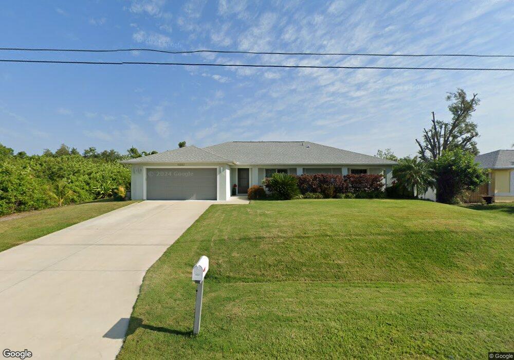
10332 Euston Ave Englewood, FL 34224
Englewood East NeighborhoodEstimated Value: $358,000 - $473,000
3
Beds
2
Baths
1,640
Sq Ft
$242/Sq Ft
Est. Value
About This Home
This home is located at 10332 Euston Ave, Englewood, FL 34224 and is currently estimated at $396,220, approximately $241 per square foot. 10332 Euston Ave is a home with nearby schools including Myakka River Elementary School, L.A. Ainger Middle School, and Lemon Bay High School.
Ownership History
Date
Name
Owned For
Owner Type
Purchase Details
Closed on
Apr 25, 2019
Sold by
Trb Development Englewood Llc
Bought by
Garcia Richard and Garcia Carol
Current Estimated Value
Home Financials for this Owner
Home Financials are based on the most recent Mortgage that was taken out on this home.
Original Mortgage
$186,800
Outstanding Balance
$163,894
Interest Rate
4.3%
Mortgage Type
New Conventional
Estimated Equity
$232,326
Purchase Details
Closed on
Jan 9, 2019
Sold by
Trb Development Charlotte Llc
Bought by
Trb Development Edglewood Llc
Create a Home Valuation Report for This Property
The Home Valuation Report is an in-depth analysis detailing your home's value as well as a comparison with similar homes in the area
Home Values in the Area
Average Home Value in this Area
Purchase History
| Date | Buyer | Sale Price | Title Company |
|---|---|---|---|
| Garcia Richard | $299,900 | Attorney | |
| Trb Development Edglewood Llc | -- | Attorney |
Source: Public Records
Mortgage History
| Date | Status | Borrower | Loan Amount |
|---|---|---|---|
| Open | Garcia Richard | $186,800 |
Source: Public Records
Tax History
| Year | Tax Paid | Tax Assessment Tax Assessment Total Assessment is a certain percentage of the fair market value that is determined by local assessors to be the total taxable value of land and additions on the property. | Land | Improvement |
|---|---|---|---|---|
| 2025 | $3,851 | $266,779 | -- | -- |
| 2023 | $3,828 | $251,709 | $0 | $0 |
| 2022 | $3,695 | $244,378 | $0 | $0 |
| 2021 | $3,679 | $237,260 | $0 | $0 |
| 2020 | $3,862 | $233,984 | $12,750 | $221,234 |
| 2019 | $364 | $10,200 | $10,200 | $0 |
| 2018 | $295 | $9,520 | $9,520 | $0 |
| 2017 | $230 | $7,735 | $7,735 | $0 |
| 2016 | $221 | $3,600 | $0 | $0 |
| 2015 | $203 | $3,273 | $0 | $0 |
| 2014 | $191 | $2,975 | $0 | $0 |
Source: Public Records
Map
Nearby Homes
- 10245 Euston Ave
- 10299 Willmington Blvd
- 10316 Grail Ave
- 10493 Grail Ave
- 10212 Willmington Blvd
- 10148 Alexandria Ave
- 10437 Grail Ave
- 10455 Huntington Ave
- 6230 Berkeley St
- 10430 Valerie Ave
- 6231 Rowe St
- 6175 Cromwell St
- 10415 Woodland Ave
- 11024 Grafton Ave
- 6154 Shasta St
- 6240 Shasta St
- 10088 Willmington Blvd
- 6150 Alloway St
- 6191 Cavan St
- 10487 Woodland Ave
- 10340 Euston Ave
- 10324 Euston Ave
- 10331 Euston Ave
- 10339 Euston Ave
- 10323 Euston Ave
- 10315 Euston Ave
- 10356 Euston Ave
- 10355 Euston Ave
- 10332 Grail Ave
- 10340 Grail Ave
- 10291 Grail Ave
- 10290 Euston Ave
- 10308 Grail Ave
- 10291 Euston Ave
- 10364 Grail Ave
- 10324 Grail Ave
- 10331 Grail Ave
- 10323 Grail Ave
- 10347 Grail Ave
- 10355 Grail Ave
Your Personal Tour Guide
Ask me questions while you tour the home.