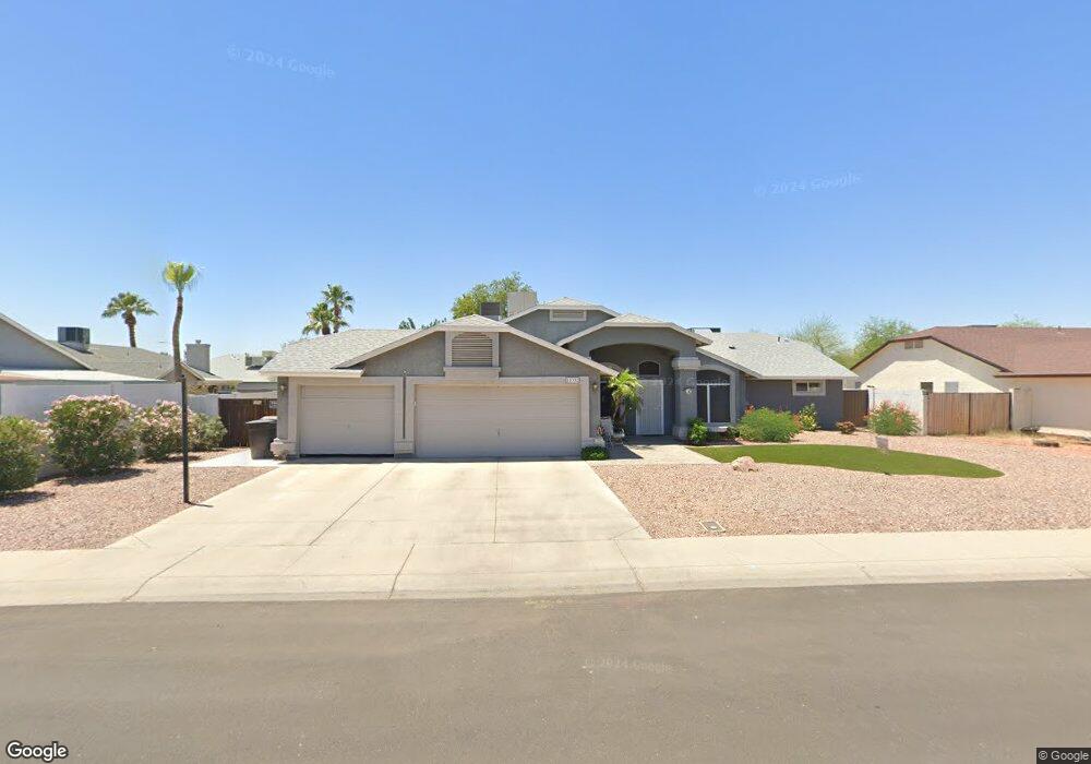
10332 N 78th Dr Peoria, AZ 85345
Estimated Value: $431,220 - $502,000
--
Bed
3
Baths
2,401
Sq Ft
$198/Sq Ft
Est. Value
About This Home
This home is located at 10332 N 78th Dr, Peoria, AZ 85345 and is currently estimated at $475,055, approximately $197 per square foot. 10332 N 78th Dr is a home located in Maricopa County with nearby schools including Santa Fe Elementary School, Peoria High School, and Academy of Math and Science - Peoria Advanced.
Ownership History
Date
Name
Owned For
Owner Type
Purchase Details
Closed on
Apr 8, 2015
Sold by
Simenson Rodney D and Simenson Denise R
Bought by
Simenson Family Trust
Current Estimated Value
Create a Home Valuation Report for This Property
The Home Valuation Report is an in-depth analysis detailing your home's value as well as a comparison with similar homes in the area
Home Values in the Area
Average Home Value in this Area
Purchase History
| Date | Buyer | Sale Price | Title Company |
|---|---|---|---|
| Simenson Family Trust | -- | None Available |
Source: Public Records
Tax History Compared to Growth
Tax History
| Year | Tax Paid | Tax Assessment Tax Assessment Total Assessment is a certain percentage of the fair market value that is determined by local assessors to be the total taxable value of land and additions on the property. | Land | Improvement |
|---|---|---|---|---|
| 2025 | $1,734 | $22,277 | -- | -- |
| 2024 | $1,191 | $21,216 | -- | -- |
| 2023 | $1,191 | $31,720 | $6,340 | $25,380 |
| 2022 | $1,167 | $24,030 | $4,800 | $19,230 |
| 2021 | $1,249 | $22,200 | $4,440 | $17,760 |
| 2020 | $1,261 | $20,460 | $4,090 | $16,370 |
| 2019 | $1,220 | $18,960 | $3,790 | $15,170 |
| 2018 | $1,180 | $18,470 | $3,690 | $14,780 |
| 2017 | $1,180 | $15,410 | $3,080 | $12,330 |
| 2016 | $1,168 | $15,600 | $3,120 | $12,480 |
| 2015 | $1,090 | $14,270 | $2,850 | $11,420 |
Source: Public Records
Map
Nearby Homes
- 7726 W Cheryl Dr
- 7810 W Peoria Ave Unit 166
- 7810 W Peoria Ave Unit 74
- 7810 W Peoria Ave Unit 121
- 7810 W Peoria Ave Unit 98
- 7810 W Peoria Ave Unit 152
- 7810 W Peoria Ave Unit 85
- 7810 W Peoria Ave Unit 79
- 7810 W Peoria Ave Unit 174
- 116XX N 80th Ave Unit 16
- 11817 N 80th Ave Unit 2
- 8105 W Peoria Ave
- 10955 N 79th Ave Unit 147
- 10955 N 79th Ave Unit 60
- 10955 N 79th Ave Unit 113
- 10955 N 79th Ave Unit 163
- 10955 N 79th Ave Unit 179
- 10955 N 79th Ave Unit 40
- 8211 W Madison St
- 7508 W Beryl Ave
- 10340 N 78th Dr
- 7842 W Beryl Ave
- 7850 W Beryl Ave
- 7825 W Comet Ave
- 7858 W Beryl Ave
- 10348 N 78th Dr
- 7826 W Beryl Ave
- 7866 W Beryl Ave
- 7817 W Comet Ave
- 10356 N 78th Dr
- 10347 N 78th Dr
- 7818 W Beryl Ave
- 7845 W Beryl Ave
- 7837 W Beryl Ave
- 7853 W Beryl Ave
- 7829 W Beryl Ave
- 7874 W Beryl Ave
- 7809 W Comet Ave
- 10355 N 78th Dr
- 7810 W Beryl Ave