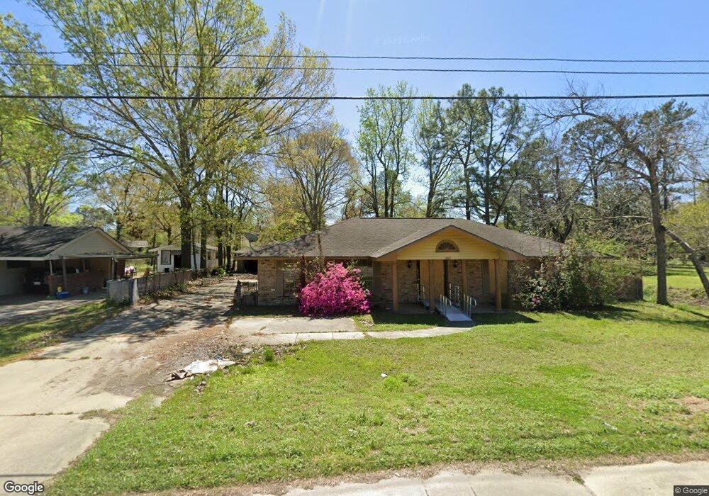
10332 Old Hammond Hwy Baton Rouge, LA 70816
Broadmoor/Sherwood NeighborhoodEstimated Value: $210,239 - $241,000
3
Beds
2
Baths
1,938
Sq Ft
$116/Sq Ft
Est. Value
About This Home
This home is located at 10332 Old Hammond Hwy, Baton Rouge, LA 70816 and is currently estimated at $225,310, approximately $116 per square foot. 10332 Old Hammond Hwy is a home located in East Baton Rouge Parish with nearby schools including Broadmoor Elementary School, Southeast Middle School, and Broadmoor Senior High School.
Ownership History
Date
Name
Owned For
Owner Type
Purchase Details
Closed on
Aug 26, 2011
Sold by
Jones Garnett C
Bought by
Richard Levone
Current Estimated Value
Home Financials for this Owner
Home Financials are based on the most recent Mortgage that was taken out on this home.
Original Mortgage
$140,000
Outstanding Balance
$97,099
Interest Rate
4.53%
Mortgage Type
VA
Estimated Equity
$128,211
Purchase Details
Closed on
Apr 6, 2006
Sold by
Pig Properties
Bought by
Jones Garrett C
Home Financials for this Owner
Home Financials are based on the most recent Mortgage that was taken out on this home.
Original Mortgage
$112,800
Interest Rate
6.21%
Mortgage Type
New Conventional
Create a Home Valuation Report for This Property
The Home Valuation Report is an in-depth analysis detailing your home's value as well as a comparison with similar homes in the area
Home Values in the Area
Average Home Value in this Area
Purchase History
| Date | Buyer | Sale Price | Title Company |
|---|---|---|---|
| Richard Levone | $140,000 | -- | |
| Jones Garrett C | $141,000 | -- |
Source: Public Records
Mortgage History
| Date | Status | Borrower | Loan Amount |
|---|---|---|---|
| Open | Richard Levone | $140,000 | |
| Previous Owner | Jones Garrett C | $112,800 |
Source: Public Records
Tax History Compared to Growth
Tax History
| Year | Tax Paid | Tax Assessment Tax Assessment Total Assessment is a certain percentage of the fair market value that is determined by local assessors to be the total taxable value of land and additions on the property. | Land | Improvement |
|---|---|---|---|---|
| 2024 | $1,431 | $18,953 | $1,200 | $17,753 |
| 2023 | $1,431 | $14,960 | $1,200 | $13,760 |
| 2022 | $1,786 | $14,960 | $1,200 | $13,760 |
| 2021 | $1,745 | $14,960 | $1,200 | $13,760 |
| 2020 | $1,734 | $14,960 | $1,200 | $13,760 |
| 2019 | $1,696 | $14,000 | $1,200 | $12,800 |
| 2018 | $1,675 | $14,000 | $1,200 | $12,800 |
| 2017 | $1,675 | $14,000 | $1,200 | $12,800 |
| 2016 | $855 | $14,000 | $1,200 | $12,800 |
| 2015 | $857 | $14,000 | $1,200 | $12,800 |
| 2014 | $854 | $14,000 | $1,200 | $12,800 |
| 2013 | -- | $14,000 | $1,200 | $12,800 |
Source: Public Records
Map
Nearby Homes
- 10344 Old Hammond Hwy
- 10218 N Magna Carta Place
- 10214 N Magna Carta Place
- 2321 Emmett Bourgeois Ln
- 10123 Hyde Park Ct
- 10008 N Magna Carta Place
- 1919 W Magna Carta Place
- 10115 Ambrose Ct
- 1850 Wimpole St
- 10926 Old Hammond Hwy Unit 27
- 10926 Old Hammond Hwy Unit 20
- 2010 Red Stick Dr
- 2031 Red Stick Villas Dr
- 2421 Aubin Ln
- 10656 Rondo Ave
- 10970 Darius Dr
- 2020 Lac Cache Ct
- 1820 Carolyn Sue Dr Unit L
- 1820 Carolyn Sue Dr Unit B
- 10555 Barbara St
- 924 Old Hammond Hwy Unit 29
- C-3 Old Hammond Hwy
- C4 Old Hammond Hwy
- C3 Old Hammond Hwy
- C2 Old Hammond Hwy
- not assigned Old Hammond Hwy Unit approx add
- 10320 Old Hammond Hwy
- 10354 Old Hammond Hwy
- 10345 Cyprus Cedar Ave
- 10355 Cyprus Cedar Ave
- 10335 Cyprus Cedar Ave
- 10367 Cyprus Cedar Ave
- 10364 Old Hammond Hwy
- 2025 Silverest Ave
- 10389 Cyprus Cedar Ave
- 2035 Silverest Ave
- 10422 Old Hammond Hwy
- 0 Cyprus Cedar St
- 1913 E Magna Carta Place
- 1911 E Magna Carta Place